Pluzhne
Плужне | |
|---|---|
 Pluzhne. Administration | |
 Flag  Coat of arms | |
 Pluzhne Location in Khmelnytskyi Oblast | |
| Coordinates: 50°10′49″N 26°33′46″E / 50.18028°N 26.56278°E | |
| Country | |
| Oblast | Khmelnytskyi |
| Raion | Shepetivka |
| First mention date | 1576 |
| Government | |
| • Mayor | Vitaliy Martyniuk |
| Area | |
| • Total | 7,649 km2 (2,953 sq mi) |
| • Land | 83,660 km2 (32,300 sq mi) |
| Elevation | 255 m (837 ft) |
| Population (2001) | |
| • Total | 3,297 |
| • Density | 431,170/km2 (1,116,700/sq mi) |
| Time zone | UTC+2 ( EET) |
| • Summer ( DST) | UTC+3 ( EEST) |
| Postal code | 30320 |
| Area code | +3803852 |
| Website | Page on Official Website of Verkhovna Rada |
Pluzhne ( Ukrainian: Плужне, Belarusian: Плужна, Polish: Płuźno, Płuzhno, Russian: Плужное) is a selo in Shepetivka Raion, Khmelnytskyi Oblast ( province), Ukraine. The village is located on the river Ustya, 24 km away from the city of Iziaslav, 44 km away from Shepetivka and 127 km away from Khmelnytskyi. Pluzhne hosts the administration of Pluzhne rural hromada, one of the hromadas of Ukraine. [1] Population is 3,297 inhabitants (as of 2001). [2]
Until 18 July 2020, Pluzhne belonged to Iziaslav Raion. The raion was abolished in July 2020 as part of the administrative reform of Ukraine, which reduced the number of raions of Khmelnytskyi Oblast to three. The area of Iziaslav Raion was merged into Shepetivka Raion. [3] [4]
Historical demographics of Pluzhne

As of 1978, the village's population is 5600
[5]
Gallery
-
 Pluzhne. View on tsenter
 -
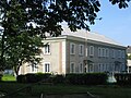
 Grammar School
 -
 Monument to Children
 -
 Boarding School


.jpg)
References
- ^ "Плужненская громада" (in Russian). Портал об'єднаних громад України.
- ^ Parliament of Ukraine. Pluzhne. Discount card (in Ukrainian)
- ^ "Про утворення та ліквідацію районів. Постанова Верховної Ради України № 807-ІХ". Голос України (in Ukrainian). 2020-07-18. Retrieved 2020-10-03.
- ^ "Нові райони: карти + склад" (in Ukrainian). Міністерство розвитку громад та територій України.
- ^ Map of the General Staff. M-35-XV (1980) Archived 2011-07-24 at the Wayback Machine (in Ukrainian)
External links
- Weather in the village Pluzhne (in Ukrainian)
- Passport Pluzhnenskoyi Village Council Information on 2011-01-01 (in Ukrainian)
- The murder of the Jews of Pluzhne during World War II, at Yad Vashem website.