Plains, Kansas | |
|---|---|
 Location within
Meade County and
Kansas | |
 | |
| Coordinates: 37°15′51″N 100°35′23″W / 37.26417°N 100.58972°W [1] | |
| Country | United States |
| State | Kansas |
| County | Meade |
| Founded | 1800s |
| Platted | 1885 |
| Incorporated | 1908 |
| Area | |
| • Total | 1.00 sq mi (2.59 km2) |
| • Land | 1.00 sq mi (2.59 km2) |
| • Water | 0.00 sq mi (0.00 km2) |
| Elevation | 2,759 ft (841 m) |
| Population | |
| • Total | 1,037 |
| • Density | 1,000/sq mi (400/km2) |
| Time zone | UTC-6 ( CST) |
| • Summer ( DST) | UTC-5 (CDT) |
| ZIP code | 67869 |
| Area code | 620 |
| FIPS code | 20-56100 |
| GNIS ID | 2396219 [1] |
Plains is a city in Meade County, Kansas, United States. [1] As of the 2020 census, the population of the city was 1,037. [3] It is located along U.S. Route 54 highway. It is notable for the width of its main street which is the widest in the United States at 155 feet 5 inches (47.37 m) across.
History
.jpg)
Plains was originally called West Plains, [4] and under the latter name was platted in January 1885. [5]
Geography
According to the United States Census Bureau, the city has a total area of 1.00 square mile (2.59 km2), all of it land. [6]
Climate
According to the Köppen Climate Classification system, Plains has a semi-arid climate, abbreviated "BSk" on climate maps. [7]
Demographics
| Census | Pop. | Note | %± |
|---|---|---|---|
| 1890 | 62 | — | |
| 1910 | 333 | — | |
| 1920 | 361 | 8.4% | |
| 1930 | 383 | 6.1% | |
| 1940 | 619 | 61.6% | |
| 1950 | 718 | 16.0% | |
| 1960 | 780 | 8.6% | |
| 1970 | 857 | 9.9% | |
| 1980 | 1,044 | 21.8% | |
| 1990 | 957 | −8.3% | |
| 2000 | 1,163 | 21.5% | |
| 2010 | 1,146 | −1.5% | |
| 2020 | 1,037 | −9.5% | |
| U.S. Decennial Census | |||
2020 census
The 2020 United States census counted 1,037 people, 367 households, and 268 families in Plains. [8] [9] The population density was 1,038.0 per square mile (400.8/km2). There were 433 housing units at an average density of 433.4 per square mile (167.3/km2). [9] [10] The racial makeup was 65.0% (674) white or European American (54.19% non-Hispanic white), 0.1% (1) black or African-American, 0.0% (0) Native American or Alaska Native, 0.0% (0) Asian, 0.0% (0) Pacific Islander or Native Hawaiian, 17.65% (183) from other races, and 17.26% (179) from two or more races. [11] Hispanic or Latino of any race was 43.01% (446) of the population. [12]
Of the 367 households, 41.7% had children under the age of 18; 58.0% were married couples living together; 22.3% had a female householder with no spouse or partner present. 23.4% of households consisted of individuals and 8.2% had someone living alone who was 65 years of age or older. [9] The average household size was 2.8 and the average family size was 3.0. [13] The percent of those with a bachelor’s degree or higher was estimated to be 13.2% of the population. [14]
32.3% of the population was under the age of 18, 8.4% from 18 to 24, 25.6% from 25 to 44, 21.4% from 45 to 64, and 12.3% who were 65 years of age or older. The median age was 31.8 years. For every 100 females, there were 95.3 males. [9] For every 100 females ages 18 and older, there were 107.1 males. [9]
The 2016-2020 5-year American Community Survey estimates show that the median household income was $64,074 (with a margin of error of +/- $5,226) and the median family income was $69,398 (+/- $8,290). [15] Males had a median income of $56,454 (+/- $5,263) versus $19,583 (+/- $10,756) for females. The median income for those above 16 years old was $43,641 (+/- $3,929). [16] Approximately, 19.8% of families and 14.6% of the population were below the poverty line, including 19.2% of those under the age of 18 and 7.9% of those ages 65 or over. [17] [18]
2010 census
At the 2010 census, [19] there were 1,146 people, 385 households and 310 families residing in the city. The population density was 1,146.0 inhabitants per square mile (442.5/km2). There were 439 housing units at an average density of 439.0 per square mile (169.5/km2). The racial makeup of the city was 88.1% White, 0.3% African American, 1.0% Native American, 0.4% Asian, 8.5% from other races, and 1.7% from two or more races. Hispanic or Latino of any race were 36.0% of the population.
There were 385 households, of which 42.9% had children under the age of 18 living with them, 67.3% were married couples living together, 8.3% had a female householder with no husband present, 4.9% had a male householder with no wife present, and 19.5% were non-families. 18.2% of all households were made up of individuals, and 6.5% had someone living alone who was 65 years of age or older. The average household size was 2.98 and the average family size was 3.38.
The median age in the city was 30.9 years. 33.9% of residents were under the age of 18; 8.8% were between the ages of 18 and 24; 25.9% were from 25 to 44; 21.6% were from 45 to 64; and 9.8% were 65 years of age or older. The gender makeup of the city was 51.8% male and 48.2% female.
2000 census
At the 2000 census, [20] there were 1,163 people, 402 households and 303 families residing in the city. The population density was 1,175.8 inhabitants per square mile (454.0/km2). There were 453 housing units at an average density of 458.0 per square mile (176.8/km2). The racial makeup of the city was 82.12% White, 1.29% Native American, 14.27% from other races, and 2.32% from two or more races. Hispanic or Latino of any race were 26.23% of the population.
There were 402 households, of which 43.5% had children under the age of 18 living with them, 64.7% were married couples living together, 7.0% had a female householder with no husband present, and 24.4% were non-families. 22.1% of all households were made up of individuals, and 10.7% had someone living alone who was 65 years of age or older. The average household size was 2.89 and the average family size was 3.41.
34.5% of the population were under the age of 18, 10.1% from 18 to 24, 27.6% from 25 to 44, 16.3% from 45 to 64, and 11.6% who were 65 years of age or older. The median age was 28 years. For every 100 females, there were 102.6 males. For every 100 females age 18 and over, there were 101.1 males.
The median household income was $39,688 and the median family income was $44,167. Males had a median income of $31,354 compared with $21,023 for females. The per capita income for the city was $16,047. About 11.4% of families and 13.6% of the population were below the poverty line, including 19.3% of those under age 18 and 0.9% of those age 65 or over.
Education
The community is served by Southwestern Heights USD 483 public school district. Its high school, Southwestern Heights, is located between Kismet and Plains along U.S. Route 54 highway. The Southwestern Heights High School mascot is Southwestern Heights Mustangs. [21]
References
- ^ a b c d U.S. Geological Survey Geographic Names Information System: Plains, Kansas
- ^ "2019 U.S. Gazetteer Files". United States Census Bureau. Retrieved July 24, 2020.
- ^ a b "Profile of Plains, Kansas in 2020". United States Census Bureau. Archived from the original on November 22, 2021. Retrieved November 22, 2021.
- ^ Kansas State Historical Society (1916). Biennial Report of the Board of Directors of the Kansas State Historical Society. Kansas State Printing Plant. pp. 239.
- ^ Sullivan, Frank Seymour (1916). A History of Meade County, Kansas. Crane & Company. pp. 34.
- ^ "US Gazetteer files 2010". United States Census Bureau. Archived from the original on January 25, 2012. Retrieved July 6, 2012.
- ^ Climate Summary for Plains, Kansas
- ^ "US Census Bureau, Table P16: HOUSEHOLD TYPE". data.census.gov. Retrieved January 3, 2024.
- ^ a b c d e "US Census Bureau, Table DP1: PROFILE OF GENERAL POPULATION AND HOUSING CHARACTERISTICS". data.census.gov. Retrieved January 3, 2024.
- ^ Bureau, US Census. "Gazetteer Files". Census.gov. Retrieved December 30, 2023.
- ^ "US Census Bureau, Table P1: RACE". data.census.gov. Retrieved January 3, 2024.
- ^ "US Census Bureau, Table P2: HISPANIC OR LATINO, AND NOT HISPANIC OR LATINO BY RACE". data.census.gov. Retrieved January 3, 2024.
- ^ "US Census Bureau, Table S1101: HOUSEHOLDS AND FAMILIES". data.census.gov. Retrieved January 3, 2024.
- ^ "US Census Bureau, Table S1501: EDUCATIONAL ATTAINMENT". data.census.gov. Retrieved January 3, 2024.
- ^ "US Census Bureau, Table S1903: MEDIAN INCOME IN THE PAST 12 MONTHS (IN 2020 INFLATION-ADJUSTED DOLLARS)". data.census.gov. Retrieved January 3, 2024.
- ^ "US Census Bureau, Table S2001: EARNINGS IN THE PAST 12 MONTHS (IN 2020 INFLATION-ADJUSTED DOLLARS)". data.census.gov. Retrieved January 3, 2024.
- ^ "US Census Bureau, Table S1701: POVERTY STATUS IN THE PAST 12 MONTHS". data.census.gov. Retrieved January 3, 2024.
- ^ "US Census Bureau, Table S1702: POVERTY STATUS IN THE PAST 12 MONTHS OF FAMILIES". data.census.gov. Retrieved January 3, 2024.
- ^ "U.S. Census website". United States Census Bureau. Retrieved July 6, 2012.
- ^ "U.S. Census website". United States Census Bureau. Retrieved January 31, 2008.
- ^ "Southwestern Heights - USD 483". USD 483. Retrieved January 5, 2017.
Further reading
External links
- Plains - Directory of Public Officials
- USD 483, local school district
- Photos of early Plains
- Plains City Map, KDOT
Municipalities and communities of
Meade County, Kansas, United States | ||
|---|---|---|
| Cities | 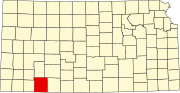 | |
|
Unincorporated communities | ||
| Townships |
| |