| Pivka | |
|---|---|
 Pivka River | |
| Location | |
| Country | Slovenia |
| Physical characteristics | |
| Source | |
| • location | Zagorje, Pivka |
| • coordinates | 45°38′20.47″N 14°13′41.59″E / 45.6390194°N 14.2282194°E |
| • elevation | 555 m (1,821 ft) [1] |
| Mouth | |
• location | Flows to Postojna Cave |
• coordinates | 45°47′0.43″N 14°12′10.09″E / 45.7834528°N 14.2028028°E |
• elevation | 510 m (1,670 ft) [1] |
| Length | 27 km (17 mi) [1] |
| Basin size | 262 km2 (101 sq mi) [1] |
| Basin features | |
| Progression | Unica→ Ljubljanica→ Sava→ Danube→ Black Sea |
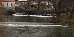
The Pivka is a karst lost river in Slovenia. The river is 27 kilometres (17 mi) in length. [1] The Pivka ends in Planina Cave, where it merges with the Rak River and then the Unica River. The confluence of the Pivka and the Rak is one of the largest subterranean confluences in Europe. [2] The Pivka created Postojna Cave, the longest cave system in Slovenia as well as one of its top tourism sites.
References
- ^ a b c d e Rivers, longer than 25 km, and their catchment areas, Statistical Office of the Republic of Slovenia
- ^ Kogovšek, Janja; Petrič, Metka; Zupan Hajna, Nadja; Pipan, Tanja. "Planinska jama" [Planina Cave]. In Šmid Hribar, Mateja; Golež, Gregor; Podjed, Dan; Kladnik, Drago; Erhartič, Bojan; Pavlin, Primož; Ines, Jerele (eds.). Enciklopedija naravne in kulturne dediščine na Slovenskem [Encyclopedia of Natural and Cultural Heritage in Slovenia] (in Slovenian). Retrieved 17 May 2012.
External links
-
 Media related to
Pivka (river) at Wikimedia Commons
