You can help expand this article with text translated from
the corresponding article in French. (November 2022) Click [show] for important translation instructions.
|
Pereire–Levallois | |||||||||||
|---|---|---|---|---|---|---|---|---|---|---|---|
| RER station | |||||||||||
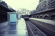
 The station in 2007 | |||||||||||
| General information | |||||||||||
| Location | 4 Place du Maréchal-Juin 17th arrondissement of Paris France | ||||||||||
| Coordinates | 48°53′7″N 2°17′52″E / 48.88528°N 2.29778°E | ||||||||||
| Owned by | SNCF | ||||||||||
| Operated by | SNCF | ||||||||||
| Line(s) |
| ||||||||||
| Platforms | 2 | ||||||||||
| Tracks | 3 | ||||||||||
| Bus routes |
| ||||||||||
| Bus operators | RATP, Noctilien | ||||||||||
| Connections | |||||||||||
| Other information | |||||||||||
| Station code | 87381012 | ||||||||||
| Fare zone | 1 | ||||||||||
| History | |||||||||||
| Opened | 2 May 1854 | ||||||||||
| Passengers | |||||||||||
| 2016 | 5,248,800 | ||||||||||
| Services | |||||||||||
| |||||||||||
| Location | |||||||||||
|
| |||||||||||
Pereire–Levallois is a station in Paris's express suburban rail system, the RER. It is in the 17th arrondissement of Paris. [1]
-
 The station in 1984
 -
 Entrance


Adjacent station
- Pereire on Paris Métro Line 3.
- Shuttle buses connect Pont Cardinet on SNCF rail station.
See also
References
External links
Wikimedia Commons has media related to
Gare de Pereire - Levallois.
- Pereire–Levallois station at Transilien, the official website of SNCF (in French)
48°53′7″N 2°17′52″E / 48.88528°N 2.29778°E
|
|
| ||||||||||
|---|---|---|---|---|---|---|---|---|---|---|---|
|
| |||||||||||
|
|
| ||||||||||
|
| This Réseau Express Régional article is a stub. You can help Wikipedia by expanding it. |