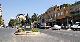
Pazarcık | |
|---|---|
District and
municipality | |
 | |
 Map showing Pazarcık District in Kahramanmaraş Province | |
| Coordinates: 37°29′22″N 37°17′48″E / 37.48944°N 37.29667°E | |
| Country | Turkey |
| Province | Kahramanmaraş |
| Government | |
| • Mayor | Haydar İkizer ( CHP) |
| Area | 1,253 km2 (484 sq mi) |
| Population (2022)
[1] | 70,173 |
| • Density | 56/km2 (150/sq mi) |
| Time zone | UTC+3 ( TRT) |
| Postal code | 46700 |
| Area code | 0344 |
| Website |
www |
Pazarcık ( Kurdish: Bazarcix) is a municipality and district of Kahramanmaraş Province, Turkey. [2] Its area is 1,253 km2, [3] and its population is 70,173 (2022). [1] It is in the southeastern part of the province. The cement plant is a major source of greenhouse gas. [4] The town includes Abdals of the Kara Hüseyinler tribe. [5]
On 6 February 2023, a magnitude 7.8 earthquake struck Pazarcik. [6]
Composition
There are 84 neighbourhoods in Pazarcık District: [7]
- 15 Temmuz
- Ahmet Bozdağ
- Akçakoyunlu
- Akçalar
- Akdemir
- Armutlu
- Aşağımülk
- Bağdınısağır
- Beşçeşme
- Bölükçam
- Büyüknacar Fatih
- Büyüknacar Kocadere
- Büyüknacar Merkez
- Çamlıca
- Çamlıtepe
- Cengiz Topel
- Çiçek
- Çiçekalanı
- Çiğdemtepe
- Cimikanlı
- Çöçelli
- Damlataş
- Dedepaşa
- Eğlen
- Eğrice
- Emiroğlu
- Evri Pınarbaşı
- Evri Taşbiçme
- Fatih
- Ganidağıketiler
- Göçer
- Göynük
- Hanobası
- Harmancık
- Hasankoca
- Hürriyet
- İncirli
- Kadıncık
- Karaağaç
- Karabıyıklı
- Karaçay
- Karagöl
- Karahüyük
- Keleş
- Kizirli
- Kızkapanlı
- Kuzeykent
- Mehmet Emin Arıkoğlu
- Memiş Özdal
- Memişkahya
- Menderes
- Mezraa
- Musolar
- Narlı Bahçelievler
- Narlı Cumhuriyet
- Narlı İsmetpaşa
- Nefsidoğanlı
- Ördekdede
- Osmandede
- Sadakalar
- Şahintepe
- Sakarkaya
- Sallıuşağı
- Salmanıpak
- Salmanlı
- Sarıerik
- Sarıl
- Şehit Nurettin Ademoğlu
- Soku
- Sultanlar
- Taşdemir
- Tetirlik
- Tilkiler
- Turunçlu
- Ufacıklı
- Ulubahçe
- Yarbaşı
- Yeşilkent
- Yiğitler
- Yolboyu
- Yukarıhöcüklü
- Yukarımülk
- Yumaklıcerit Bağlar
- Yumaklıcerit Cumhuriyet
Notable natives
- Ferruh Bozbeyli (1927–2019), Turkish politician.
- Hasan Yükselir (1955–), Turkish singer and composer.
- Dilber Ay (1956–2019), Turkish singer.
- KC Rebell (1988–), German rapper of Kurdish origin.
- Ahmet Aksu (1887–1954), Turkish politician
References
- ^ a b "Address-based population registration system (ADNKS) results dated 31 December 2022, Favorite Reports" (XLS). TÜİK. Retrieved 19 September 2023.
- ^ Büyükşehir İlçe Belediyesi, Turkey Civil Administration Departments Inventory. Retrieved 19 September 2023.
- ^ "İl ve İlçe Yüz ölçümleri". General Directorate of Mapping. Retrieved 19 September 2023.
- ^ "Emissions Map". Climate TRACE. Retrieved 2022-11-12.
- ^ Peter Alfred, Andrews; Benninghaus, Rüdiger, eds. (1989). Ethnic Groups in the Republic of Turkey. p. 231.
- ^ "Turkey-Syria earthquake: Death toll passes 11,000". Deutsche Welle. 8 February 2023. Retrieved 8 February 2023.
- ^ Mahalle, Turkey Civil Administration Departments Inventory. Retrieved 19 September 2023.
External links
Wikimedia Commons has media related to
Pazarcık.
- (in Turkish) District governor's official website
- (in Turkish) District municipality's official website


