(Redirected from
Passo San Giacomo)
| San Giacomo | |
|---|---|
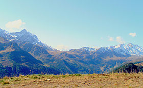
 San Giacomo Pass (center) from the northern side | |
| Elevation | 2,313 m (7,589 ft) [1] |
| Traversed by | Trail |
| Location |
Piedmont,
Italy Ticino, Switzerland |
| Range | Lepontine Alps |
| Coordinates | 46°27′33″N 8°27′09″E / 46.45917°N 8.45250°E |
The San Giacomo Pass ( Italian: Passo San Giacomo) is an Alpine pass connecting Switzerland and Italy. It connects Bedretto on its northern side (valley of Leventina) to Formazza on its southern side.
The pass is located between the Grieshorn (west) and the Marchhorn (east).
References
External links
