Olorunsogo | |
|---|---|
| Coordinates: 8°45′50″N 4°06′14″E / 8.76389°N 4.10389°E | |
| Country | |
| State | Oyo State |
| Government | |
| • Local Government Chairman and the Head of the Local Government Council | Juliana Oluwakemi Akanni ( PDP) |
| Time zone | UTC+1 ( WAT) |
|
| |
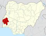
Olorunsogo is a Local Government Area in Oyo State, Nigeria. Its headquarters are in the town of Igbeti.
It has an area of 1,069 km2 and a population of 81,759 at the 2006 census.
The postal code of the area is 212. [1]
Climate
It is oppressively hot and cloudy during the wet season, and humid and partially cloudy during the dry season, creating a hot environment all year long. [2] [3] [4]
References
- ^ "Post Offices- with map of LGA". NIPOST. Archived from the original on 2012-11-26. Retrieved 2009-10-20.
- ^ "Igbeti Climate, Weather By Month, Average Temperature (Nigeria) - Weather Spark". weatherspark.com. Retrieved 2023-09-15.
- ^ "Olorunsogo, Oyo, NigeriaWeather Forecast and Conditions - The Weather Channel | Weather.com". The Weather Channel. Retrieved 2023-09-15.
- ^ "Olorunsogo, Oyo, Nigeria - City, Town and Village of the world". en.db-city.com. Retrieved 2023-09-15.
