This article relies largely or entirely on a
single source. (March 2018) |
Obilić
Обилић | |
|---|---|
Village | |
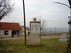
 Monument in Obilić. | |
| Coordinates: 43°04′34″N 21°45′04″E / 43.07611°N 21.75111°E | |
| Country | |
| Region | Southern and Eastern Serbia |
| District | Jablanica |
| Municipality | Bojnik |
| Elevation | 883 ft (269 m) |
| Population (2022)
[1] | |
| • Total | 42 |
| Time zone | UTC+1 ( CET) |
| • Summer ( DST) | UTC+2 ( CEST) |
Obilić ( Serbian Cyrillic: Обилић) is a village in the municipality of Bojnik, Serbia. According to the 2022 census, the village has a population of 42 inhabitants. [1]
History
Serbian guerilla leaders met on 21 February in Obilić and held a two-day long meeting where they decided to launch an uprising in March. [2]
Population
| 1948 | 1953 | 1961 | 1971 | 1981 | 1991 | 2002 | 2011 | 2022 |
| 255 | 204 | 145 | 153 | 150 | 107 | 94 | 54 | 42 |
References
- ^ a b "2022 Serbian Census. Total population, by settlements" (xlsx). Statistical Office of the Republic of Serbia. 2022. Retrieved 17 May 2024.
- ^ Mitrović, Andrej (2007). Serbia's Great War 1914–1918. West Lafayette: Purdue University Press. p. 253.
