Nora, Virginia | |
|---|---|
Unincorporated community | |
 Post office in Nora (2020) | |
 Nora, Virginia  Nora, Virginia | |
| Coordinates: 37°04′15″N 82°20′50″W / 37.07083°N 82.34722°W | |
| Country | United States |
| State | Virginia |
| County | Dickenson |
| Elevation | 1,532 ft (467 m) |
| Time zone | UTC-5 ( Eastern (EST)) |
| • Summer ( DST) | UTC-4 (EDT) |
| ZIP code | 24272 |
| Area code | 276 |
| GNIS feature ID | 1497048 [1] |
Nora is an unincorporated community in Dickenson County in the southern U.S. state of Virginia. [2] In the 2000 US census, its population is listed as 566. [3] Nora is situated along the McClure River.
Coal mining has always been the primary business for the community and county. However, in recent years natural gas production has increased sharply because it has become possible to extract gas from the underlying Huron Shale formation. The Huron Shale deposit in this part of Virginia is called the Nora Field. [4]
History
The site of what is now Nora was originally called "Mouth of Open Fork", and in 1882 it was briefly the county seat of the newly formed Dickenson County. [5]
In 1904, a post office was built at Mouth of Open Fork, and the first postmaster, W. A. Dorton, arranged for the community and post office to be named for his wife Nora. [6]
The Clinchfield Railroad, which was built to haul coal from the area, passes through Nora. Construction of the railroad was completed in 1915, when the last track was laid near Nora. [7]
Up through the 1960s, Nora was known locally as "Tiger Town", because the tiny village had three taverns, resulting in frequent alcohol-induced brawls. [6]
In 1977, the McClure River flooded and destroyed much of Nora. [8]
Notable residents
People associated with Nora include:
- Margaret Binns (1884-1968). A native of Brooklyn, NY and a graduate of Vassar College, she came to Nora in 1915 on the first train to reach the town. She worked for 50 years as deaconess of the small Episcopal Church in Nora. Her home was a gathering place and recreation center for the children of the town. [9]
- Ralph Stanley, bluegrass musician, grew up in the nearby town of McClure, and he attended high school at Nora.
- Kathleen Counts (1932 - 1983). Counts was a coal miner from Nora. In 1983 she was killed, along with six others, in a mine explosion at McClure. She is believed to be the first woman miner killed in the US. [10]
- Trazel Silvers was a basketball player at Ervinton High School, and he later played professionally, first for the Harlem Globetrotters, and then for several teams in Europe. [11]
References
- ^ "Nora". Geographic Names Information System. United States Geological Survey, United States Department of the Interior.
- ^ U.S. Geological Survey Geographic Names Information System: Nora, Virginia
- ^ "Nora, Virginia (VA) ~ population data, races, housing & economy". Usbeacon.com. Retrieved July 27, 2018.
- ^ "Lower Huron Shale - Huron Shale Map - West Virginia Shale". Oilshalegas.com. Retrieved July 27, 2018.
- ^ Sutherland, Elihu Jasper, Meet Virginia's Baby - A Pictorial History of Dickenson County Virginia, 1955
- ^ a b Tennis, Joe " Virginia Crossroads: An Almanac of Place Names and Places to See", 2004, ISBN 1-57072-256-0
- ^ Goforth, James A." Building the Clinchfield" ,2004, ISBN 978-1-57072-291-2
- ^ "Binns-Counts Community Center - History". Archived from the original on September 10, 2011. Retrieved April 13, 2011.
- ^ Holmes, Urban Tigner " What is Anglicanism?" 1982, ISBN 0-8192-1295-4
- ^ "Virginia Coal Heritage Trail - Dickenson County - McClure". Trailsrus.com. Retrieved July 27, 2018.
- ^ "Bhc's BACK IN TIME: Trazel Silvers saw many things during long hoops career". Archived from the original on October 8, 2011. Retrieved April 13, 2011.
Municipalities and communities of
Dickenson County, Virginia, United States | ||
|---|---|---|
| Towns | 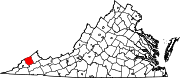 | |
| CDPs | ||
|
Unincorporated communities | ||
| Footnotes | ‡This populated place also has portions in an adjacent county or counties | |