Nijswiller
Nieswieler | |
|---|---|
Village | |
.JPG) Nijswiller Castle | |
 Nijswiller Location in the Netherlands  Nijswiller Location in the province of Limburg in the Netherlands | |
| Coordinates: 50°48′22″N 5°57′32″E / 50.8060°N 5.9588°E | |
| Country | Netherlands |
| Province | Limburg |
| Municipality | Gulpen-Wittem |
| Area | |
| • Total | 0.61 km2 (0.24 sq mi) |
| Elevation | 93 m (305 ft) |
| Population (2021)
[1] | |
| • Total | 725 |
| • Density | 1,200/km2 (3,100/sq mi) |
| Time zone | UTC+1 ( CET) |
| • Summer ( DST) | UTC+2 ( CEST) |
| Postal code | 6286
[1] |
| Dialing code | 043 |
Nijswiller ( Limburgish: Nieswieler) is a village in the southern part of the Dutch province of Limburg. It is a part of the municipality of Gulpen-Wittem, and is located about 19 kilometres (12 mi) east of Maastricht. [3]
History
The village was first mentioned in 1179 as "de Wilra sancti Dionisii". The current name means "farm of Nijs". Nijs is short for Saint Denis of Paris, the patron saint of the village. [4] Nijswiller developed in the Middle Ages along the old road from Maastricht to Aachen at the crossing with the Selzerbeek. [5]
In 1288, the Peace of Nijswiller was signed between John I of Brabant and Reginald I of Guelders after the Battle of Worringen which was the concluding part of the War of the Limburg Succession. [6] In 1648, Nijswiller was a free heerlijkheid which did not belong to Duchy of Jülich, the Austrian Netherlands or the Dutch Republic. In 1794, it was conquered by France, and became part of the United Kingdom of the Netherlands in 1814. [6]
Nijswiller Castle was first recorded in 1275. [5] There is a two metre thick irregular wall in the oldest part of the castle which is probably a remnant of the original tower. In 1678, the van Schaesberg family were forced to sell the castle, and the building started to deteriorate. In 1703, it was restored, and in 1860, it was significantly extended. Between 1934 and 1980, the castle was used by the Sisters of St. Francis of Heythuysen. In 2008, it became private property. [7]
The Catholic St Dionysius Church is a single aisled church with a little ridge turret. The nave dates from the 12th century up to the windows. Between 1895 and 1896, the church was redesigned by Pierre Cuypers. The ridge turret and windows probably date from a 1905 restoration. [5] The church used to be place of pilgrimage for German Catholics. [6]
Notable people
- Ralf Vandebergh (born 1976), astronomer, photographer and satellite spotter [8]
Gallery
-
 Forest near Nijswiller
 -
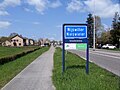 Welcome to Nijswiller
 -
 St Dionysius Church
 -
 Water pump
.jpg)


References
- ^ a b c "Kerncijfers wijken en buurten 2021". Central Bureau of Statistics. Retrieved 29 April 2022.
- ^ "Postcodetool for 6286AA". Actueel Hoogtebestand Nederland (in Dutch). Het Waterschapshuis. Retrieved 29 April 2022.
- ^ "Distance Nijswiller, NLD -> Maastrict, NLD". Distance.to (in Dutch). Retrieved 29 April 2022.
- ^ "Nijswiller - (geografische naam)". Etymologiebank (in Dutch). Retrieved 29 April 2022.
- ^ a b c Sabine Broekhoven, & Ronald Stenvert (2003). Nijswiller (in Dutch). Zwolle: Waanders. ISBN 90 400 9623 6. Retrieved 29 April 2022.
- ^ a b c "Nijswiller". Plaatsengids (in Dutch). Retrieved 29 April 2022.
- ^ "Nijswiller, kasteel (Nijswiller)". Rijckheyt (in Dutch). Retrieved 29 April 2022.
- ^ "New Photos Surface of Secretive X-37B Space Plane in Orbit on Classified Mission". The Aviantionist. Retrieved 29 April 2022.