Nevele | |
|---|---|
Village and former municipality | |
 St Mauritius and Gezellen Church | |
 Flag  Seal | |
 Nevele Location in Belgium | |
| Coordinates: 51°02′N 03°33′E / 51.033°N 3.550°E | |
| Country | |
| Region | Flemish Region |
| Province | East Flanders |
| Arrondissement | Ghent |
| Municipality | Ninove |
| Area | |
| • Total | 13.90 km2 (5.37 sq mi) |
| Population (2021)
[1] | |
| • Total | 2,875 |
| • Density | 210/km2 (540/sq mi) |
| Time zone | CET |
| Postal code | 9850 |
| Dialing code | 09 |
| Website | www.deinze.be |
Nevele (Dutch pronunciation: [ˈneːvələ]) is a village and former municipality located in the Belgian province of East Flanders. The municipality comprises the towns of Hansbeke, Landegem, Merendree, Nevele proper, Poesele and Vosselare. In 2018, the municipality of Nevele had a total population of 12,179. The total area is 51.89 km2. [2]
Effective 1 January 2019, the municipality was merged into Deinze.
Subdivisions
Nevele consisted of six deelgemeenten (sub-municipalities).
| # | Name | Area | Population |
|---|---|---|---|
| I | Nevele | 13,86 | |
| II | Hansbeke | 9,83 | |
| III | Merendree | 10,94 | |
| IV | Landegem | 8,48 | |
| V | Poesele | 2,52 | |
| VI | Vosselare | 6,27 |
|
|
Nevele has borders with:
|

Famous inhabitants
- Cyriel Buysse, novelist
- Renaat de Rudder: born in Oostakker in 1897, he moved with his parents to Landegem in 1909. In 1914 he volunteered for the Belgian army to fight in the first World War, where he wrote on the physical and moral pain he was suffering, until he died on 12 December 1917.
- Rosalie Loveling and Virginie Loveling, writers, aunts of Cyriel Buysse
- Leo Lovaert
- Monika van Paemel
Gallery
-
 Former tobacco factory
 -
 View on Landegem
 -
 House in Nevele
 -
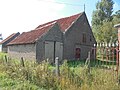 Farm in Nevele


.jpg)
References
- ^
a
b
"Bevolking per statistische sector - Sector 44094A". Statistics Belgium. Retrieved 6 May 2022.
Nevele only
- ^ ""Wettelijke Bevolking per gemeente op 1 januari 2018"". StatBel. Retrieved 9 March 2019.
External links
-
 Media related to
Nevele at Wikimedia Commons
Media related to
Nevele at Wikimedia Commons - Official website - Only available in Dutch
Places adjacent to Nevele | ||||||||||||||||
|---|---|---|---|---|---|---|---|---|---|---|---|---|---|---|---|---|
| ||||||||||||||||
| International | |
|---|---|
| Geographic | |
|
| This East Flanders location article is a stub. You can help Wikipedia by expanding it. |