Neschwitz
Njeswačidło | |
|---|---|
 Castle | |
 Coat of arms | |
Location of Neschwitz within Bautzen district 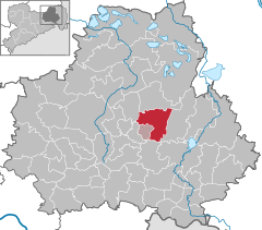 | |
 Neschwitz  Neschwitz | |
| Coordinates: 51°16′N 14°20′E / 51.267°N 14.333°E | |
| Country | Germany |
| State | Saxony |
| District | Bautzen |
| Municipal assoc. | Neschwitz |
| Subdivisions | 17 |
| Government | |
| • Mayor (2022–29) | Gerd Schuster [1] ( CDU) |
| Area | |
| • Total | 45.99 km2 (17.76 sq mi) |
| Elevation | 149 m (489 ft) |
| Population (2022-12-31)
[2] | |
| • Total | 2,385 |
| • Density | 52/km2 (130/sq mi) |
| Time zone | UTC+01:00 ( CET) |
| • Summer ( DST) | UTC+02:00 ( CEST) |
| Postal codes | 02699 |
| Dialling codes | 035933, 035937 |
| Vehicle registration | BZ, BIW, HY, KM |
| Website | www.neschwitz.de |
Neschwitz, Sorbian Njeswačidło, is a municipality in the east of Saxony, Germany. It belongs to the district of Bautzen and lies 14 km northwest of the eponymous city.
The municipality is part of the recognized Sorbian settlement area in Saxony. Upper Sorbian has an official status next to German, all villages bear names in both languages.
Geography
The municipality is situated in the Upper Lusatian flatland.
Villages
Several villages belong to the municipality:
- Neschwitz (Njeswačidło)
- Caßlau (Koslow)
- Doberschütz (Dobrošicy)
- Holscha (Holešow)
- Holschdubrau (Holešowska Dubrawka)
- Kleinholscha ("Holška")
- Krinitz (Króńca)
- Lissahora (Liša Hora)
- Loga (Łahow)
- Lomske (Łomsk)
- Luga (Łuh)
- Neudorf (Nowa Wjes)
- Pannewitz (Banecy)
- Saritsch (Zarěč)
- Übigau (Wbohow)
- Weidlitz (Wutołčicy) and
- Zescha (Šešow)
References
- ^ Gewählte Bürgermeisterinnen und Bürgermeister im Freistaat Sachsen, Stand: 17. Juli 2022, Statistisches Landesamt des Freistaates Sachsen.
- ^ "Einwohnerzahlen nach Gemeinden als Excel-Arbeitsmappe" (XLS) (in German). Statistisches Landesamt des Freistaates Sachsen. 2024.

| International | |
|---|---|
| National | |
| Geographic | |
|
| This Bautzen location article is a stub. You can help Wikipedia by expanding it. |