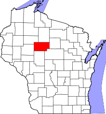
This is a list of the National Register of Historic Places listings in Taylor County, Wisconsin. It is intended to provide a comprehensive listing of entries in the National Register of Historic Places that are located in Taylor County, Wisconsin. The locations of National Register properties for which the latitude and longitude coordinates are included below may be seen in a map. [1]
There are 8 properties and districts listed on the National Register in the county.
This
National Park Service list is complete through
NPS recent listings posted April 5, 2024.
[2]
Current listings
| [3] | Name on the Register | Image | Date listed [4] | Location | City or town | Description |
|---|---|---|---|---|---|---|
| 1 | J. W. Benn Building |  |
December 22, 1983 ( #83004320) |
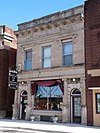
202-204 S. Main St. 45°08′14″N 90°20′37″W / 45.137222°N 90.343611°W | Medford | This 1912 Beaux-Arts building housed the post office until the 1930s, then Gruener's Bakery, [5] and now Damm Accounting. |
| 2 | Big Indian Farms |  |
July 11, 1988 ( #87001827) |
Address Restricted | Perkinstown | About 100 "stray band" Potawatomi, Chippewa and others lived at this remote site from 1896 to 1908. Includes burials and dance ring. [6] |
| 3 | Jump River Town Hall |  |
March 28, 1974 ( #74000127) |
S of WI 73 on Bridge Dr. 45°21′07″N 90°48′10″W / 45.351944°N 90.802778°W | Jump River | 1915 example of Prairie School architecture, designed by Purcell & Elmslie to suggest a logging camp building, or possibly a wannigan. [7] |
| 4 | Medford Free Public Library |  |
April 1, 1993 ( #93000259) |
104 E. Perkins St. 45°08′02″N 90°20′30″W / 45.133889°N 90.341667°W | Medford | This Carnegie library was designed in Prairie School style by Wausau architect Hans Liebert and built in 1916. [8] |
| 5 | Medford Post Office |  |
October 24, 2000 ( #00001244) |
304 S. Main St. 45°08′11″N 90°20′36″W / 45.136389°N 90.343333°W | Medford | The Colonial Revival-styled post office was built in 1937. [9] It is now used by other businesses. |
| 6 | Mondeaux Dam Recreation Area |  |
August 21, 1984 ( #84003784) |
Roughly bounded by Mondeaux River and Forest Rd. 45°20′01″N 90°27′03″W / 45.333611°N 90.450833°W | Westboro | Flowage, campgrounds, and lodge, built by the WPA and CCCs from 1936 to 1938. [10] |
| 7 | Saint Ann's Catholic Church and Cemetery |  |
December 14, 1995 ( #95001455) |
W3963 Brehm Ave. 45°16′50″N 90°15′02″W / 45.280556°N 90.250556°W | Greenwood | Classic wooden Gothic Revival church built in 1888, at a rural crossroads a few miles east of Chelsea. [11] |
| 8 | Taylor County Courthouse |  |
May 14, 1980 ( #80000198) |
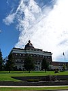
224 S. 2nd, Courthouse Sq. 45°08′15″N 90°20′31″W / 45.1375°N 90.341944°W | Medford | Classical Revival courthouse with metal clock dome designed by B. Mehner and built in 1913. [12] [13] |
See also
- List of National Historic Landmarks in Wisconsin
- National Register of Historic Places listings in Wisconsin
- Listings in neighboring counties: Chippewa, Clark, Lincoln, Marathon, Price, Rusk
References
- ^ The latitude and longitude information provided is primarily from the National Register Information System, and has been found to be fairly accurate for about 99% of listings. For 1%, the location info may be way off. We seek to correct the coordinate information wherever it is found to be erroneous. Please leave a note in the Discussion page for this article if you believe any specific location is incorrect.
- ^ National Park Service, United States Department of the Interior, "National Register of Historic Places: Weekly List Actions", retrieved April 5, 2024.
- ^ Numbers represent an alphabetical ordering by significant words. Various colorings, defined here, differentiate National Historic Landmarks and historic districts from other NRHP buildings, structures, sites or objects.
- ^ The eight-digit number below each date is the number assigned to each location in the National Register Information System database, which can be viewed by clicking the number.
- ^ "J. W. Benn Building". Architecture and History Inventory. Wisconsin Historical Society. Retrieved 2014-03-02.
- ^ Robert A. Birmingham (1986). Edgar S. Oerichbauer (ed.). Stray Bands and Dream Dancers: Indian Farms and Potawatomi Settlement in Central Wisconsin During the Late 19th and Early 20th Century. Burnett County Historical Society.
- ^ "Jump River Town Hall". Purcell and Elmslie, Architects. organica.org, John Panning. Retrieved 2011-12-30.
- ^ "Medford Free Public Library - National Register of Historic Places". Wisconsin Historical Society. Retrieved 2011-05-09.
- ^ "Medford Post Office". Architecture and History Inventory. Wisconsin Historical Society. Retrieved 2014-03-02.
- ^ "Mondeaux Dam Public Utility Area". Architecture and History Inventory. Wisconsin Historical Society. Retrieved 2014-03-02.
- ^ "St. Ann's Catholic Church and Cemetery". Architecture and History Inventory. Wisconsin Historical Society. Retrieved 2014-03-02.
- ^ "Main Page Photos of Wisconsin Courthouses". Wisconsin Register of Deeds Association. Archived from the original on 2012-08-06. Retrieved 2011-12-30.
- ^ "Taylor County Courthouse". Architecture and History Inventory. Wisconsin Historical Society. Retrieved 2014-03-02.
Wikimedia Commons has media related to
National Register of Historic Places in Taylor County, Wisconsin.
