From Wikipedia, the free encyclopedia
This list includes properties and districts listed on the
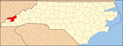
National Register of Historic Places in
Swain County, North Carolina . Click the "Map of all coordinates" link to the right to view an online map of all properties and districts with latitude and longitude coordinates in the table below.
[1]
Current listings This
National Park Service list is complete through
NPS recent listings posted April 12, 2024.
[2]
[3]
Name on the Register
Image
Date listed
[4]
Location
City or town
Description
1
Cheoah Hydroelectric Development
Cheoah Hydroelectric Development
May 21, 2004 (
#04000464 ) 1512 Tapoca Rd., NC 129
35°27′00″N 83°56′10″W / 35.45°N 83.936111°W / 35.45; -83.936111 (Cheoah Hydroelectric Development )
Robbinsville
Extends into
Graham County
2
Clingmans Dome Observation Tower
Clingmans Dome Observation Tower
August 15, 2012 (
#12000515 ) Terminus of Clingmans Dome Rd.
35°33′46″N 83°29′55″W / 35.562766°N 83.498493°W / 35.562766; -83.498493 (Clingmans Dome Observation Tower )
Bryson City
Extends into
Sevier County, Tennessee
3
Frye-Randolph House and Fryemont Inn
Frye-Randolph House and Fryemont Inn
February 18, 1983 (
#83001919 ) Fryemont Rd.
35°25′29″N 83°26′42″W / 35.42465°N 83.445114°W / 35.42465; -83.445114 (Frye-Randolph House and Fryemont Inn )
Bryson City
4
Governors Island
Governors Island
June 4, 1973 (
#73002239 )
U.S. Route 19 east of Bryson City
[5]
35°26′13″N 83°24′16″W / 35.436944°N 83.404444°W / 35.436944; -83.404444 (Governors Island )
Bryson City
Also known as "Kituhwa"
[6]
5
Hall Cabin
Hall Cabin
January 30, 1976 (
#76000162 ) 15 miles northeast of Fontana in
Great Smoky Mountains National Park
35°31′12″N 83°40′46″W / 35.52°N 83.679444°W / 35.52; -83.679444 (Hall Cabin )
Fontana
Also known as the J.H. Kress Cabin
6
Abel Hyatt House
Abel Hyatt House
March 22, 1991 (
#91000340 ) Eastern side of NC 1168, 0.2 miles north of its junction with NC 1191
35°26′15″N 83°23′47″W / 35.437494°N 83.396471°W / 35.437494; -83.396471 (Abel Hyatt House )
Bryson City
7
Mingus Mill
Mingus Mill
November 29, 2016 (
#16000808 ) Newfound Gap Rd.,
Great Smoky Mountains National Park
35°31′12″N 83°18′35″W / 35.520065°N 83.309835°W / 35.520065; -83.309835 (Mingus Mill )
Cherokee
8
Nununyi Mound and Village Site
Upload image January 22, 1980 (
#80002901 ) Between Acquoni Rd. and the
Oconaluftee River , north of Cherokee
[5]
35°29′40″N 83°18′39″W / 35.494444°N 83.310833°W / 35.494444; -83.310833 (Nununyi Mound and Village Site )
Cherokee
Site 31SW3
[7]
9
Oconaluftee Archeological District
Upload image February 19, 1982 (
#82001715 ) Address Restricted
Cherokee
10
Oconaluftee Baptist Church
Oconaluftee Baptist Church
January 1, 1976 (
#76000163 ) 6 miles north of Cherokee on
U.S. Route 441 in
Great Smoky Mountains National Park
35°33′13″N 83°18′31″W / 35.553611°N 83.308611°W / 35.553611; -83.308611 (Oconaluftee Baptist Church )
Cherokee
Part of Smokemont ghost town
11
Oconaluftee Ranger Station
Oconaluftee Ranger Station
November 29, 2016 (
#16000809 ) Newfound Gap Rd.,
Great Smoky Mountains National Park
35°30′47″N 83°18′23″W / 35.513088°N 83.306409°W / 35.513088; -83.306409 (Oconaluftee Ranger Station )
Cherokee
12
Swain County Courthouse
Swain County Courthouse
May 10, 1979 (
#79001752 ) Main and Fry Sts.
35°25′40″N 83°26′44″W / 35.427778°N 83.445556°W / 35.427778; -83.445556 (Swain County Courthouse )
Bryson City
See also References
^ The latitude and longitude information provided in this table was derived originally from the National Register Information System, which has been found to be fairly accurate for about 99% of listings. Some locations in this table may have been corrected to current GPS standards.
^ National Park Service,
United States Department of the Interior ,
"National Register of Historic Places: Weekly List Actions" , retrieved April 12, 2024.
^ Numbers represent an alphabetical ordering by significant words. Various colorings, defined
here , differentiate
National Historic Landmarks and
historic districts from other NRHP buildings, structures, sites or objects.
^ The eight-digit number below each date is the number assigned to each location in the
National Register Information System database, which can be viewed by clicking the number.
^
a b
Master Site Record , Research Laboratories of Archaeology, University of North Carolina at Chapel Hill, n.d. Accessed 2014-06-23.
^
"National Register Information System" .
National Register of Historic Places .
National Park Service . July 9, 2010.
^ Davis, R.P. Stephen, Jr., et al. "
An Abbreviated NAGPRA Inventory of theNorth Carolina Archaeological Collection ", University of North Carolina at Chapel Hill, 1998, 7. Accessed 2014-06-23.
Topics Lists Other lists
Topics Lists by state Lists by insular areas Lists by associated state Other areas Related


_Baptist_Church,_Cherokee,_NC.jpg)
,_Cherokee,_NC.jpg)