Native name: 南日岛 | |
|---|---|
 Nanri Island Location in the Taiwan Strait  Nanri Island Nanri Island (Southeast Asia)  Nanri Island Nanri Island (Asia) | |
| Geography | |
| Location | In the Taiwan Strait, southeast of the Asian mainland in Nanri Town, Xiuyu District, Putian, Fujian, China |
| Coordinates | 25°12′08″N 119°29′53″E / 25.202288°N 119.498077°E |
| Administration | |
| Province | Fujian |
| Prefecture-level city | Putian |
| District | Xiuyu |
| Town | Nanri |
| Additional information | |
| Time zone | |

Nanri Island [1] (Chinese: simplified Chinese: 南日岛; traditional Chinese: 南日島), Nanjisü, [2] Nanjih, historically known as Nanni Shan (南匿山) and Nanri Shan (南日山), [3] is a small island off the coast of China. Nanri Town (南日镇) is an administrative unit of Xiuyu District, Putian, Fujian, People's Republic of China which includes 111 islands and islets. [3] [4]
History
In October 1952, the island was the site of the Battle of Nanri Island between the People's Liberation Army and the Republic of China Army; the engagement ended in an ROC victory and resulted in the ROC occupying Nanri. However, ROC forces later withdrew to Taiwan, and the island was re-occupied by the People's Republic of China. [5]
Administrative divisions
The town of Nanri (which includes nearby islands) is divided into seventeen villages: [3] [6]
- Haishan ( 海山 村), Yunwan ( 云万 村), Yanxia ( 岩下 村), Shipan ( 石盘 村), Shanchu ( 山初 村), Wanfeng ( 万峰 村), Sandun ( 三墩 村), Xigao ( 西高 村), Shayang ( 沙洋 村), Gangnan ( 港南 村), Fuye ( 浮叶 村), Houye ( 后叶 村), Dongdai ( 东岱 村), Xiaori ( 小日 村), Aoyu ( 鳌屿 村, also known as Ta-ao Hsü (大嶅㠘)), Luopan ( 罗盘 村), Chishan ( 赤山 村)
Other populated places include Fou-tou (浮斗), Hsi-hu (西户), Hsi-kao, Ts'ao-hu, T'ou-ying-shih (頭英石), Ts'u-shan (粗山), Shih-t'ou-p'an and Shang-t'ou. [7]
Economy
The island is heavily involved in the fishing industry, and several fish farms have been established off the coast of the island. [8] [9] The island's mudflats are cultivated for seaweed and kelp production. [9] In 2015, a wind farm was established on the island. [10] [11]
Gallery
Maps including Nanri Island:
-
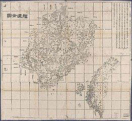 Map including Nanri Island (labeled as 南日嶼)
 -
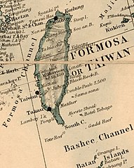 Map of the area including Lamyit I. (Nanjih or Nanri Island) (1880)
 -
 Japanese map including Nanri Island (labeled as 南日島) (1943)
 -
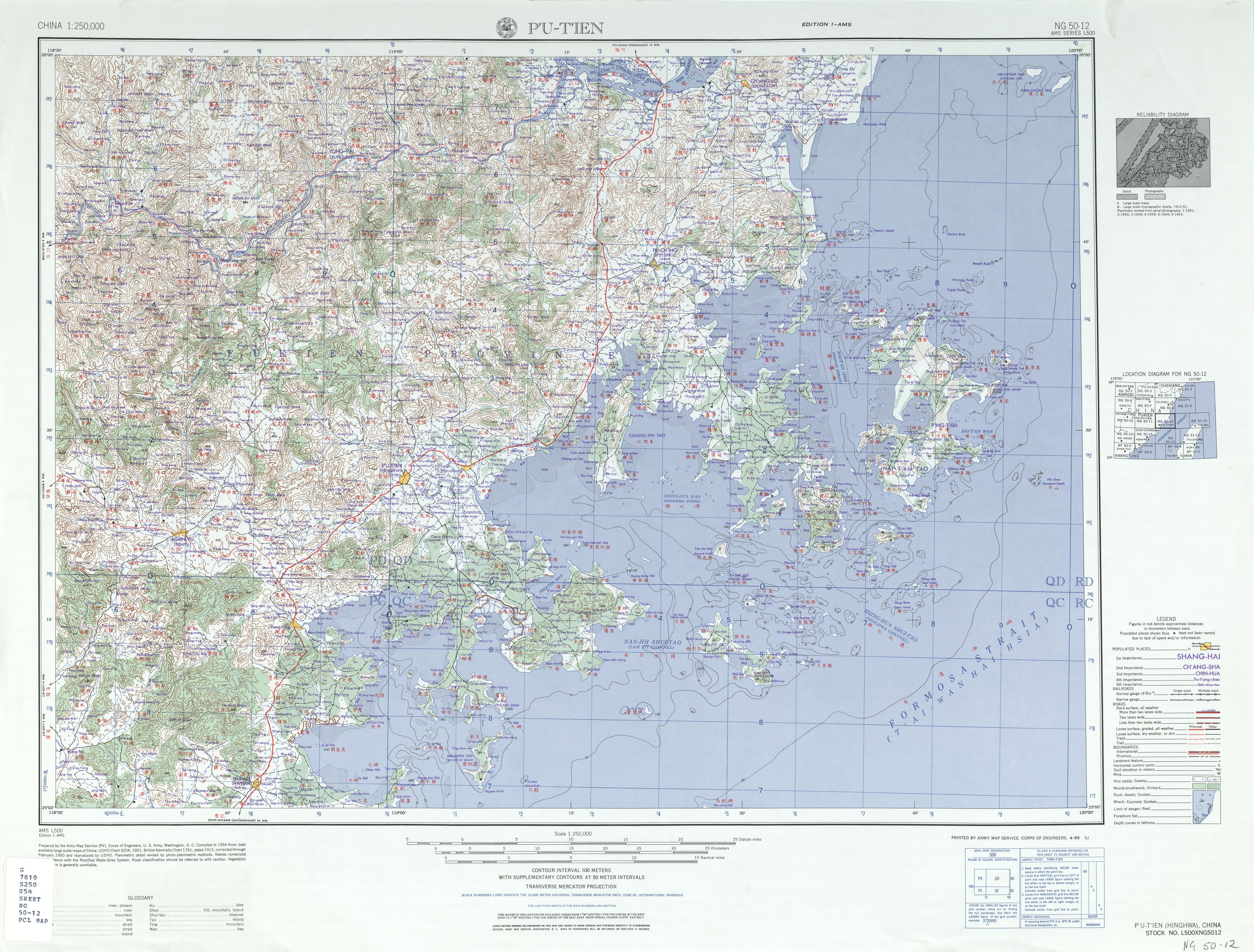
 Map including Nanri Island (labeled as NAN-JIH TAO 南日島) ( AMS, 1954)
 -
 Map including Nanri Island (labeled as Nan-jih Tao (Lam Yit)) ( AMS, 1954)
 -
 Map including Nanri Island (labeled as NANRI DAO) ( DMA, compiled 1971, revised 1996)

_in_1880,_from-_Stanford%27s_map_of_the_empires_of_China_and_Japan_with_the_adjacent_parts_of_the_Russian_Empire,_India,_Burma_etc._LOC_2006458442_(cropped).jpg)


References
- ^ Huang, Faming; Lin, Yanhong; Liang, Huixin; Zhao, Rongrong; Chen, Qiuming; Lin, Jie; Huang, Jinliang (3 December 2019). "Coordination of Marine Functional Zoning Revision at the Provincial and Municipal Levels: A Case Study of Putian, China". Journal of Marine Science and Engineering. 7 (12): 5. doi: 10.3390/jmse7120442.
-
^
Edward Stanford (1908).
Atlas of the Chinese Empire (1 ed.). pp. 24, 82.
Nanjisü{...}Nanjisü, Fukien . . 25.14 N 119.30 E
- ^
a
b
c
南日镇. 莆田市秀屿区人民政府 (in Simplified Chinese). 7 September 2017. Retrieved 10 February 2020.
南日岛古称南匿山,又名南日山,{...}全镇陆域总面积56平方千米,由111个岛屿组成,面积在0.1平方千米以上的岛屿有18个,有"十八列岛"之称,较大的有小日、鳌屿、罗盘、赤山等岛。{...}全岛有17个村,
- ^ 海岛资源. 莆田市秀屿区人民政府 (in Simplified Chinese). 7 September 2017. Retrieved 8 February 2020.
- ^ High Seas Buffer: The Taiwan Patrol Force, 1950-1979 By Bruce A. Elleman p60 Naval War College Newport Papers. 2012
-
^
2018年统计用区划代码和城乡划分代码:南日镇 [2018 Statistical Area Numbers and Rural-Urban Area Numbers: Nanri Town] (in Simplified Chinese).
National Bureau of Statistics of the People's Republic of China. 2018. Retrieved 15 February 2020.
统计用区划代码 城乡分类代码 名称 350305107201 121 海山村委会 350305107202 220 云万村委会 350305107203 220 岩下村委会 350305107204 220 石盘村委会 350305107205 220 山初村委会 350305107206 220 万峰村委会 350305107207 220 三墩村委会 350305107208 220 西高村委会 350305107209 220 沙洋村委会 350305107210 220 港南村委会 350305107211 220 浮叶村委会 350305107212 220 后叶村委会 350305107213 220 东岱村委会 350305107214 220 小日村委会 350305107215 220 鳌屿村委会 350305107216 220 罗盘村委会 350305107217 220 赤山村委会
- ^ "NG 50-12 P'U-T'IEN" (in English and Chinese). Washington, D. C.: Army Map Service. 1954 – via Perry–Castañeda Library Map Collection.
-
^ Alerts | 29/09/15 (2015-09-29).
"Fishing farms around NanRi Island, China". SAFETY4SEA. Retrieved 2019-03-22.
{{
cite web}}
: CS1 maint: numeric names: authors list ( link) - ^ a b 苗明媚. "Total fishery output in Nanri Island of SE China's Fujian up 6.2 percent - Xinhua | English.news.cn". www.xinhuanet.com. Archived from the original on March 22, 2019. Retrieved 2019-03-22.
- ^ "Nanri Island Offshore Wind Power Project | Reconnecting Asia". reconnectingasia.csis.org. Retrieved 2019-03-22.
- ^ 杨懿. "In pics: wind farm on SE China's Nanri Island - Xinhua | English.news.cn". www.xinhuanet.com. Archived from the original on March 4, 2019. Retrieved 2019-03-24.