Namasia
那瑪夏區 | |
|---|---|
| Namasia District [1] | |
 Maya Village | |
 Namasia District in Kaohsiung City | |
| Coordinates: 23°16′18″N 120°43′33″E / 23.271627°N 120.725906°E | |
| Country | Taiwan |
| Municipality | Kaohsiung City |
| Boroughs | List
|
| Government | |
| • Type | District government |
| • District chief | Payan Islituan ( Ind.) |
| Population (October 2023) | |
| • Total | 3,165 |
| Website |
namasia-en |
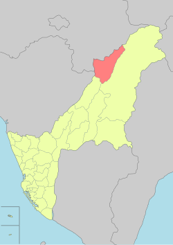
Namasia District [1] [2] [3] [4] [5] [6] ( Kanakanavu language, Bunun language: Namasia; Chinese: 那瑪夏 區; Hanyu Pinyin: Nàmǎxià Qū; Tongyong Pinyin: Nàmǎsià Cyu; Wade–Giles: Na4-ma3-hsia4 Ch'ü1), formerly Sanmin Township (三民鄉; Sānmín Xiāng), is a mountain indigenous district located in the northeastern part of Kaohsiung, Taiwan. It is the second largest district in Kaohsiung after Taoyuan District.
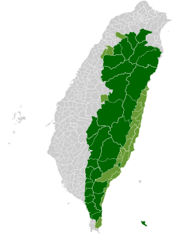
The population of the township is mainly the indigenous Bunun, Kanakanavu and Saaroa peoples. The modern-day population of the Kanakanavu people live in the two villages of Manga and Takanua. [7]
Name
On 1 January 2008, the then-township (which then was a part of Kaohsiung County) was renamed from Sanmin to Namasia, as the name of Sanmin (taken from the Sun Yat-sen's Three Principles of the People), was considered an overly political name. Rather, the name Namasia was chosen, as it is the name of a local river in the Tsou language, while its meaning is "better and better" in the Bunun language. [8]
History
During the period of Japanese rule, Namasia was grouped with Maolin District and Taoyuan District and classified as "Aboriginal Areas" (蕃地), which was governed under Kizan District of Takao Prefecture.
Geography
The lowest point in the Qishan River valley is 430 meters above sea level; the highest is the peak of Mount Xinwangling (新望嶺), at 2,481 meters. The four main settlements upriver are Nangisalu (南沙魯), Maya (瑪雅), and Takanua (達卡努瓦) 1 & 2 .
There is plentiful wildlife: 29 mammal species, 97 bird species, 30 types of reptile, 16 amphibians, and 18 fishes. There are also 89 butterfly species.
Administrative divisions
Namasia District is divided into three villages:
- Nangisalu Village (南沙魯里)
- Maya(Mangacun) Village (瑪雅里)
- Takanua(Tangaanua) Village (達卡努瓦里) [9]
| Namasia District administrative divisions | ||||||
|---|---|---|---|---|---|---|

Takanua Village
Maya Village
Nangisalu Village
|
Politics
On 29 November 2014, Dahu Istanda of Taiwan First Nations Party [10] was elected the first ever District Magistrate of Namasia. On 24 November 2018, Payan Islituan was elected the District Magistrate of Namasia.
See also
References
- ^
a
b
"Administrative Districts". 高雄市政府. 30 September 2016. Retrieved 4 April 2017.
Namasia District:
-
^
"District Mayor's Remarks". Namasia District Office. Retrieved 28 July 2019.
Welcome to Namasia District . Just follow Tai 21 Expressway northbound, you will come right into Namasia. {...}From the beautiful mountains and rivers, we sincerely invite you to witness and experience the tribal myths and the beauty of Namasia.{...}Address: No.1, Anshan Ln., Namasia District, Kaohsiung City 849, Taiwan (R.O.C.)
-
^ Steven Crook (21 May 2019).
"Making a Comeback from Morakot".
Taiwan Business TOPICS. Retrieved 28 July 2019.
This April, Kaohsiung's Namasia District enjoyed perhaps its largest-ever influx of visitors when firefly-chasing tourists made the most of a four-day weekend.
-
^ Christopher L. Knight; Glen Burgin; Yung-Fang Chen.
"Living with typhoons: Disaster management in rural Taiwan".
Royal Geographical Society. p. 105. Retrieved 28 July 2019.
RJM: Yes, but they were renamed in 2008. Minzu has become Nangisalu, Mingchuan has become Maya and Mingshen 1 and 2 has become Dakanua. Previously they were considered very KMT so they wanted something a little less political, so they've reverted to aboriginal names. My wife voted. They gave her a free teapot for voting. It used to be considered Sanming County, now it's Namasia District. That changed as well.
-
^ Chen Ting-fang (October 2019). "Camphor Trees Recall Jiasian's Captivating History". Love Kaohsiung 愛·高雄. No. 4. Translated by Hou Ya-ting. Information Bureau, Kaohsiung City Government. p. 3.
Long ago, poor transportation infrastructure in Kaohsiung's mountainous districts meant that those traveling between central Jiasian and what are now Taoyuan and Namasia districts often had to spend a night in Jiasian.
-
^
1.7-鄉鎮市區戶口數 [Population for Township and District].
Ministry of the Interior (in Chinese (Taiwan) and English). August 2020. Retrieved 21 September 2020.
那瑪夏區 Namasia District 252.9895 850 3,146 1,614 1,532 105.35 3.70 12
- ^ Zeitoun, Elizabeth; Teng, Stacy F. (2014). The Position of Kanakanavu and Saaroa Within the Formosan Languages Revisited (PDF). The 14th International Symposium on Chinese Languages and Linguistics (IsCLL-14), June 4–9, 2014. Academia Sinica, Taipei. Archived from the original (PDF) on 2014-06-06. Retrieved 2015-07-16.
- ^ Gao, Pat (1 February 2015). "Promoting Indigenous Rights". Taiwan Today. Retrieved 12 June 2021.
- ^ Web, Namasia Township Office (2 December 2010). "Namasia Township Office Web". Archived from the original on 14 July 2014.
- ^ "Taiwan: First Indigenous Political Party Founded". Unrepresented Nations and Peoples Organization. December 13, 2012.
