Nahanni Butte Airport | |||||||||||
|---|---|---|---|---|---|---|---|---|---|---|---|
| Summary | |||||||||||
| Airport type | Public | ||||||||||
| Operator | Government of the Northwest Territories | ||||||||||
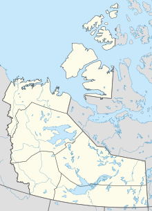
| Location | Nahanni Butte, Northwest Territories | ||||||||||
| Time zone | MST ( UTC−07:00) | ||||||||||
| Elevation AMSL | 598 ft / 182 m | ||||||||||
| Coordinates | 61°01′47″N 123°23′18″W / 61.02972°N 123.38833°W | ||||||||||
| Map | |||||||||||
| Runways | |||||||||||
| |||||||||||
Source:
Canada Flight Supplement
[1] | |||||||||||
Nahanni Butte Airport ( TC LID: CBD6) is a public aerodrome located near Nahanni Butte, Northwest Territories, Canada, east of the Nahanni National Park Reserve.
Pilots are requested to check for the presence of wood bison on the runway prior to landing.
See also
References
