| Mount Aeolus | |
|---|---|
| Highest point | |
| Elevation | 3,230 ft (980 m) NGVD 29 [1] |
| Prominence | 1,150 ft (350 m) |
| Coordinates | 43°14′26″N 73°02′19″W / 43.2406309°N 73.0387151°W [2] |
| Geography | |
| Location | Dorset, Bennington County, Vermont |
| Parent range | Taconic Range |
| Topo map | USGS Manchester |
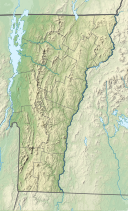
Mount Aeolus is a mountain summit in Dorset, Bennington County, Vermont, United States. Mount Aeolus is one of the Taconic Mountains. It lies 1.5 miles (2.4 km) west of the community of East Dorset. [2]

Name
Its name is derived from Aeolus, the Greek god of the wind. The Board on Geographic Names ruled in favor of the current name in 1986; prior to that time, the mountain had been referred to as "Mount Eolus" and "Green Peak". [2]
References
- ^ "Mount Aeolus, Vermont". Peakbagger.com. Retrieved 2011-06-07.
- ^ a b c "Mount Aeolus". Geographic Names Information System. United States Geological Survey, United States Department of the Interior. Retrieved 2011-06-07.
