| Monocacy River | |
|---|---|
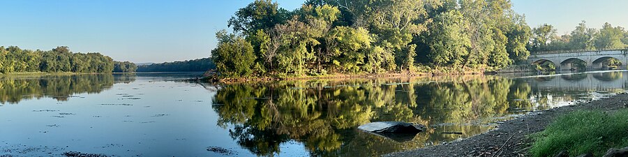
 Monocacy River near
Frederick, Maryland in 2007 | |
 The Monocacy River watershed | |
| Native name | Monnockkesey ( Shawnee) |
| Location | |
| Country | United States |
| State | Maryland |
| County | Frederick Carroll |
| Physical characteristics | |
| Source | |
| • location | Harney, Carroll County, Maryland, United States |
| • coordinates | 39°43′11″N 77°13′03″W / 39.71972°N 77.21750°W |
| • elevation | 400 ft (120 m) |
| Mouth | Potomac River |
• location | Dickerson, Maryland, United States |
• coordinates | 39°13′22″N 77°27′15″W / 39.22278°N 77.45417°W |
• elevation | 200 ft (61 m) |
| Length | 58 mi (93 km) |
| Basin size | 970 sq mi (2,500 km2) |
| Discharge | |
| • location | Frederick |
| • average | 1,550 cu ft/s (44 m3/s) |
| • minimum | 573 cu ft/s (16.2 m3/s) |
| • maximum | 3,060 cu ft/s (87 m3/s) |
| Discharge | |
| • location | Bridgeport, Frederick County, Maryland |
| • average | 400 cu ft/s (11 m3/s) |
| Basin features | |
| Tributaries | |
| • left | Piney Creek, Double Pipe Creek, Israel Creek, Linganore Creek, Furnace Branch |
| • right | Toms Creek, Tuscarora Creek, Carroll Creek, Ballenger Creek |
The Monocacy River ( /məˈnɒkəsi/) is a free-flowing left tributary to the Potomac River, which empties into the Atlantic Ocean via the Chesapeake Bay. The river is 58.5 miles (94.1 km) long, [1] with a drainage area of about 970 square miles (2,500 km2). [2] It is the largest Maryland tributary to the Potomac.
The name "Monocacy" comes from the Shawnee name for the river Monnockkesey, which translates to "river with many bends." (However, another local tradition asserts that "Monocacy" means "well-fenced garden" in an Indian language.)
The Monocacy National Battlefield lies alongside part of the river, marking an 1864 engagement during the American Civil War, the Battle of Monocacy Junction. The Chesapeake and Ohio Canal crosses over the river at the Monocacy Aqueduct, the largest of the 11 aqueducts on the canal.
-
 Confluence of Monocacy and Potomac Rivers by the Monocacy Aqueduct

Geography
The river rises in Carroll County, Maryland, west of the unincorporated town of Harney at the Maryland- Pennsylvania border. The river is formed by the confluence of Marsh Creek and Rock Creek, which flow out of Adams County, Pennsylvania. Maryland tributaries include Furnace Branch, Tuscarora Creek, Carroll Creek, Linganore Creek and Ballenger Creek in Frederick County and Double Pipe Creek in Carroll County; other Pennsylvania tributaries include Alloway Creek and Toms Creek in Adams County.
About 60% of the Monocacy watershed is dedicated to agricultural use; about 33% of the watershed is forested. The city of Frederick and its suburbs form the largest urban area within the watershed.
The 970 square mile watershed averages a flow of 600 million gallons per day (Mgal/d) at the mouth where it enters the Potomac River. [3]
Dendrology
The vegetation of the watershed is very similar to what one would expect to find through the Piedmont and valley and ridge regions. Some invasive species that threaten the balance of the ecosystem. A very good source for plant and tree information is the USDA-NRCS Plant Fact Sheets.
Pollution
The State of Maryland designated the Monocacy as a Maryland Scenic River in 1974. [4] However, it has one of the greatest nonpoint source pollution problems in the state due in large part to runoff from the 3,500 farms, livestock operations, and dairies in the watershed. The Maryland Department of the Environment (MDE) has listed the Monocacy with impaired water quality for nutrient pollution, sediment, and fecal coliform bacteria. [5] [6] A major tributary basin, the Double Pipe Creek watershed, is also impaired by these pollutants. [7] A 2012 MDE report said that fish and other aquatic life in the river were severely impacted by pollution and loss of habitat. [8]: 7, 10
Some farmers in the Monocacy watershed participate in the national Conservation Stewardship Program operated by the U.S. Department of Agriculture (USDA), designed to help stem pollution due to erosion and pollutant runoff from farming. [9] In the 1990s the watershed was part of a national water quality demonstration project sponsored by USDA, which helped farmers reduce fertilizer usage and reduced discharges of nitrogen and phosphorus to the river. [10]
See also
References
- ^ U.S. Geological Survey. National Hydrography Dataset high-resolution flowline data. The National Map Archived 2012-03-29 at the Wayback Machine, accessed August 15, 2011
- ^ "Chapter 3. The Physical Environment". Monocacy Scenic River Management Plan (Report). Frederick, MD: Frederick County Council. 2019.
- ^ "The Monocacy". Monocacy Scenic River Citizens Advisory Board. 2009. Final Report.
- ^ Monocacy Scenic River Advisory Board. "Monocacy Scenic River Study and Management Plan." Archived 2006-09-15 at the Wayback Machine; Maryland Department of Natural Resources, Annapolis, MD. 1990. p.3.
- ^ "TMDLs and Water Quality Plans for the Upper Monocacy River". Baltimore, MD: Maryland Department of the Environment (MDE). Retrieved 2023-01-02.
- ^ "TMDLs and Water Quality Plans for the Lower Monocacy River". MDE. Retrieved 2023-01-02.
- ^ "TMDLs and Water Quality Plans for Double Pipe Creek". MDE. Retrieved 2023-01-02.
- ^ Watershed Report for Biological Impairment of the Lower Monocacy River Watershed (PDF) (Report). MDE. July 2012.
- ^ U.S. Natural Resources Conservation Service (NRCS). "Conservation Security Program - Monocacy Watershed." Archived 2009-03-20 at the Wayback Machine Accessed 2009-03-07.
- ^ USDA. "Demonstration Projects – Selected Impacts" Archived 2008-10-10 at the Wayback Machine October 31, 2006.
External links
- Monocacy Scenic River Water Trail Map & Guide - Chesapeake Bay Gateways Network (2006)
- Monocacy River factsheet - Alliance for the Chesapeake Bay
- Monocacy & Catoctin Watershed Alliance
- Monocacy Aqueduct – C&O Canal Virtual Tour
- Monocacy Basin Stream Monitoring Project
- Monocacy Battlefield – National Park Service
- Fishing the Monocacy River
- Kayaking/Canoeing the Monocacy