| Mokai Power Station | |
|---|---|
|
| |
| Country | New Zealand |
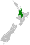
| Location | Waikato |
| Coordinates | 38°31′50″S 175°55′32″E / 38.53056°S 175.92556°E |
| Status | Operational |
| Commission date | 2000 |
| Owner(s) | Tuaropaki Power Company |
| Power generation | |
| Nameplate capacity | 113 MW |
| Annual net output | 930 GWh [1] |
| External links | |
| Website | www.tuaropaki.com |
The Mokai Power Station is a geothermal power station owned by the Tuaropaki Power Company and operated by Mercury NZ Limited. It is located approximately 30 km north west of Taupō in New Zealand. The station uses a binary cycle manufactured by Ormat Industries.
The Tuaropaki Power Company is 75% owned by the Tuaropaki Trust and 25% by Mighty River Power. [2]
The plant was initially constructed in 1999 as a 55 MW geothermal power station. An additional 40 MW was added in 2005 and in 2007 plant capacity was increased to 110 MW. [3]

See also
References
- ^ "Mokai". NZ Geothermal Association. Archived from the original on 2 June 2010. Retrieved 7 December 2013.
- ^ "Our Power Stations". Mighty River Power.
- ^ "Mokai geothermal system". Waikato Regional Council.
