Meriwether County | |
|---|---|

Meriwether County Courthouse in Greenville | |
 Location within the U.S. state of
Georgia | |
 Georgia's location within the
U.S. | |
| Coordinates: 33°02′N 84°41′W / 33.04°N 84.69°W | |
| Country | |
| State | |
| Founded | 1827 |
| Named for | David Meriwether |
| Seat | Greenville |
| Largest city | Manchester |
| Area | |
| • Total | 505 sq mi (1,310 km2) |
| • Land | 501 sq mi (1,300 km2) |
| • Water | 4.2 sq mi (11 km2) 0.8% |
| Population (
2020) | |
| • Total | 20,613 [1] |
| Time zone | UTC−5 ( Eastern) |
| • Summer ( DST) | UTC−4 ( EDT) |
| Congressional district | 3rd |
| Website |
meriwethercountyga |
Meriwether County is a county located in the west central portion of the U.S. state of Georgia. As of the 2020 census, the population was 20,613. [2] [1] The county seat is Greenville, [3] home of the Meriwether County Courthouse. The county was formed on December 14, 1827, as the 73rd county in Georgia. It was named for David Meriwether, a general in the American Revolutionary War and member of Congress from Georgia. [4]
Meriwether County is part of the Atlanta-Sandy Springs-Roswell MSA.
Geography
According to the U.S. Census Bureau, the county has a total area of 505 square miles (1,310 km2), of which 501 square miles (1,300 km2) is land and 4.2 square miles (11 km2) (0.8%) is water. [5]
The county is located in the Piedmont region of the state. Portions of the Pine Mountain Range are found in the southern parts of the county near the cities of Warm Springs and Manchester.
The eastern two-thirds of Meriwether County, going east from just west of U.S. Route 27 Alternate, is located in the Upper Flint River sub-basin of the ACF River Basin (Apalachicola-Chattahoochee-Flint River Basin). The western third of the county is located in the Middle Chattahoochee River- Lake Harding sub-basin of the same ACF River Basin. [6]
Major highways
-
 Interstate 85
 -

 U.S. Route 27 Alternate
 -
 State Route 18
 -
 State Route 41
 -
 State Route 54
 -
 State Route 54 Spur
 -
 State Route 74
 -
 State Route 85
 -
 State Route 85 Alternate
 -
 State Route 85 Spur
 -
 State Route 100
 -
 State Route 109
 -
 State Route 109 Spur
 -
 State Route 173
 -
 State Route 190
 -
 State Route 194
 -
 State Route 362
 -
 State Route 403 (unsigned designation for I-85)
Adjacent counties
- Coweta County (north)
- Spalding County (northeast)
- Pike County (east)
- Upson County (southeast)
- Talbot County (south)
- Harris County (southwest)
- Troup County (west)
Communities
Cities
- Greenville (county seat)
- Luthersville
- Manchester
- Warm Springs
- Woodbury
Towns
Unincorporated community
Demographics
| Census | Pop. | Note | %± |
|---|---|---|---|
| 1830 | 4,422 | — | |
| 1840 | 14,132 | 219.6% | |
| 1850 | 16,476 | 16.6% | |
| 1860 | 15,330 | −7.0% | |
| 1870 | 13,756 | −10.3% | |
| 1880 | 17,651 | 28.3% | |
| 1890 | 20,740 | 17.5% | |
| 1900 | 23,339 | 12.5% | |
| 1910 | 25,180 | 7.9% | |
| 1920 | 26,167 | 3.9% | |
| 1930 | 22,437 | −14.3% | |
| 1940 | 22,055 | −1.7% | |
| 1950 | 21,055 | −4.5% | |
| 1960 | 19,756 | −6.2% | |
| 1970 | 19,461 | −1.5% | |
| 1980 | 21,229 | 9.1% | |
| 1990 | 22,411 | 5.6% | |
| 2000 | 22,534 | 0.5% | |
| 2010 | 21,992 | −2.4% | |
| 2020 | 20,613 | −6.3% | |
| 2023 (est.) | 20,931 | [7] | 1.5% |
| U.S. Decennial Census
[8] 1790-1880 [9] 1890-1910 [10] 1920-1930 [11] 1930-1940 [12] 1940-1950 [13] 1960-1980 [14] 1980-2000 [15] 2010 [2] 2020 [1] | |||
| Race | Num. | Perc. |
|---|---|---|
| White (non-Hispanic) | 12,084 | 58.62% |
| Black or African American (non-Hispanic) | 7,273 | 35.28% |
| Native American | 64 | 0.31% |
| Asian | 78 | 0.38% |
| Pacific Islander | 6 | 0.03% |
| Other/Mixed | 633 | 3.07% |
| Hispanic or Latino | 475 | 2.3% |
As of the 2020 United States census, there were 20,613 people, 8,051 households, and 5,504 families residing in the county.
Politics
Meriwether County is a moderately Republican county. The last Democrat to win the county was Al Gore in 2000.
| Year | Republican | Democratic | Third party | |||
|---|---|---|---|---|---|---|
| No. | % | No. | % | No. | % | |
| 2020 | 6,524 | 59.96% | 4,287 | 39.40% | 69 | 0.63% |
| 2016 | 5,222 | 56.47% | 3,804 | 41.13% | 222 | 2.40% |
| 2012 | 4,856 | 52.36% | 4,331 | 46.70% | 87 | 0.94% |
| 2008 | 4,982 | 52.34% | 4,465 | 46.91% | 71 | 0.75% |
| 2004 | 4,402 | 53.98% | 3,709 | 45.48% | 44 | 0.54% |
| 2000 | 3,162 | 47.13% | 3,441 | 51.29% | 106 | 1.58% |
| 1996 | 2,259 | 36.13% | 3,492 | 55.85% | 502 | 8.03% |
| 1992 | 2,364 | 32.30% | 4,002 | 54.67% | 954 | 13.03% |
| 1988 | 3,101 | 51.31% | 2,934 | 48.54% | 9 | 0.15% |
| 1984 | 3,195 | 52.73% | 2,864 | 47.27% | 0 | 0.00% |
| 1980 | 1,838 | 31.66% | 3,876 | 66.77% | 91 | 1.57% |
| 1976 | 1,450 | 23.09% | 4,830 | 76.91% | 0 | 0.00% |
| 1972 | 3,420 | 73.82% | 1,213 | 26.18% | 0 | 0.00% |
| 1968 | 1,120 | 20.55% | 1,760 | 32.29% | 2,571 | 47.17% |
| 1964 | 2,250 | 48.14% | 2,423 | 51.84% | 1 | 0.02% |
| 1960 | 706 | 18.55% | 3,100 | 81.45% | 0 | 0.00% |
| 1956 | 592 | 15.88% | 3,137 | 84.12% | 0 | 0.00% |
| 1952 | 531 | 13.01% | 3,551 | 86.99% | 0 | 0.00% |
| 1948 | 204 | 8.47% | 1,967 | 81.65% | 238 | 9.88% |
| 1944 | 189 | 7.95% | 2,187 | 92.05% | 0 | 0.00% |
| 1940 | 174 | 5.98% | 2,726 | 93.74% | 8 | 0.28% |
| 1936 | 138 | 5.36% | 2,438 | 94.61% | 1 | 0.04% |
| 1932 | 53 | 1.99% | 2,604 | 97.82% | 5 | 0.19% |
| 1928 | 287 | 15.93% | 1,515 | 84.07% | 0 | 0.00% |
| 1924 | 103 | 7.74% | 886 | 66.57% | 342 | 25.69% |
| 1920 | 186 | 14.94% | 1,059 | 85.06% | 0 | 0.00% |
| 1916 | 36 | 2.88% | 1,118 | 89.44% | 96 | 7.68% |
| 1912 | 26 | 2.66% | 862 | 88.05% | 91 | 9.30% |
Media
The county is served by the Meriwether Vindicator newspaper.
See also
- National Register of Historic Places listings in Meriwether County, Georgia
- List of counties in Georgia
References
- ^ a b c US 2020 Census Bureau report, Meriwether County, Georgia
- ^ a b "State & County QuickFacts". United States Census Bureau. Archived from the original on June 7, 2011. Retrieved June 24, 2014.
- ^ "Find a County". National Association of Counties. Retrieved June 7, 2011.
- ^ Gannett, Henry (1905). The Origin of Certain Place Names in the United States. U.S. Government Printing Office. p. 206.
- ^ "US Gazetteer files: 2010, 2000, and 1990". United States Census Bureau. February 12, 2011. Retrieved April 23, 2011.
- ^ "Georgia Soil and Water Conservation Commission Interactive Mapping Experience". Georgia Soil and Water Conservation Commission. Retrieved November 19, 2015.
- ^ "Annual Estimates of the Resident Population for Counties: April 1, 2020 to July 1, 2023". United States Census Bureau. Retrieved March 31, 2024.
- ^ "Decennial Census of Population and Housing by Decades". United States Census Bureau.
- ^ "1880 Census Population by Counties 1790-1800" (PDF). United States Census Bureau. 1880.
- ^ "1910 Census of Population - Georgia" (PDF). United States Census Bureau. 1910.
- ^ "1930 Census of Population - Georgia" (PDF). United States Census Bureau. 1930.
- ^ "1940 Census of Population - Georgia" (PDF). United States Census Bureau. 1940.
- ^ "1950 Census of Population - Georgia -" (PDF). United States Census Bureau. 1950.
- ^ "1980 Census of Population - Number of Inhabitants - Georgia" (PDF). United States Census Bureau. 1980.
- ^ "2000 Census of Population - Population and Housing Unit Counts - Georgia" (PDF). United States Census Bureau. 2000.
- ^ "Explore Census Data". data.census.gov. Retrieved December 14, 2021.
- ^ Leip, David. "Dave Leip's Atlas of U.S. Presidential Elections". uselectionatlas.org. Retrieved March 22, 2018.
External links
Places adjacent to Meriwether County, Georgia | ||||||||||||||||
|---|---|---|---|---|---|---|---|---|---|---|---|---|---|---|---|---|
| ||||||||||||||||
Municipalities and communities of
Meriwether County, Georgia, United States | ||
|---|---|---|
| Cities | 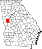 | |
| Towns | ||
|
Unincorporated communities | ||
| Footnotes | ‡This populated place also has portions in an adjacent county or counties | |
|  | |||||
|
| ||||||
| International | |
|---|---|
| National | |
| Other | |