Meadows Place, Texas | |
|---|---|
 A sign indicating Meadows Place | |
 | |
| Coordinates: 29°38′59″N 95°35′19″W / 29.64972°N 95.58861°W | |
| Country | United States |
| State | Texas |
| County | Fort Bend |
| Incorporated | November 14, 1983 |
| Government | |
| • Mayor | Charles Jessup |
| Area | |
| • Total | 0.93 sq mi (2.42 km2) |
| • Land | 0.93 sq mi (2.42 km2) |
| • Water | 0.00 sq mi (0.00 km2) |
| Population (
2020) | |
| • Total | 4,767 |
| • Density | 4,920.69/sq mi (1,899.30/km2) |
| Time zone | UTC-6 ( Central (CST)) |
| • Summer ( DST) | UTC-5 (CDT) |
| FIPS code | 48-47337 [2] |
| Website |
www |
Meadows Place is a city located in Fort Bend County in the U.S. state of Texas within the Houston–Sugar Land–Baytown metropolitan area. As of the 2020 U.S. Census, the city population was 4,767. [3]
Meadows Place was part of Stafford's extraterritorial jurisdiction prior to incorporation on November 14, 1983. Meadows Place was incorporated as Meadows, but this was changed to "Meadows Place" in 1997 due to postal conflicts with a city of a similar name, Meadow, Texas. The city of Meadows Place has its own police force and 24/7 fire and EMS protection. The current mayor is Charles Jessup.
Meadows Place shares a ZIP code (77477) with Stafford, Texas, and the post office is in Stafford, but postal addresses in Meadows Place are designated as "Meadows Place, Texas".
History
Meadows Place began as the Meadows Municipal Utility District, which had been established in 1967.The Meadows Place development farmland was purchased by Ayrshire Corporation. In 1968, the first houses were constructed by Ayrshire Corporation, a second-generation family-owned company founded in 1946. Ayrshire has developed mix use property throughout the United States and Australia. The Meadows place development is representative of their development capabilities. Meadows incorporated on November 14, 1983, to avoid being annexed by Houston. In 1990, the city had 4,606 residents. [4] The population in 2010 was listed as 4,660 residents. In June 2012, Meadows Place received an award from Keep Texas Beautiful for a water reuse project that culminated in a beautiful new lake in the center of the city which, in addition to recreation, is used for irrigation of most of the city's parks land and baseball complex. So dramatic was the transformation, Meadows Place was asked to make a poster presentation at the 28th annual Water ReUse Symposium in Denver, Colorado. The presentation—"No City is Too Small to Receive Benefits from Water Reuse"—met with such acclaim they were invited to share their story at an international water convention. Hundreds of people from the US, Canada, Mexico, even Sweden and Norway, have come to see how a small city with limited resources could bring such a project to fruition. [5]
Geography

Meadows Place is located along the northeast border of Fort Bend County at 29°38′59″N 95°35′19″W / 29.64972°N 95.58861°W (29.649599, –95.588747). [6] It is bordered by the city of Sugar Land to the west, Stafford to the south, and Houston to the northeast in Harris County. Downtown Houston is 16 miles (26 km) to the northeast via Interstate 69, the Southwest Freeway.
According to the United States Census Bureau, the city has a total area of 0.9 square miles (2.3 km2), all land.
The city is located between West Bellfort Avenue, U.S. Route 59/I-69, Dairy Ashford Road, and West Airport Boulevard. [7] Meadows Place is 1 mile (1.6 km) southwest of Houston's Beltway 8. [8]
Demographics
| Census | Pop. | Note | %± |
|---|---|---|---|
| 1990 | 4,606 | — | |
| 2000 | 4,912 | 6.6% | |
| 2010 | 4,660 | −5.1% | |
| 2020 | 4,767 | 2.3% | |
| U.S. Decennial Census [9] | |||
| Race | Number | Percentage |
|---|---|---|
| White (NH) | 2,039 | 42.77% |
| Black or African American (NH) | 480 | 10.07% |
| Native American or Alaska Native (NH) | 7 | 0.15% |
| Asian (NH) | 858 | 18.0% |
| Some Other Race (NH) | 18 | 0.38% |
| Mixed/Multi-Racial (NH) | 192 | 4.03% |
| Hispanic or Latino | 1,173 | 24.61% |
| Total | 4,767 |
As of the 2020 United States census, there were 4,767 people, 1,775 households, and 1,274 families residing in the city.
As of the census [2] of 2000, there were 4,912 people, 1,598 households, and 1,358 families residing in the city. The population density was 5,247.8 inhabitants per square mile (2,026.2/km2). There were 1,616 housing units at an average density of 1,726.5 per square mile (666.6/km2). The racial makeup of the city was 71.82% White, 6.09% African American, 0.22% Native American, 15.72% Asian, 0.10% Pacific Islander, 3.24% from other races, and 2.81% from two or more races. Hispanic or Latino of any race were 11.46% of the population.
There were 1,598 households, out of which 43.2% had children under the age of 18 living with them, 70.9% were married couples living together, 10.8% had a female householder with no husband present, and 15.0% were non-families. 12.6% of all households were made up of individuals, and 2.9% had someone living alone who was 65 years of age or older. The average household size was 3.01 and the average family size was 3.28.
In the city, the population was spread out, with 27.9% under the age of 18, 6.8% from 18 to 24, 26.5% from 25 to 44, 29.7% from 45 to 64, and 9.2% who were 65 years of age or older. The median age was 39 years. For every 100 females, there were 90.2 males. For every 100 females age 18 and over, there were 86.4 males.
The median income for a household in the city was $73,180, and the median income for a family was $75,708. Males had a median income of $51,173 versus $35,929 for females. The per capita income for the city was $27,134. About 1.7% of families and 4.5% of the population were below the poverty line, including 5.8% of those under age 18 and 14.5% of those age 65 or over.
Government

Meadows Place has a mayor- alderman form of government. The city council consists of the mayor and five aldermen. [13]
Fort Bend County does not have a hospital district. OakBend Medical Center serves as the county's charity hospital which the county contracts with. [14]
Infrastructure
Water System
The City of Meadows Place operates its own water system consisting of three water wells around the city.
Education
Primary and secondary schools

Meadows Place residents are within the Fort Bend Independent School District. Children attend Meadows Elementary School (located in the city of Meadows Place), [15] Dulles Middle School (in Sugar Land), [16] and Dulles High School (also in Sugar Land). [17] Dulles Junior and Dulles High School were already built as Meadows Place opened. Meadows Elementary was occupied in August 1973. Dulles Junior High School reopened and was reoccupied in 1983. [18]
In 2018 the FBISD administration proposed closing Meadows Elementary. In response parents from the community advocated for keeping the school open. [19] An area resident quoted by KTRK-TV, stated that the members of the community believed that if Meadows Elementary was shut down, their property values would decline. [20]
Sugar Grove Christian School, a preschool and elementary school, is in Meadows Place. It was founded in 1969, as the Sharpstown Christian School. [21]
Colleges and universities
Community college facilities in proximity to Meadows Place are Houston Community College facilities and the Wharton County Junior College (HCC) facilities. Colleges and universities in proximity to Meadows Place include Houston Baptist University and the University of Houston Sugar Land campus. [8]
The Texas Legislature specifies that the HCC boundary includes "the part of the Fort Bend Independent School District that is not located in the service area of the Wharton County Junior College District and that is adjacent to the Houston Community College System District." [22] Wharton College's boundary within FBISD is defined only as the City of Sugar Land and the ETJ of Sugar Land, [23] Meadows Place is in neither location. [24] Meadows Place is in HCC. [25]
Parks and recreation
Meadows Place has six parks within the city: Mark McGrath Municipal Park, Jim McDonald Park, Brighton Lane Park, Meadow Glen Park, Meadow Valley Park, and Kangaroo Court Park.
The city also has a Discovery & Nature Center, that offers up-close experiences with several different species of animals. The center is open to residents and non-residents for a fee. It can also be rented for birthday parties and special occasions.
In addition, the city has a community center, community swimming pool, tennis courts, pickleball courts, baseball fields, splash pad, walking trails, and a running path. Both the community center and swimming pool are available for rental.
In 2011, the city built a lake complex in the middle of their park using Type 1 reclaimed water. This facility is used for fishing, hiking, and birdwatching year round. The lake is used as source of water for irrigation of city parks, saving the city money on subsidence fees. This project was recognized as the number two top environmental project in the State of Texas by Keep Texas Beautiful in 2012 and has had visitors from around the country.
Gallery
-
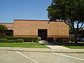 Meadows Place Police Department
 -
 Meadows Place Fire Station
 -
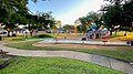
 Mark McGrath Municipal Park
 -
 Mark McGrath Municipal Park
 -
 Mark McGrath Municipal Park Splash Pad
 -
 Mark McGrath Municipal Park
 -
 Jim McDonald Park (Includes Sensory Park
 -
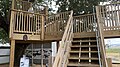
 Helman Playground at Jim McDonald Park
 -
 Meadow Valley Park
 -
 Meadow Valley Park
 -
 Brighton Lane Park
 -
 Meadow Glen Park
 -
 Kangaroo Court Park
 -
 Discovery & Nature Center
 -
 Discovery & Nature Center
 -
 Discovery & Nature Center
 -
 Discovery & Nature Center
 -
 Discovery & Nature Center


.jpg)


References
- ^ "2019 U.S. Gazetteer Files". United States Census Bureau. Retrieved August 7, 2020.
- ^ a b "U.S. Census website". United States Census Bureau. Retrieved January 31, 2008.
- ^ "Geographic Identifiers: 2010 Demographic Profile Data (G001): Meadows Place city, Texas". U.S. Census Bureau, American Factfinder. Retrieved August 29, 2016.[ dead link]
- ^ " Meadows, Texas." Handbook of Texas Online. Retrieved on April 4, 2010.
- ^ Daniels, Karen (October 2, 2013). "Meadows Place wows audience at 28th annual Water Symposium". Fort Bend Start. Retrieved January 14, 2019.
- ^ "US Gazetteer files: 2010, 2000, and 1990". United States Census Bureau. February 12, 2011. Retrieved April 23, 2011.
- ^ " City of Meadows Place Territory Archived 2009-01-31 at the Wayback Machine." City of Meadows Place. Retrieved on June 13, 2009.
- ^ a b " City of Meadows Place Offers the Best of Both Worlds Archived 2008-08-04 at the Wayback Machine." City of Meadows Place. Retrieved on December 2, 2010.
- ^ "Census of Population and Housing". Census.gov. Retrieved June 4, 2015.
- ^ "Explore Census Data". data.census.gov. Retrieved May 23, 2022.
- ^ https://www.census.gov/ [ not specific enough to verify]
- ^ "About the Hispanic Population and its Origin". www.census.gov. Retrieved May 18, 2022.
- ^ " [1]." City of Meadows Place. Retrieved on August 8, 2019.
- ^ Knipp, Bethany (November 2, 2016). "Fort Bend County lacks hospital district". Community Impact Newspaper. Retrieved October 18, 2021.
- ^ " Meadows Elementary Attendance Zone." Fort Bend Independent School District. Retrieved on September 12, 2011.
- ^ " Dulles Middle School Attendance Zone." Fort Bend Independent School District. Retrieved on September 12, 2011.
- ^ " Dulles High School Attendance Zone." Fort Bend Independent School District. Retrieved on September 12, 2011.
- ^ " FBISD History Archived 2008-09-07 at the Wayback Machine." Fort Bend Independent School District. Retrieved on April 4, 2010.
- ^ Rosenhouse, Mike (April 3, 2018). "Meadows Place parents fight for the future of local elementary school". CW 39. Retrieved April 13, 2018.
- ^ Romo, Steven (April 11, 2018). "Passion on display at final Fort Bend ISD zoning meeting". KTRK-TV. Retrieved April 13, 2018.
- ^ " About SGCS Archived 2012-04-25 at the Wayback Machine." Sugar Grove Christian School. Retrieved on November 12, 2011. "11600 West Airport Blvd, Meadows Place, TX 77477"
- ^ "Sec. 130.182. HOUSTON COMMUNITY COLLEGE SYSTEM DISTRICT SERVICE AREA". Retrieved March 10, 2024.
- ^ "Sec. 130.211. WHARTON COUNTY JUNIOR COLLEGE DISTRICT SERVICE AREA".
- ^ "Fort Bend County Cities & ETJs" (PDF). Fort Bend County. Retrieved March 10, 2024. - Compare with the city map.
- ^ "HCC Single Member Districts 2023" (PDF). Houston Community College. Retrieved March 10, 2024. - See profile page - Compare with the map of Arcola.
External links
| Counties |  | |
|---|---|---|
| "Principal" cities | ||
| Other cities |
For a complete listing, see list of cities and towns in Houston–The Woodlands–Sugar Land MSA | |
| Unincorporated areas | ||
| Bodies of water | ||
Municipalities and communities of
Fort Bend County, Texas, United States | ||
|---|---|---|
| Cities |  | |
| Town | ||
| Villages | ||
| CDPs | ||
|
Other communities | ||
| Former communities | ||
| Ghost towns | ||
| Footnotes | ‡This populated place also has portions in an adjacent county or counties ±Former CDP annexed by Missouri City ^Former CDP annexed by Sugar Land #Still active as a community, but is no longer listed as a census-designated place | |