Meadow Mills, Virginia | |
|---|---|
 Meadow Mills  Meadow Mills | |
| Coordinates: 39°1′23″N 78°18′21″W / 39.02306°N 78.30583°W | |
| Country | United States |
| State | Virginia |
| County | Frederick |
| Time zone | UTC−5 ( Eastern (EST)) |
| • Summer ( DST) | UTC−4 (EDT) |
| GNIS feature ID | 1495924 [1] |
Meadow Mills is an unincorporated community in Frederick County, Virginia, United States. Meadow Mills is located in southern Frederick County southwest of Middletown on Cedar Creek, hence its former eponymous name of Cedar Creek.
The presence of grain as local crop in Meadow Mills is indicated in an 1882 issue of The Stephen City Star community newspaper where the presence of mills and the use of threshes within the community of Meadow Mills is mentioned. Two Meadow Mills residents, J. and W. Hottel are also named as millers. [2]
References
- ^ U.S. Geological Survey Geographic Names Information System: Meadow Mills, Virginia
- ^ "Stephens City Star 22 July 1882 — Virginia Chronicle: Digital Newspaper Archive". virginiachronicle.com. Retrieved September 12, 2023.
Wikimedia Commons has media related to
Meadow Mills, Virginia.
Municipalities and communities of
Frederick County, Virginia, United States | ||
|---|---|---|
| Towns | 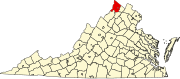 | |
| CDPs | ||
|
Other communities |
| |
This Frederick County, Virginia state location article is a stub. You can help Wikipedia by expanding it. |