| Mayo River Rio Mayo en Mesa Colorada | |
|---|---|
| Location | |
| Country | Mexico |
| State | Sonora |
| Physical characteristics | |
| Mouth | Gulf of California |
• coordinates | 26°43′48″N 109°47′32″W / 26.7301°N 109.7921°W |
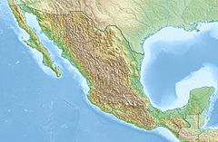
The Mayo River is located in the Mexican state of Sonora. [1] [2]
The Adolfo Ruiz Cortines Dam, named after a former president of Mexico, generates electricity and irrigates agriculture in the Mayo Valley. It is 30 km east of the city of Navojoa, in the municipality of Álamos.
See also
References
- ^ The Rio Mayo at the end of the 20th Century, Google books
- ^ "Mayo". GeoNames. Retrieved July 26, 2021.
