Matheson, Colorado | |
|---|---|
 Looking north on Main Street (
County Road 149) from the town's south side, November 2021 | |
 Matheson Location of the Matheson CDP in the
State of Colorado. | |
| Coordinates: 39°10′06″N 103°58′37″W / 39.1683162°N 103.9770183°W [1] | |
| Country | |
| State | |
| County | Elbert County |
| Government | |
| • Type | unincorporated community |
| Area | |
| • Total | 1.716 sq mi (4.444 km2) |
| • Land | 1.716 sq mi (4.444 km2) |
| • Water | 0.000 sq mi (0.000 km2) |
| Elevation | 5,843 ft (1,781 m) |
| Population | |
| • Total | 79 |
| • Density | 46/sq mi (18/km2) |
| Time zone | UTC-7 ( MST) |
| • Summer ( DST) | UTC-6 ( MDT) |
| ZIP Code [4] | 80830 |
| Area code | 719 |
| GNIS feature [2] | Matheson CDP |
Matheson is a census-designated place (CDP) and post office in and governed by Elbert County, Colorado, United States. The CDP is a part of the Denver–Aurora–Lakewood, CO Metropolitan Statistical Area. The Matheson post office has the ZIP Code 80830. [4] At the United States Census 2020, the population of the Matheson CDP was 79. [3]
History
The town was named after Duncan Matheson, the original owner of the town site. [5]
Geography
The Matheson CDP has an area of 1,098 acres (4.444 km2), all land. [1]
Demographics
| Year | Pop. | ±% |
|---|---|---|
| 2020 | 79 | — |
| Source: United States Census Bureau | ||
The United States Census Bureau defined the Matheson CDP for the United States Census 2020.
In popular culture
The television series Honey, I Shrunk the Kids: The TV Show is set in Matheson, Colorado. However, the series portrays Matheson as much larger, a hub of high-tech industry, and located somewhere in the mountains west of Denver.
See also
References
- ^ a b c "State of Colorado Census Designated Places - BAS20 - Data as of January 1, 2020". United States Census Bureau. Retrieved December 22, 2020.
- ^ a b c "U.S. Board on Geographic Names: Domestic Names". United States Geological Survey. Retrieved December 22, 2020.
- ^ a b United States Census Bureau. "Matheson CDP, Colorado". Retrieved March 19, 2023.
- ^ a b "Look Up a ZIP Code". United States Postal Service. Retrieved December 22, 2020.
- ^ Dawson, John Frank. Place names in Colorado: why 700 communities were so named, 150 of Spanish or Indian origin. Denver, CO: The J. Frank Dawson Publishing Co. p. 34.
External links
Municipalities and communities of
Elbert County, Colorado, United States | ||
|---|---|---|
| Towns | 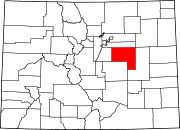 | |
| CDP | ||
|
Unincorporated communities | ||