Mata de Plátano | |
|---|---|
Barrio | |
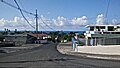
 Main road in Mata de Platano | |
 Location of Mata de Plátano within the municipality of Luquillo shown in red | |
 Mata de Plátano Location of Puerto Rico | |
| Coordinates: 18°22′01″N 65°44′14″W / 18.366911°N 65.737269°W [1] | |
| Commonwealth | |
| Municipality | |
| Area | |
| • Total | 5.19 sq mi (13.4 km2) |
| • Land | 4.49 sq mi (11.6 km2) |
| • Water | 0.70 sq mi (1.8 km2) |
| Elevation | 20 ft (6 m) |
| Population (2010) | |
| • Total | 8,972 |
| • Density | 1,998.2/sq mi (771.5/km2) |
| Source: 2010 Census | |
| Time zone | UTC−4 ( AST) |
Mata de Plátano is a barrio in the municipality of Luquillo, Puerto Rico. Its population in 2010 was 8,972. [3] [4] [5]
| Census | Pop. | Note | %± |
|---|---|---|---|
| 1910 | 824 | — | |
| 1920 | 897 | 8.9% | |
| 1930 | 573 | −36.1% | |
| 1940 | 885 | 54.5% | |
| 1950 | 1,036 | 17.1% | |
| 1960 | 1,033 | −0.3% | |
| 1970 | 0 | −100.0% | |
| 1980 | 5,447 | — | |
| 1990 | 6,783 | 24.5% | |
| 2000 | 8,318 | 22.6% | |
| 2010 | 8,972 | 7.9% | |
| U.S. Decennial Census 1899 (shown as 1900) [6] 1910-1930 [7] 1930-1950 [8] 1980-2000 [9] 2010 [10] | |||
Gallery
-
 Mata de Platano barrio street and ocean view

See also
References
- ^ a b "US Gazetteer 2019". US Census. US Government.
- ^ U.S. Geological Survey Geographic Names Information System: Mata de Plátano barrio
- ^ Picó, Rafael; Buitrago de Santiago, Zayda; Berrios, Hector H. Nueva geografía de Puerto Rico: física, económica, y social, por Rafael Picó. Con la colaboración de Zayda Buitrago de Santiago y Héctor H. Berrios. San Juan Editorial Universitaria, Universidad de Puerto Rico,1969.
- ^ Gwillim Law (20 May 2015). Administrative Subdivisions of Countries: A Comprehensive World Reference, 1900 through 1998. McFarland. p. 300. ISBN 978-1-4766-0447-3. Retrieved 25 December 2018.
- ^ Puerto Rico: 2010 Population and Housing Unit Counts.pdf (PDF). U.S. Dept. of Commerce, Economics and Statistics Administration, U.S. Census Bureau. 2010.
- ^ "Report of the Census of Porto Rico 1899". War Department Office Director Census of Porto Rico. Archived from the original on July 16, 2017. Retrieved September 21, 2017.
- ^ "Table 3-Population of Municipalities: 1930 1920 and 1910" (PDF). United States Census Bureau. Archived (PDF) from the original on August 17, 2017. Retrieved September 21, 2017.
- ^ "Table 4-Area and Population of Municipalities Urban and Rural: 1930 to 1950" (PDF). United States Census Bureau. Archived (PDF) from the original on August 30, 2015. Retrieved September 21, 2014.
- ^ "Table 2 Population and Housing Units: 1960 to 2000" (PDF). United States Census Bureau. Archived (PDF) from the original on July 24, 2017. Retrieved September 21, 2017.
- ^ Puerto Rico: 2010 Population and Housing Unit Counts.pdf (PDF). U.S. Dept. of Commerce Economics and Statistics Administration U.S. Census Bureau. 2010. Archived (PDF) from the original on 2017-02-20. Retrieved 2019-08-02.
|
| This Luquillo, Puerto Rico location article is a stub. You can help Wikipedia by expanding it. |