Marystown | |
|---|---|
| Coordinates: 44°43′15″N 93°32′29″W / 44.72083°N 93.54139°W | |
| Country | United States |
| State | Minnesota |
| County | Scott |
| Township | Louisville Township |
| Elevation | 974 ft (297 m) |
| Population (2019) | |
| • Total | 1 |
| Time zone | UTC-6 ( Central (CST)) |
| • Summer ( DST) | UTC-5 (CDT) |
| ZIP code | 55379 |
| Area code | 952 |
| GNIS feature ID | 647602 [1] |
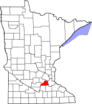
Marystown is an unincorporated community in Louisville Township, Scott County, Minnesota, United States, near Shakopee. The community is located along Scott County Road 15 and 160th Street West.
References


