This article needs additional citations for
verification. (January 2017) |
Malem Hodar | |
|---|---|
 | |
| Coordinates: 14°05′N 15°18′W / 14.083°N 15.300°W | |
| Country | |
| Region | Kaffrine Region |
| Capital | Malem Hodar |
| Population (2023 census)
[1] | |
| • Total | 135,403 |
| Time zone | UTC±00:00 ( GMT) |
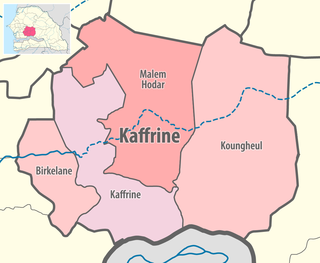
Malem Hodar Department is one of the 45 departments of Senegal, and is located in the Kaffrine Region. It was created as part of the new region in 2008.
The main settlement is the commune of Malem Hodar. Id addition there are the rural communities (Communautés rurales) of Darou Minam, Djanke Souf, Khelcom, Ndiobene Samba Lamo, Ndioume Ngainthe and Sagna. [2]
References
- ^ Senegal: Administrative Division
- ^ "Découpage administratif de la région de Kaffrine". au Senegal.com. Retrieved 12 November 2016.