You can help expand this article with text translated from
the corresponding article in Finnish. (June 2023) Click [show] for important translation instructions.
|
Luvia | |
|---|---|
Former municipality | |
| Luvian kunta Luvia kommun | |
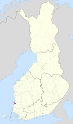
 Location of Luvia in
Finland | |
| Coordinates: 61°21′40″N 021°37′30″E / 61.36111°N 21.62500°E | |
| Country | Finland |
| Region | Satakunta |
| Sub-region | Pori sub-region |
| Charter | 1870 |
| Consolidated | 2017 |
| Government | |
| • Municipal manager | Kari Ojalahti |
| Time zone | UTC+2 ( EET) |
| • Summer ( DST) | UTC+3 ( EEST) |
| Climate | Dfb |
| Website | www.luvia.fi |
Luvia is a former municipality of Finland. It was merged to Eurajoki on 1 January 2017.
It was located in the province of Western Finland, part of the Satakunta region. The municipality covered an area of 861.20 square kilometres (332.51 sq mi) of which 692.07 km2 (267.21 sq mi) was water. [1]
The dominant municipal language was Finnish.
See also
References
- ^ Area of Finnish Municipalities 1 January 2016. National Land Survey of Finland
External links
![]() Media related to
Luvia at Wikimedia Commons
Media related to
Luvia at Wikimedia Commons
- Municipality of Luvia – Official website (in Finnish)

