| Hamburg U-Bahn station | |||||||||||
 | |||||||||||
| General information | |||||||||||
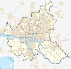
| Location | Lutterothstraße 20255 Hamburg, Germany | ||||||||||
| Coordinates | 53°34′55″N 09°56′51″E / 53.58194°N 9.94750°E | ||||||||||
| Operated by | Hamburger Hochbahn AG | ||||||||||
| Line(s) |
| ||||||||||
| Platforms | 1 island platform | ||||||||||
| Tracks | 2 | ||||||||||
| Connections | Bus | ||||||||||
| Construction | |||||||||||
| Structure type | Underground | ||||||||||
| Accessible | Yes | ||||||||||
| Other information | |||||||||||
| Station code | HHA: LT [1] | ||||||||||
| Fare zone | HVV: A/101 and 103 [2] | ||||||||||
| History | |||||||||||
| Opened | 30 May 1965 [1] | ||||||||||
| Electrified | at opening | ||||||||||
| Services | |||||||||||
| |||||||||||
| |||||||||||
Lutterothstraße is a metro station on the Hamburg U-Bahn line U2. The underground station was opened in May 1965 [1] and is located in the Hamburg district of Eimsbüttel, Germany. Eimsbüttel is center of the Hamburg borough of Eimsbüttel.
Trains
Lutterothstraße is served by Hamburg U-Bahn line U2; departures are every 5 minutes. [1]
Gallery
-
One of the station's entrances
See also
References
- ^ a b c d "Lutterothstraße". hamburger-untergrundbahn.de (in German). Archived from the original on 27 June 2013. Retrieved 2 February 2015.
- ^ "Tarifplan" (PDF). Hamburger Verkehrsverbund. 9 December 2018. Retrieved 18 October 2019.
External links
![]() Media related to
U-Bahnhof Lutterothstraße at Wikimedia Commons
Media related to
U-Bahnhof Lutterothstraße at Wikimedia Commons
- Line and route network plans at hvv.de (in German and English)


