| Lovers Key State Park | |
|---|---|
| Lovers Key Carl E. Johnson State Park | |
IUCN category V (protected landscape/seascape) | |
 | |
  | |
| Location | Lee County, Florida, United States |
| Nearest city | Bonita Springs, Florida |
| Coordinates | 26°23′38″N 81°52′44″W / 26.39389°N 81.87889°W |
| Area | 712 acres (2.88 km2) |
| Governing body | Florida Department of Environmental Protection |
Lovers Key State Park is a 712-acre (2.88 km2) Florida State Park located on Lover's Key and three other barrier islands—Black Island, Inner and Long Key. It is at 8700 Estero Blvd., Fort Myers Beach, between Big Carlos Pass and New Pass and 10.5 miles (16.9 km) west of Interstate 75 on exit 116. The park lies within the city limits of Bonita Springs and is just north of Bonita Beach. The park uses a Fort Myers Beach zip code for address purposes. [1]
Activities include shelling, swimming, picnicking, boating, and sunbathing, as well as canoeing/kayaking, hiking, bicycling and wildlife viewing. Among the wildlife of the park are West Indian manatees, bottlenose dolphins, marsh rabbits, and over 40 bird species, including roseate spoonbills, osprey, snowy egret, bald eagles, and American kestrel. Black Island has woodpeckers, hawks, owls and warblers.
Amenities include a two-mile (3 km) long beach on Lovers Key. Black Island has over five miles (8 km) of multiuse trails; bicycle, canoe, and kayak rentals, gazebo, picnic areas, boat ramp, and two playgrounds. The park is open from 8:00 am till sundown year-round.
Gallery
-
 The entrance along the Bonita Beach Causeway
 -
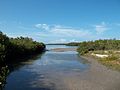
 South side of park
 -
 South side of park
 -
 Bayside entrance
 -
 North side of park
 -
 North side of park
 -
 North side of park


References
- ^ "Lovers Key State Park A LOVELY LOCATION WITH AN UNTARNISHED TWO-MILE STRETCH OF BEACH". Retrieved December 12, 2021.
External links
- Lovers Key State Park at Florida State Parks
- Lovers Key / Carl E. Johnson State Recreation Area at Absolutely Florida
- Lovers Key State Recreation Area at Wildernet
- [1] DEP confirms park in city limits (page 1) - December 2005