Llubí | |
|---|---|
 Aerial view of Llubí | |
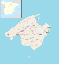
 Location within
Mallorca | |
| Coordinates: 39°42′N 3°00′E / 39.700°N 3.000°E | |
| Country | |
| Autonomous community | |
| Province | Balearic Islands |
| Comarca | Pla de Mallorca |
| Area | |
| • Total | 34.92 km2 (13.48 sq mi) |
| Population (2018)
[1] | |
| • Total | 2,243 |
| • Density | 64/km2 (170/sq mi) |
| Time zone | UTC+1 ( CET) |
| • Summer ( DST) | UTC+2 ( CEST) |
Llubí (Catalan pronunciation: [ʎuˈbi]) is a small municipality on Majorca, one of the Balearic Islands, Spain. It has population of 1,800 inhabitants.
It is located approximately 28 mi (45 km) from the capital city Palma de Mallorca. [2]
Llubí is mostly known for its cultivation of capers and traditional Majorcan architecture.
References
- ^ Municipal Register of Spain 2018. National Statistics Institute.
- ^ "Llubi Tourist Information and Travel Guide". www.undiscovered-majorca.com.


