This article needs additional citations for
verification. (May 2024) |
Llocnou de la Corona | |
|---|---|
 Town Hall. | |
|
Location of Llocnou de la Corona | |
| Coordinates: 39°25′20″N 0°22′56″W / 39.42222°N 0.38222°W | |
| Country | Spain |
| Autonomous community | Valencian Community |
| Province | Valencia |
| Comarca | Horta Sud |
| Judicial district | Catarroja |
| Founded | 1676 |
| Government | |
| • Mayor | Manuel Gimeno Ruiz |
| Area | |
| • Total | 0.0128 km2 (0.0049 sq mi) |
| Elevation | 12 m (39 ft) |
| Population (2018)
[1] | |
| • Total | 118 |
| • Density | 9,200/km2 (24,000/sq mi) |
| Demonym | Llocnoví |
| Time zone | UTC+1 ( CET) |
| • Summer ( DST) | UTC+2 ( CEST) |
| Postal code | 46910 |
| Official language(s) | Valencian |
| Website | Official website |
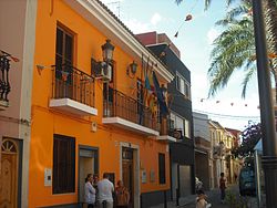
Llocnou de la Corona (Valencian pronunciation: [ˌʎɔɡˈnɔw ðe la koˈɾona]; Spanish: Lugar Nuevo de la Corona) is a municipality in the comarca of Horta Sud in the Valencian Community, Spain. It is the smallest municipality in Spain, covering 0.0128 km2 (0.0049 sq mi). As of 2010 [update], it had 130 inhabitants.
References
- ^ Municipal Register of Spain 2018. National Statistics Institute.

