| Little Ogeechee River (Hancock County) | |
|---|---|
 | |
| Location | |
| Country | United States |
| Physical characteristics | |
| Source | |
| • location | Georgia |
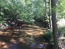
The Little Ogeechee River in Hancock County is one of two rivers with that name in the U.S. state of Georgia. It rises in Hancock County northeast of Sparta and flows southeast into Washington County, passing through Hamburgh State Park and entering the Ogeechee River 3 miles (5 km) southwest of Mitchell. The river is 21.3 miles (34.3 km) long. [1]
See also
References
- ^ U.S. Geological Survey. National Hydrography Dataset high-resolution flowline data. The National Map Archived 2012-03-29 at the Wayback Machine, accessed April 26, 2011
- U.S. Geological Survey Geographic Names Information System: Little Ogeechee River
- USGS Hydrologic Unit Map - State of Georgia (1974)
33°10′51″N 82°44′20″W / 33.18070°N 82.73902°W