These seamounts and volcanoes do not have simple
hotspot-like age progressions, with some volcanoes being younger than one would expect from age progression and having more than one active episode. In some places, a middle
Cretaceous and a late Cretaceous episode of volcanic activity have been determined by
radiometric dating. Despite this, some hotspot-based genesis models have been formulated, often implying that
French Polynesian hotspots are responsible for the formation of seamounts,[1] with the
Society hotspot,
Rurutu hotspot,
Rarotonga hotspot and the
Macdonald hotspot being candidate hotspots responsible for the development of the Marshall Islands seamounts.[3] Such linkages are in part supported by geochemical data.[4] Some discrepancies between the age and position of such seamounts and the predictions of the hotspot model may reflect the activity of short-lived hotspots linked to large
mantle plumes that produce more than one hotspot.[5]
While its position makes it a candidate member of the Ralik hotspot trail, it appears to be too old.[17] There is some geochemical similarity to the
Rurutu hotspot.[4]
While its position makes it a candidate member of the Ralik hotspot trail, it appears to be too old.[17] There is some geochemical similarity to the
Rurutu hotspot.[4]
Depending on the plate reconstruction model chosen, Lobbadede appears to coincide with the location of the
Macdonald hotspot.[10]Limestone and fossils of
Campanian-
Cenomanian age have been found on Lobbadede,[3] which appears to have had a second volcanic episode in the
Cretaceous.[20]
Slumps and terraces, terraces that appear to be congruent with these on Lomilik, surround this seamount. Its summit plateau is covered by sediments, sediment-filled basins and volcanic knolls.[30]
The summit has volcanic knobs and sediment-filled basins in between. The north flank has a terrace and the rest of the slopes is covered with slumps,
talus and sediments.[30]
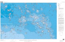
Flat-topped seamount that can be considered a
guyot[44] and is located between the
Ratak Chain and the
Ralik Chain,[45] and fairly old. Its geochemistry is intermediate between these two chains as well, which may indicate that volcanism was strongly influenced by the
crust.[46] Look Seamount is dotted by volcanic cones and has a rilled appearance[47] as well as
slumps; the summit is covered by sediment that mostly buries small volcanic pinnacles and sediment-filled depressions.[37]
Flat-topped seamount that can be considered a
guyot;[44] basins and volcanic knolls dot its summit platform and some pinnacles contain
craters.[37] Fossils indicate that Ruwituntun developed either during or before the
Albian.[21]
Biotite,
hornblende and
plagioclase have been dredged from Likelep, and the seamount is of
Campanian age. Likelep may be part of a seamount trail[58] and is part of the
Ujlān volcanic complex.[59] A sediment cap and volcanic structures are found on its top, with a volcanic cone protruding through the sediment. Slumps occur on its flanks and a seamount farther north is connected to Likelep.[57]
May have been produced by the
Rarotonga hotspot together with Eniwetok[62] and is part of the Ujlān volcanic complex.[59] Part of the sediment cap on its summit appears to have been removed by a slump.[57]
Seamount with three separate summits.[47] Ujlan may be part of a seamount trail[58] and is part of the Ujlān volcanic complex.[59] The southwestern flank has a terrace.[57]
Lotab may be part of a seamount trail[58] and is part of the Ujlān volcanic complex;[59] it also features traces of
mass failures[57] and on the northeastern flank it is connected to another seamount.[61]
^
abAsavin, A. M.; Daryin, A. V.; Melnikov, M. E. (21 December 2014). "Microrhythmic distribution of Co, Mn, Ni, and La contents in cobalt-rich ferromanganese crusts from the Magellan Seamounts". Geochemistry International. 53 (1): 23.
doi:
10.1134/s0016702915010024.
ISSN0016-7029.
Davis, Alicé S.; Pringle, Malcolm S.; Pickthorn, Leda-Beth G.; Clague, David A.; Schwab, William C. (1989). "Petrology and age of alkalic lava from the Ratak Chain of the Marshall Islands". Journal of Geophysical Research: Solid Earth. 94 (B5): 5757–5774.
doi:
10.1029/JB094iB05p05757.
ISSN2156-2202.
Hyeong, Kiseong; Kim, Jonguk; Yoo, Chan Min; Moon, Jai-Woon; Seo, Inah (December 2013). "Cenozoic history of phosphogenesis recorded in the ferromanganese crusts of central and western Pacific seamounts: Implications for deepwater circulation and phosphorus budgets". Palaeogeography, Palaeoclimatology, Palaeoecology. 392: 293–301.
doi:
10.1016/j.palaeo.2013.09.012.
ISSN0031-0182.
Koppers, Anthony A. P.; Staudigel, Hubert; Pringle, Malcolm S.; Wijbrans, Jan R. (October 2003). "Short-lived and discontinuous intraplate volcanism in the South Pacific: Hot spots or extensional volcanism?". Geochemistry, Geophysics, Geosystems. 4 (10).
doi:
10.1029/2003GC000533.
Koppers, Anthony A.P; Staudigel, Hubert; Wijbrans, Jan R (May 2000). "Dating crystalline groundmass separates of altered Cretaceous seamount basalts by the 40Ar/39Ar incremental heating technique". Chemical Geology. 166 (1–2): 139–158.
doi:
10.1016/S0009-2541(99)00188-6.
ISSN0009-2541.