(Redirected from
List of lakes in Perry County, Arkansas)
There are at least 28 named lakes and reservoirs in Perry County, Arkansas.
Lakes
- Bull Lake, 34°57′47″N 092°51′55″W / 34.96306°N 92.86528°W, el. 279 feet (85 m) [1]
- Bull Lake Slough, 34°58′33″N 092°50′55″W / 34.97583°N 92.84861°W, el. 272 feet (83 m) [2]
- Clear Lake, 34°58′14″N 092°50′36″W / 34.97056°N 92.84333°W, el. 269 feet (82 m) [3]
- Open Lake, 34°58′24″N 092°42′58″W / 34.97333°N 92.71611°W, el. 276 feet (84 m) [4]
- Winford Brake, 34°59′36″N 092°41′05″W / 34.99333°N 92.68472°W, el. 259 feet (79 m) [5]
Reservoirs
- Big Fish Pond, 34°58′06″N 092°57′31″W / 34.96833°N 92.95861°W, el. 318 feet (97 m) [6]
- Clear Water Lake, 35°02′28″N 092°57′54″W / 35.04111°N 92.96500°W, el. 486 feet (148 m) [7]
- Cove Creek Lake, 34°54′55″N 093°04′10″W / 34.91528°N 93.06944°W, el. 384 feet (117 m) [8]
- Darby's Pond, 34°58′35″N 092°49′04″W / 34.97639°N 92.81778°W, el. 289 feet (88 m) [9]
- Deltic Farms Lake, 34°53′23″N 092°46′17″W / 34.88972°N 92.77139°W, el. 449 feet (137 m) [10]
- Francis Lake, 34°58′37″N 092°39′02″W / 34.97694°N 92.65056°W, el. 266 feet (81 m) [11]
- Harris Brake, 34°58′35″N 092°46′16″W / 34.97639°N 92.77111°W, el. 282 feet (86 m) [12]
- Harris Brake Public Fishing Lake, 34°59′12″N 092°46′31″W / 34.98667°N 92.77528°W, el. 279 feet (85 m) [13]
- Henry Lake, 34°55′21″N 092°48′22″W / 34.92250°N 92.80611°W, el. 669 feet (204 m) [14]
- Jones Lake Number Two, 35°05′22″N 092°33′38″W / 35.08944°N 92.56056°W, el. 285 feet (87 m) [15]
- Lake Sylvia, 34°52′09″N 092°49′20″W / 34.86917°N 92.82222°W, el. 633 feet (193 m) [16]
- Ouachita Creek Watershed Site One Reservoir, 35°02′28″N 092°34′19″W / 35.04111°N 92.57194°W, el. 285 feet (87 m) [17]
- Ouachita Creek Watershed Site Three Reservoir, 35°04′06″N 092°34′03″W / 35.06833°N 92.56750°W, el. 279 feet (85 m) [18]
- Ouachita Creek Watershed Site Two Reservoir, 35°03′06″N 092°33′55″W / 35.05167°N 92.56528°W, el. 282 feet (86 m) [19]
- Owens Lake, 35°05′42″N 093°33′37″W / 35.09500°N 93.56028°W, el. 348 feet (106 m) [20]
- Rock Creek Lake, 34°55′37″N 092°57′51″W / 34.92694°N 92.96417°W, el. 387 feet (118 m) [21]
- South Fouche Site Seven Reservoir, 35°00′46″N 092°49′32″W / 35.01278°N 92.82556°W, el. 410 feet (120 m) [22]
- South Fouche Site Six Reservoir, 34°55′37″N 092°57′51″W / 34.92694°N 92.96417°W, el. 387 feet (118 m) [23]
- South Fourche Site One Reservoir, 34°51′54″N 093°11′27″W / 34.86500°N 93.19083°W, el. 577 feet (176 m) [24]
- The Campbells Lake, 34°56′36″N 092°34′19″W / 34.94333°N 92.57194°W, el. 525 feet (160 m) [25]
- Van Dalsen Lake, 34°59′36″N 092°44′31″W / 34.99333°N 92.74194°W, el. 289 feet (88 m) [26]
- Willenberg Lake, 35°02′06″N 092°54′37″W / 35.03500°N 92.91028°W, el. 397 feet (121 m) [27]
- Womack Lake, 35°02′30″N 092°51′13″W / 35.04167°N 92.85361°W, el. 322 feet (98 m) [28]
See also
Notes
- ^ "Bull Lake". Geographic Names Information System. United States Geological Survey, United States Department of the Interior.
- ^ "Bull Lake Slough". Geographic Names Information System. United States Geological Survey, United States Department of the Interior.
- ^ "Clear Lake". Geographic Names Information System. United States Geological Survey, United States Department of the Interior.
- ^ "Open Lake". Geographic Names Information System. United States Geological Survey, United States Department of the Interior.
- ^ "Winford Brake". Geographic Names Information System. United States Geological Survey, United States Department of the Interior.
- ^ "Big Fish Pond". Geographic Names Information System. United States Geological Survey, United States Department of the Interior.
- ^ "Clear Water Lake". Geographic Names Information System. United States Geological Survey, United States Department of the Interior.
- ^ "Cove Creek Lake". Geographic Names Information System. United States Geological Survey, United States Department of the Interior.
- ^ "Darbys Pond". Geographic Names Information System. United States Geological Survey, United States Department of the Interior.
- ^ "Deltic Farms Lake". Geographic Names Information System. United States Geological Survey, United States Department of the Interior.
- ^ "Francis Lake". Geographic Names Information System. United States Geological Survey, United States Department of the Interior.
- ^ "Harris Brake". Geographic Names Information System. United States Geological Survey, United States Department of the Interior.
- ^ "Harris Brake Public Fishing Lake". Geographic Names Information System. United States Geological Survey, United States Department of the Interior.
- ^ "Henry Lake". Geographic Names Information System. United States Geological Survey, United States Department of the Interior.
- ^ "Jones Lake Number Two". Geographic Names Information System. United States Geological Survey, United States Department of the Interior.
- ^ "Lake Sylvia". Geographic Names Information System. United States Geological Survey, United States Department of the Interior.
- ^ "Ouachita Creek Watershed Site One Reservoir". Geographic Names Information System. United States Geological Survey, United States Department of the Interior.
- ^ "Ouachita Creek Watershed Site Three Reservoir". Geographic Names Information System. United States Geological Survey, United States Department of the Interior.
- ^ "Ouachita Creek Watershed Site Two Reservoir". Geographic Names Information System. United States Geological Survey, United States Department of the Interior.
- ^ "Owens Lake". Geographic Names Information System. United States Geological Survey, United States Department of the Interior.
- ^ "Rock Creek Lake". Geographic Names Information System. United States Geological Survey, United States Department of the Interior.
- ^ "South Fouche Site Seven Reservoir". Geographic Names Information System. United States Geological Survey, United States Department of the Interior.
- ^ "South Fouche Site Six Reservoir". Geographic Names Information System. United States Geological Survey, United States Department of the Interior.
- ^ "South Fourche Site One Reservoir". Geographic Names Information System. United States Geological Survey, United States Department of the Interior.
- ^ "The Campbells Lake". Geographic Names Information System. United States Geological Survey, United States Department of the Interior.
- ^ "Van Dalsen Lake". Geographic Names Information System. United States Geological Survey, United States Department of the Interior.
- ^ "Willenberg Lake". Geographic Names Information System. United States Geological Survey, United States Department of the Interior.
- ^ "Womack Lake". Geographic Names Information System. United States Geological Survey, United States Department of the Interior.
Municipalities and communities of
Newton County, Arkansas, United States | ||
|---|---|---|
| City | 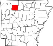 | |
| Town | ||
| Townships | ||
| CDPs | ||
|
Other unincorporated communities | ||