This is an incomplete list of New York State Historic Markers in Ulster County, New York. [1]
Listings County-Wide
(147 Markers)
| # | Marker heading | Image | Designator | Location | City or town | Coordinates | Marker text |
|---|---|---|---|---|---|---|---|
| 1 | CHURCH OF THE ASCENSION ESOPUS |  |
State Ed Dept, 1935 | US 9W AT WEST PARK | Esopus | 41°48′17.59″N 73°57′32.87″W / 41.8048861°N 73.9591306°W | CHURCH OF THE ASCENSION ESOPUS BUILT 1842 |
| 2 |
|
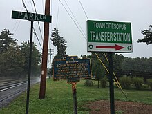 |
State Ed Dept, 1935 | B'WAY & PARK LA., IN WEST PARK, | Esopus | 41°47′56.9544″N 73°57′32.4612″W / 41.799154000°N 73.959017000°W |
JOHN BURROUGHS |
| 3 | GENERAL WASHINGTON |  |
State Ed Dept, 1938 | N.E. CORNER ZANDHOECK RD. & MILLBROOK AVE. | Hurley | 41°55′27.75″N 74°03′40.1″W / 41.9243750°N 74.061139°W | GENERAL WASHINGTON
WAS GIVEN A PUBLIC RECEPTION HERE ON HIS JOURNEY FROM WEST POINT TO KINGSTON, NOV. 16, 1782 |
| 4 | OLD GUARD HOUSE | 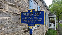 |
State Ed Dept, 1938 | US 209 | Hurley | 41°55′33.42″N 74°03′49.86″W / 41.9259500°N 74.0638500°W | LIEUT. DAVID TAYLOR,
BRITISH SPY, WAS CONFINED IN THIS HOUSE AND HANGED ON AN APPLE TREE, OCTOBER 18, 1777 |
| 5 | OLD MINE ROAD |  |
State Ed Dept, 1949 | US 209. | Hurley | 41°55′30.94″N 74°03′46.77″W / 41.9252611°N 74.0629917°W | ESOPUS-MINISINK TRAIL
INDIAN TRAIL CONNECTING |
| 6 | VAN DEUSEN HOUSE |  |
NY State Historical Marker (no date) | US 209. | Hurley | 41°55′30.66″N 74°03′45.01″W / 41.9251833°N 74.0625028°W | BUILT 1723
TEMPORARY CAPITOL OF STATE AFTER BURNING OF KINGSTON 1777. |
| 7 | ELMENDORF TAVERN [2] [3] | SE CORNER MAIDEN LA. & FAIR ST. | Kingston | MEETING PLACE
STATE COMMITTEE OF SAFETY 1777 | |||
| 8 | FIRST KINGSTON ACADEMY | SW CORNER JOHN & CROWN STS. | Kingston | FIRST KINGSTON ACADEMY
FOUNDED 1774 BY TRUSTEES OF TOWN OF KINGSTON. | |||
| 9 | PLAN OF KINGSTON STOCKADE |  |
NY State Historical Marker, 1927 | N. FRONT ST. & CLINTON AVE. | Kingston | 41°56′07.2″N 74°01′07″W / 41.935333°N 74.01861°W | PLAN OF KINGSTON
STOCKADE ( WILTWYCK) FORT (F) AND 1658 STREETS SITE OF OLD STOCKADE 1658 |
| 10 | SITE OF OLD BLOCKHOUSE |  |
NY State Historical Marker, 1927 | S.W. CORNER MAIN & FAIR STS. | Kingston | 41°55′57.7″N 74°01′05.3″W / 41.932694°N 74.018139°W | SITE OF
OLD BLOCKHOUSE BUILT 1658 |
| 11 | SITE OF BOGARDUS TAVERN |  |
NY State Historical Marker, 1927 | N.W. CORNER MAIDEN LA. & FAIR ST. | Kingston | 41°55′52.09″N 74°01′01.17″W / 41.9311361°N 74.0169917°W | SITE OF BOGARDUS TAVERN FIRST MEETING PLACE NEW YORK STATE ASSEMBLY SEPTEMBER 10TH 1777 |
| 11b | (Return of NY Assembly to Kingston) | 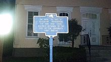 |
(no agency or date) | N.W. CORNER MAIDEN LA. & FAIR ST. | Kingston | 41°55′52.09″N 74°01′01.17″W / 41.9311361°N 74.0169917°W | ON APRIL 23, 1977, A DELEGATION REPRESENTING THE NEW YORK STATE ASSEMBLY RETURNED TO THE SITE OF THE ASSEMBLY'S FIRST MEETING |
| 12 | SITE OF TAPPEN HOUSE |  |
NY State Historical Marker, 1927 | S.W. CORNER N. FRONT & WALL STS. | Kingston | 41°56′06.36″N 74°01′12.32″W / 41.9351000°N 74.0200889°W | SITE OF TAPPEN HOUSE OCCUPIED BY GEORGE CLINTON WHILE GOVERNOR OF STATE |
| 13 | VAN KEUREN HOMESTEAD |  |
State Ed Dept, 1938 | ST. JAMES ST. BETWEEN PINE & CLINTON AVES. | Kingston | 41°55′50.7″N 74°00′52.3″W / 41.930750°N 74.014528°W [4] | VAN KEUREN HOMESTEAD BURNED BY BRITISH OCT. 17, 1777. REBUILT AND OCCUPIED BY DIRECT DESCENDANTS OF ORIGINAL OWNER SINCE THEN. |
| 14 | COLONEL DEYO HOME | NYS 55 E. OF TRAFFIC CIRCLE | Lloyd | COLONEL DEYO HOME
ERECTED 1805 BUILT AND OCCUPIED BY COLONEL JACOB DEYO 8TH REGIMENT, NEW YORK STATE GUARD | |||
| 15 | ELTING HOMESTEAD |  |
State Ed Dept, 1938 | MAIN ST., S. OF ELTING PL., IN HIGHLAND | Lloyd | 41°43′15.04″N 73°57′54.37″W / 41.7208444°N 73.9651028°W | BUILT BY PHILIP ELTING 1817
WHO FOUNDED VILLAGE OF HIGHLAND ON HIS FARM WHICH WAS DEVISED BYT HIS GRANDFATHER ABRAHAM ELTING TO NOAH ELTING APRIL 1797 |
| 16 | ELTING'S LANDING | W. OF R.R., NEAR RIVER IN HIGHLAND | Lloyd | BOMBARDED BY BRITISH 1777
NOAH ELTING'S FERRY 1793 HORSE DRAWN FLAT BOAT 1819 "DUTCHESS AND ULSTER", STEAM POWER FERRY EST. 1830 | |||
| 17 | HIGHLAND LANDING | 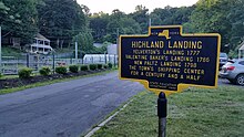 |
State Ed Dept, 1949 | E. END OF MAIN ST., HIGHLAND | Lloyd | 41°43′01.1″N 73°57′00.1″W / 41.716972°N 73.950028°W |
YELVERTON'S LANDING 1777
VALENTINE BAKER'S LANDING 1786 NEW PALTZ LANDING 1798 THE TOWN'S SHIPPING CENTER FOR A CENTURY AND A HALF |
| 18 | PRESBYTERIAN CHURCH | 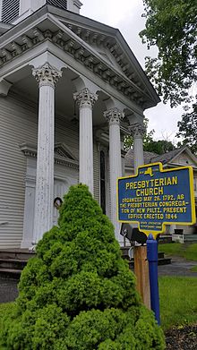 |
State Ed Dept, 1932 | CHURCH & GROVE STS., HIGHLAND | Lloyd | 41°43′10.38″N 73°57′55.44″W / 41.7195500°N 73.9654000°W | ORGANIZED MAY 26, 1792, AS
THE PRESBYTERIAN CONGREGA- TION OF NEW PALTZ. PRESENT EDIFICE ERECTED 1844. |
| 19 | REVOLUTIONARY DRILL FIELD 1775 | US 9W S. OF TRAFFIC CIRCLE | Lloyd | 9TH COMPANY THIRD
ULSTER COUNTY REGIMENT COMMANDED BY CAPTAIN PELEG RANSOM | |||
| 20 | ULSTER COUNTY | NYS 55 AT W. ENTRANCE TO MID-HUDSON BRIDGE | Lloyd | ONE OF ORIGINAL COUNTIES
OF NEW YORK STATE, 1683, RECEIVED ITS NAME FROM THE EARLDOM IN IRELAND OF JAMES, DUKE OF YORK. | |||
| 21 |
|
 |
State Ed Dept, 1939 | NYS 213 AT HIGH FALLS | Marbletown | 41°49′42.3696″N 74°07′59.178″W / 41.828436000°N 74.13310500°W | 1 1/2 MILE
SITE OF CLOVE REFORMED CHURCH |
| 22 | DAVIS TAVERN | 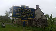 |
State Ed Dept, 1935 | Route 209 north of Marbletown, New York | Marbletown | 41°52′50.88″N 74°06′56.16″W / 41.8808000°N 74.1156000°W | DAVIS TAVERN
FOR MANY YEARS BEFORE AND |
| 23 | OLD DEPUY HOUSE |  |
State Ed Dept, 1939 | NYS 213 AT HIGH FALLS | Marbletown | 41°49′37.85″N 74°07′39.32″W / 41.8271806°N 74.1275889°W | OLD DEPUY HOUSE
BUILT IN 1797 BY S. AND A. DEPUY, |
| 24 | OLIVER HOUSE |  |
State Ed Dept, 1935 | US 209 AT MARBLETOWN | Marbletown | 41°52′48.18″N 74°06′56.1″W / 41.8800500°N 74.115583°W | IN ORIGINAL ANDREW OLIVER
HOUSE HERE, THE NEW YORK LEGISLATURE MET FOR ONE MONTH, AFTER BURNING OF KINGSTON, OCTOBER, 1777. |
| 25 | SCHOONMAKER HOME |  |
State Ed Dept, 1935 | NYS 213, E. OF HIGH FALLS, AT COXEN CREEK BRIDGE | Marbletown | 41°49′51.96″N 74°06′37.7″W / 41.8311000°N 74.110472°W | BUILT IN 1760 BY
CAP. FREDERICK SCHOONMAKER, |
| 26 | SITE OF COLONIAL CHURCH |  |
State Ed Dept, 1935 | US 209 AT MARBLETOWN | Marbletown | 41°52′45.6126″N 74°06′56.9262″W / 41.879336833°N 74.115812833°W [5] | SITE OF COLONIAL CHURCH
HERE STOOD THE EARLIEST |
| 27 | TACK TAVERN |  |
State Ed Dept, 1938 | US 209 AT STONE RIDGE | Marbletown | 41°50′55.32″N 74°08′35.52″W / 41.8487000°N 74.1432000°W | TACK TAVERN
HOME OF JOHANNES TACK, |
| 28 |
|
 |
State Ed Dept, 1939 | NYS 213 AT HIGH FALLS | Marbletown | 41°49′37.56″N 74°07′34.93″W / 41.8271000°N 74.1263694°W | DISCOVERY OF CEMENT
AT BRUCEVILLE, NATHANIEL |
| 29 |
|
CHURCH ST., S. OF NYS 213 IN HIGH FALLS | Marbletown | JOHN BURROUGHSBY S. AND A. DEPUY
AMERICAN NATURALIST TAUGHT SCHOOL AT HIGH FALLS IN 1857 NEAR PRESENT BUILDING | |||
| 30 |
|
 |
State Ed Dept, 1940 | NYS 213 AT HIGH FALLS | Marbletown | 41°49′38.64″N 74°07′39″W / 41.8274000°N 74.12750°W | OLD STONE AQUEDUCT
BUILT IN 1825 BY
D. & H. |
| 31 | BEVIER HOUSE |  |
State Ed Dept, 1935 | SE CORNER HUGUENOT ST. & BROADHEAD AVE., NEW PALTZ | New Paltz | 41°45′07.1″N 74°05′17.4″W / 41.751972°N 74.088167°W | BUILT BY LOUIS BEVIER,
THE PATENTEE, IN 1698. ELTING HOMESTEAD FROM 1740. THIS HOUSE HAS AN INTERESTING SUB-CELLAR |
| 32 | DEYO HOUSE | 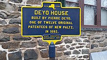 |
State Ed Dept, 1935 | HUGUENOT ST., IN NEW PALTZ | New Paltz | 41°45′04.4″N 74°05′17.0″W / 41.751222°N 74.088056°W | BUILT BY PIERRE DEYO,
ONE OF TWELVE ORIGINAL PATENTEES OF NEW PALTZ, IN 1692. |
| 33 | DIE PFALZ |  |
State Ed Dept, 1935 | HUGUENOT & N. FRONT STS., IN NEW PALTZ | New Paltz | 41°45′02.8″N 74°05′17.1″W / 41.750778°N 74.088083°W | A FRENCH HUGUENOT VILLAGE
GOVERNED BY "THE DUSINE", A BODY OF 12 MEN CHOSEN ANNUALLY. FOR 100 YEARS THE ONLY FORM OF GOVERNMENT. |
| 34 | DUBOIS HOUSE |  |
State Ed Dept, 1935 | HUGUENOT ST., IN NEW PALTZ | New Paltz | 41°45′05.4″N 74°05′17.9″W / 41.751500°N 74.088306°W | THE FORT BUILT IN 1705
BY DANIEL DUBOIS. SITE FIRST REDOUBT. THERE ARE PORT HOLES IN THE EAST END. |
| 35 | FREER HOUSE |  |
State Ed Dept, 1935 | HUGUENOT ST., IN NEW PALTZ | New Paltz | 41°45′10.6″N 74°05′18″W / 41.752944°N 74.08833°W | BUILT 1720 BY HUGO FREER,
ONE OF TWELVE ORIGINAL PATENTEES OF NEW PALTZ. THE LOW HOUSE AFTER 1732. |
| 36 | HASBROUCK HOUSE |  |
State Ed Dept, 1935 | HUGUENOT ST., IN NEW PALTZ | New Paltz | 41°45′09.7″N 74°05′17.8″W / 41.752694°N 74.088278°W | BUILT IN 1712, BY ABRAHAM, THE
PATENTEE, ONCE SOLDIER IN ENGLISH ARMY, FRIEND OF GOV. ANDROS. KITCHEN SCENE OF COCK FIGHTS. |
| 37 | JEAN HASBROUCK |  |
State Ed Dept, 1935 | HUGUENOT & N. FRONT STS., IN NEW PALTZ | New Paltz | 41°45′03.0″N 74°05′17.4″W / 41.750833°N 74.088167°W | JEAN HASBROUCK
HOUSE BUILT IN 1712, BY |
| 38 | NEW PALTZ | 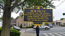 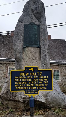 |
State Ed Dept, 1935 | NYS 208, S. OF NEW PALTZ also same on NE CORNER MAIN & N. FRONT STS., IN NEW PALTZ | New Paltz | 41°44′53.74″N 74°05′05.64″W / 41.7482611°N 74.0849000°W and 41°45′02.82″N 74°05′17.08″W / 41.7507833°N 74.0880778°W | FOUNDED 1678. SIX HOUSES
BUILT BEFORE 1720 ARE ON HUGUENOT STREET, ON THE WALKILL RIVER, HOMES OF REFUGEES OF FRANCE. |
| 39 | SITE OF THE "OWL" CHURCH [6] |  |
State Ed Dept, 1935 | CO. RD. W. OF NEW PALTZ, 1 MI. S. OF NYS 299 | New Paltz | 41°43′53.4″N 74°06′44.3″W / 41.731500°N 74.112306°W | CONFERENTIA CHURCH PARTY ORGANIZED 1767, TO MAINTAIN CONTACT WITH CLASSIS OF NORTH AMSTERDAM, HOLLAND, JOINED PALTZ CHURCH, 1783. |
| 40 | SITE OF WALLOON CHURCH |  |
State Ed Dept, 1935 | HUGUENOT ST., W. OF N. FRONT ST., IN NEW PALTZ | New Paltz | 41°45′01.9″N 74°05′18.1″W / 41.750528°N 74.088361°W | BUILT OF LOGS, FIRST
CHURCH-SCHOOL, 1783, FIRST CHURCH OS STONE 1717. CALLED "OLD FRENCH CHURCH", PRECURSOR REFORMED CHURCH. |
| 40.5 | 1799 HOUSE |  |
Huguenot Historical Society (no date) | Huguenot St, southwest of North Front St | New Paltz | 41°45′00.7″N 74°05′19.8″W / 41.750194°N 74.088833°W [7] | BUILT BY EZEKIEL ELTING AS A HOME
AND STORE. ORIGINAL GAMBREL ROOF DESTROYED IN 1888 BLIZZARD. 1968 PURCHASED BY LE FEVRE FAMILY ASSOC. MAINTAINED HHS AND LE FEVRE FAMILY. |
| 41 | STONE CHURCH - 1773 |  |
State Ed Dept, 1935 | HUGUENOT ST., NEAR BROADHEAD AVE., NEW PALTZ | New Paltz | 41°45′07.8″N 74°05′18.3″W / 41.752167°N 74.088417°W | FIRST STONE CHURCH, 1717.
SERVICES IN FRENCH TO 1753, DUTCH LANGUAGE TO 1800. CHURCH CORNER STONE SEEN AT SOUTH WALL OF PORTICO. |
| 42 | ULSTER COUNTY | NYS 32, S. OF PLATTEKILL, AT ULSTER-ORANGE CO. LINE | Plattekill | Marker no longer exists; former site is 41°36′14.9394″N 74°04′28.4412″W / 41.604149833°N 74.074567000°W. | ONE OF ORIGINAL COUNTIES
OF NEW YORK STATE, 1683, RECEIVED ITS NAME FROM THE EARLDOM IN IRELAND OF JAMES, DUKE OF YORK. | ||
| 43 | ALTON BROOKS PARKER |  |
State Ed Dept, 1932 | US 209, N. OF ACCORD | Rochester | 41°47′36.41″N 74°13′26.41″W / 41.7934472°N 74.2240028°W | MAY 14, 1852 - MAY 10, 1926
PRINCIPAL OF THIS SCHOOL, 1870–71 CHIEF JUDGE OF THE NEW YORK STATE COURT OF APPEALS, 1897-1904 CANDIDATE FOR PRESIDENT OF U.S.; 1904 |
| 44 | COLONIAL TAVERN |  |
State Ed Dept, 1936 | US 209, S. OF ACCORD | Rochester | Marker no longer exists; former site is 41°47′23.046″N 74°14′55.485″W / 41.78973500°N 74.24874583°W. [8] Marker appears in Google Street View in May 2009. [9] | SILES BOUCK, SCOUT TAKEN
IN INDIAN AND TORY RAID IN 1779, TO FORT NIAGARA, CAME BACK HERE, WHILE NEIGHBORS WERE HOLDING A MEETING |
| 45 | ROCHESTER CHURCH |  |
State Ed Dept, 1938 | US 209, S. OF ACCORD | Rochester | 41°47′25.77″N 74°14′38.45″W / 41.7904917°N 74.2440139°W | REV. NUCELLA
[10] PREACHED,
1695 LOG CHURCH BUILT, 1700 2 STONE CHURCHES, 1743, 1860, 2 OTHER CHURCHES BURNED PRESENT 6TH ON SAME SPOT |
| 46 | SITE OF INDIAN RAID | 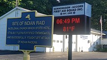 |
(no agency or date) | US 209 AT PINE BUSH | Rochester | 41°47′04.19″N 74°16′52.75″W / 41.7844972°N 74.2813194°W | SITE OF INDIAN RAID
IN COLONIAL CHURCH WHICH |
| 47 | SITE OF TRAINING FIELD |  |
State Ed Dept, 1935 | US 209, N. OF ACCORD | Rochester | 41°47′34.08″N 74°13′34.68″W / 41.7928000°N 74.2263000°W | SITE OF TRAINING FIELD
COLONIAL MILITIA, IN THE |
| 48 | SITE OF COLONIAL FORT |  |
State Ed Dept, 1938 | US 209 N. OF KERHONKSON | Rochester | 41°46′53.42″N 74°17′27.45″W / 41.7815056°N 74.2909583°W | HERE ON DEYO'S HILL STOOD A FORT PROTECTING EARLY SETTLERS FROM INDIANS |
| 49 | TOM QUICK [11] FARM |  |
(no agency or date) | US 209, N. OF ACCORD | Rochester | 41°47′28.34″N 74°14′29.18″W / 41.7912056°N 74.2414389°W | HOME OF TOM QUICK, BOUGHT FROM HARMON HEKUN, INDIAN, 1676; QUICK WAS KILLED BY INDIANS AND HIS SON SLEW MANY RED MEN IN REVENGE. 1904 |
| 50 | CREEKLOCKS |  |
State Ed Dept, 1935 | CREEKLOCKS RD., CREEKLOCKS [Hamlet] | Rosendale | 41°52′05.1702″N 74°02′37.6044″W / 41.868102833°N 74.043779000°W | ORIGINALLY WAGENDALL.
RENAMED 1825 WHEN
DELAWARE |
| 51 | D. & H. CANAL | 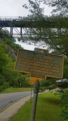 |
State Ed Dept, 1935 | NYS 213 W. OF ROSENDALE | Rosendale | 41°50′37.35″N 74°05′19.51″W / 41.8437083°N 74.0887528°W | STARTED 1825, OPENED 1828.
IMPORTANT WATERWAY IN THE DEVELOPMENT OF NEW YORK STATE, CONNECTING DELAWARE AND HUDSON RIVERS. |
| 52 | FORDING PLACE | 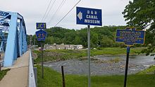 |
State Ed Dept, 1935 | NYS 32 AT ROSENDALE | Rosendale | 41°50′44.64″N 74°04′26.82″W / 41.8457333°N 74.0741167°W | USED BY GEN. CLINTON'S
FORCES, ON WAY FROM NEWBURGH TO DEFEND KINGSTON, FROM BRITISH RAIDERS IN OCTOBER, 1777. |
| 53 | FREER HOUSE | NYS 32 S. OF TILLSON | Rosendale | BUILT 1765 BY JACOB FREER,
GRANDSON OF HUGO FREER, NEW PALTZ PATENTEE; FIRST SETTLED BY FAMILY IN 1730 CALLED "HALF MOON". | |||
| 54 | GRIST MILL | NYS 213 W. OF ROSENDALE | Rosendale | OPERATED IN 1809 BY JACOB
LOW SNYDER, EARLY SETTLER; IN 1825 BY JUDGE LUCAS ELMENDORF. CEMENT GROUND HERE FOR D. & H. CANAL. | |||
| 55 | HOME OF ABRAHAM VAN WAGENEN |  |
State Ed Dept, 1935 | CREEKLOCKS RD., CREEKLOCKS [Hamlet] | Rosendale | 41°52′26.24″N 74°02′33.81″W / 41.8739556°N 74.0427250°W | HOME OF ABRAHAM VAN WAGENEN
AN ORIGINAL SETTLER, |
| 56 | JOPPENBERGH |  |
State Ed Dept, 1935 | NYS 213 W. OF ROSENDALE | Rosendale | Marker no longer exists; former site is 41°50′36.96″N 74°05′15.18″W / 41.8436000°N 74.0875500°W. Marker appears in Waymarking.com [12] and in Google Street View in May 2009. [13] | JOPPENBERGH - JACOB'S MOUNT, NAMED
FOR COL. JACOBUS RUTSEN, FIRST SETTLER, IN 1680 |
| 57 | LEFEVRE HOUSE | Rosendale | BUILT 1780; SINCE 1810
HOME OF LEFEVRE FAMILY, DESCENDANTS OF SIMON, NEW PALTZ PATENTEE, CALLED BLOEMENDAL. | ||||
| 58 | MEETING HOUSE |  |
State Ed Dept, 1935 | GRIST MILL RD., TILLSON | Rosendale | 41°49′47.89″N 74°03′55.15″W / 41.8299694°N 74.0653194°W |
FRIENDS' CHURCH, BUILT
IN 1800. PHEBE TILLSON WAS THE FIRST RECOMMENDED MINISTER. |
| 59 | NEWKIRK TAVERN | 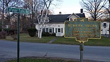 |
State Ed Dept, 1935 | NYS 32 AT MAPLE HILL | Rosendale | 41°51′54.1″N 74°03′38.5″W / 41.865028°N 74.060694°W | BUILT IN 1781 BY
GERRIT NEWKIRK. A FAMOUS HOSTERLRY. |
| 60 | PERRINE'S BRIDGE | NYS 32 S. OF TILLSON | Rosendale | ERECTED IN 1850. ONE OF
THE FEW OLD COVERED BRIDGES STILL STANDING IN NEW YORK STATE. | |||
| 61 | PETRUS VAN WAGENEN |  |
State Ed Dept, 1935 | SW CORNER CREEKLOCKS RD. & MAIN ST., BLOOMINGTON | Rosendale | 41°52′29.712″N 74°02′31.3188″W / 41.87492000°N 74.042033000°W | PETRUS VAN WAGENEN
ONE OF ORIGINAL SETTLERS |
| 62 | REFORMED PROTESTANT DUTCH CHURCH |  |
State Ed Dept, 1935 | CHURCH ST., W. OF MAIN ST., BLOOMINGTON | Rosendale | 41°52′42.978″N 74°02′42.2946″W / 41.87860500°N 74.045081833°W | REFORMED PROTESTANT DUTCH CHURCH FIRST ORGANIZED 1797, BURNED 1846, REBUILT ON PRESENT LOCATION, 1847. |
| 63 | ROSENDALE CEMENT | NYS 213 W. OF ROSENDALE | Rosendale |
ROSENDALE CEMENT DISCOVERED HERE IN 1826.
FIRST COMMERCIAL MILL OPERATED HERE 1826 BY WATSON E. LAWRENCE, CALLED LAWRENCEVILLE. | |||
| 64 | RUTSEN HOUSE | NYS 32 AT ROSENDALE | Rosendale | FIRST HOUSE BUILT IN TOWN
BY JACOBUS RUTSEN IN 1680. JACOBUS RUTSEN HARDENBERGH GEN. GEORGE WASHINGTON. | |||
| 65 | SITE OF DE WITT HOUSE |  |
State Ed Dept, 1935 | NYS 32 AT BLOOMINGTON | Rosendale | 41°53′15.1656″N 74°02′36.888″W / 41.887546000°N 74.04358000°W | SITE OF DE WITT HOUSE BUILT 1736; DESTROYED 1930; HOME OF COL. CHARLES DE WITT, MEMBER PROVINCIAL CONGRESS CALLED CROCODILE INN, ABOUT 1800. |
| 66 | SITE OF DE WITT MILL |  |
State Ed Dept, 1935 | NYS 32 AT BLOOMINGTON | Rosendale | 41°53′14.69″N 74°02′37.366″W / 41.8874139°N 74.04371278°W | SITE OF DE WITT MILL ERECTED ABOUT 1750 BY COL. CHARLES DE WITT. FLOUR GROUND HERE FOR AMERICAN ARMY IN THE REVOLUTION. |
| 67 | SITE OF TAVERN |  |
State Ed Dept, 1935 | E. OF NYS 32 IN MAPLE HILL | Rosendale | 41°51′53.2″N 74°03′45.1″W / 41.864778°N 74.062528°W | SITE OF TAVERN, FIRST CHURCH
ERECTED HERE IN 1797, REFORMED CHURCH OF BLOEMENDAL BURNED 1846, REBUILT 1847, AT NEW LOCATION AT BLOOMINGTON |
| 68 | SNYDER HOME |  |
State Ed Dept, 1935 | CO. RD. AT COTTEKILL | Rosendale | 41°51′08.3″N 74°06′12.94″W / 41.852306°N 74.1035944°W | SNYDER HOME
COMMUNITY FIRST SETTLED |
| 69 | TAWAERI TAQUI | 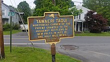 |
State Ed Dept, 1935 | SPRINGTOWN RD., TILLSON | Rosendale | 41°49′46.96″N 74°04′35.58″W / 41.8297111°N 74.0765500°W | NORTHWEST CORNER OF
PATENT GRANTED TO THE HUGUENOT SETTLERS OF NEW PALTZ, IN 1677, IS ONE HALF MILE WEST. |
| 70 | TILLSON HOME | 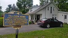 |
State Ed Dept, 1935 | Rosendale | 41°49′44.58″N 74°04′13.8″W / 41.8290500°N 74.070500°W | FIRST ESTABLISHED IN 1778.
HOME OF JOB TILLSON, SCOUT IN REVOLUTIONARY ARMY AT 12 YEARS. COMMUNITY NAMED IN HONOR OF FAMILY. | |
| 71 | WAGENDALL |  |
State Ed Dept, unreadable date | CREEKLOCKS RD., CREEKLOCKS | Rosendale | 41°52′28.6242″N 74°02′30.3138″W / 41.874617833°N 74.041753833°W [15] | ON THIS FARM IS HOME OF
JACOB AARTSEN VAN WAGENEN, BUILT 1669, FIRST SETTLER, AND HOME OF JOHANNES VAN WAGENEN, BUILT 1775. |
| 72 | WHITE'S MILL |  |
State Ed Dept, 1935 | CO. RD. AT WHITEPORT | Rosendale | 41°52′55.76″N 74°03′04.43″W / 41.8821556°N 74.0512306°W | BUILT 1830 BY HUGH WHITE, SUPPLIED CEMENT FOR CROTON RESERVOIR, WHITEPORT NAMED TO HONOR HUGH WHITE. |
| 73 | BARCLAY HEIGHTS |  |
(no agency or date) | US 9W, S. OF BARCLAY ST., IN SAUGERTIES | Saugerties | 42°03′54.38″N 73°56′54.58″W / 42.0651056°N 73.9484944°W | NAMED FOR HENRY BARCLAY 1778–1851. EARLY SETTLER WHO FOUNDED TRINITY CHURCH, UTILIZED LOCAL WATER POWER AND GREATLY PROMOTED INDUSTRY |
| 74 | BRICK CHURCH |  |
State Ed Dept, 1936 | LIVINGSTON ST., W. OF NYS 32, SAUGERTIES | Saugerties | 42°04′41.4″N 73°57′22.0″W / 42.078167°N 73.956111°W | BUILT 1827. USED FOR WORSHIP UNTIL 1852. THEN SOLD FOR USE AS AN ACADEMY. LATER KNOWN AND USED AS BURHANS BLACKSMITH SHOP |
| 75 | BRINK HOMESTEAD |  |
State Ed Dept, 1936 | CO. RD., 1-1/2 MIS. S. OF MT. MARION | Saugerties | 42°01′19.1″N 73°59′46.4″W / 42.021972°N 73.996222°W | OWNED CONTINUOUSLY BY FAMILY
OF CORNELIUS LAMBERTSEN BRINK, PURCHASER, 1688, OF SECOND LAND GRANT IN TOWN. ART OF ORIGINAL HOUSE REMAINS. |
| 76 | FLATBUSH REFORMED CHURCH OF SAUGERTIES, N. Y. |  |
State Ed Dept, 1938 | NYS 32, 1-1/2 MIS. S. OF GLASCO | Saugerties | 42°01′22.4″N 73°57′18.7″W / 42.022889°N 73.955194°W [16] | FLATBUSH REFORMED CHURCH
OF SAUGERTIES, N. Y. ORGANIZED JUNE 9, 1807. BUILDING ERECTED 1808. |
| 77 | GLASCO TURNPIKE | 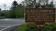  |
State Ed Dept, 1935 |
Rt. 212, east of
Woodstock NYS Route 32 and Main Street in Hamlet of Glasco |
Saugerties |
42°03′01.54″N 74°04′07.02″W / 42.0504278°N 74.0686167°W and 42°02′36″N 73°57′12.5″W / 42.04333°N 73.953472°W [17] |
GLASCO TURNPIKE
ROAD FROM EARLY GLASS WORKS |
| 78 | INDIAN CAVE |  |
State Ed Dept, 1936 | NYS 32, SO. OF KATSBAAN | Saugerties | 42°06′34″N 73°58′06.5″W / 42.10944°N 73.968472°W [18] | HOME OF "NACHTE JAN", LAST INDIAN OF REGION. FRIEND OF CORNELIUS PERSEN, OFTEN WARNED HIM OF ATTACKS BY INDIANS AND TORIES. |
| 79 | KATSBAAN CHURCH |  |
State Ed Dept, 1936 | CO. RD., 8 MIS. N. OF KATSBAAN | Saugerties | 42°07′16.4″N 73°57′42.5″W / 42.121222°N 73.961806°W [19] | ERECTED 1732 KNOWN AS "DE STEENEKERK OP DE KATS BAAN." REBUILT 1867. IN NORTH WALL ARE STONES WITH NAMES OF BUILDERS. |
| 80 | KIERSTED HOUSE |  |
State Ed Dept, 1936 | MAIN ST., E. OF WASHINGTON AVE., SAUGERTIES | Saugerties | 42°04′44″N 73°56′58.3″W / 42.07889°N 73.949528°W | KIERSTED HOUSE OF PRE-REVOLUTIONARY DAYS. HOME OF DR. CHRISTOPHER KIERSTED, FIRST PHYSICIAN IN TOWN, RENDERED SERVICE DURING REVOLUTIONARY WAR |
| 81 | KING'S ROAD |  |
State Ed Dept, 1936 | NYS 32, 100 YDS. N. OF THRUWAY ENTRANCE NO. 20 | Saugerties | 42°05′14.4″N 73°58′26.4″W / 42.087333°N 73.974000°W | OLDEST HIGHWAY IN TOWN, 1703. FIRST KNOWN AS "FOOTPATH" TO ALBANY, THEN AS THE "QUEEN'S HIGHWAY", LATER AS "THE OLD KING'S ROAD." |
| 82 | LUTHERAN CHURCH |  |
State Ed Dept, 1936 | US 9W AT WEST CAMP | Saugerties | 42°07′26.5″N 73°55′55.6″W / 42.124028°N 73.932111°W | ORGANIZED IN 1710 BY THE PALATINES. FIRST PASTOR REV. JOSHUA KOCHERTHAL. FIRST CHURCH NEAR SITE OF PRESENT CHURCH. |
| 83 | MYER HOMESTEAD | CO. RD., 1-1/2 MIS. S. OF NYS 32 | Saugerties | LAND DEEDED 1724 TO
CHRISTIAN MYER, PROMINENT PALATINE SETTLER; EIGHTEEN DESCENDANTS SERVED IN REVOLUTIONARY WAR | |||
| 84 | MYNDERSE HOUSE |  |
State Ed Dept, 1936 | MYNDERSE ST., S. OF US 9W, IN SAUGERTIES | Saugerties | 42°04′39.4″N 73°56′35.1″W / 42.077611°N 73.943083°W [20] | JOHN PERSON, PATENTEE 1712, BUILT GRIST MILL AND EST'D FERRY ACROSS ESOPUS CREEK. DEEDED TO DAUGHTER OF MYNDERT MYNDERSE. ADDITION BUILT 1743 |
| 85 | POST TAVERN SITE |  |
State Ed Dept, 1936 | MAIN ST., W. OF PARTITION ST., SAUGERTIES | Saugerties | 42°04′40″N 73°57′09.8″W / 42.07778°N 73.952722°W [21] | USED AS PATRIOTS MEETING PLACE DURING REVOLUTION. ARTICLES OF ASSOCIATION SIGNED HERE. RELIGIOUS SERVICES HELD HERE 1815–29. |
| 86 | SAWYER'S MILL |  |
State Ed Dept, 1936 | US 9W N. OF SAUGERTIES AT BRIDGE | Saugerties | 42°05′03.2″N 73°56′35.6″W / 42.084222°N 73.943222°W [22] | STOOD ON THIS SITE 1663. SAUGERTIES DERIVED ITS NAME FROM THE DUTCH WORD "DE ZAAGERTJES". |
| 87 | SCHOONMAKER HOMESTEAD |  |
State Ed Dept, 1936 | MAIN ST., W. OF MYNDERSE ST. IN SAUGERTIES | Saugerties | 42°04′49.2312″N 73°56′40.293″W / 42.080342000°N 73.94452583°W [23] | ELDER KATSBAAN CHURCH, MEMBER OF GENERAL COMMITTEE OF ARTICLES OF ASSOCIATION. OCCUPIED CON- TINUOUSLY BY DESCENDANTS. PRE-REVOLUTIONARY HOUSE. |
| 88 | SETTLERS CAPTURED |  |
State Ed Dept, 1935 | NYS 212, E. OF WOODSTOCK | Saugerties | 42°02′32.24″N 74°04′43.26″W / 42.0422889°N 74.0786833°W | SETTLERS CAPTURED
JUNE 18, 1780, NEAR THIS |
| 89 | TAVERN SITE |  |
State Ed Dept, 1937 | NO. OF NYS 32, AT KATSBAAN | Saugerties | 42°06′40″N 73°58′03.4″W / 42.11111°N 73.967611°W [24] | TAVERN SITE KEPT BY CHRISTIAN FIERO. PUBLIC MEETING PLACE DURING REVOLUTION. FIRST TOWN MEETING HELD HERE APRIL 16, 1811. |
| 90 | ULSTER COUNTY | State Ed Dept, 1936 | US 9W AT ULSTER-GREENE CO. LINE | Saugerties | Marker no longer exists; former site is 42°07′50.8″N 73°55′41.9″W / 42.130778°N 73.928306°W. [25] Marker appears in Google Street View in May 2012 [26] and June 2009. [27] | ONE OF ORIGINAL COUNTIES
OF NEW YORK STATE, 1683, RECEIVED ITS NAME FROM THE EARLDOM IN IRELAND OF JAMES, DUKE OF YORK. | |
| 91 | WEST CAMP | US 9W AT WEST CAMP | Saugerties | SETTLED 1710 BY
PALATINES
FROM THE RHINELAND FOR PRODUCTION OF NAVAL STORES. BUILT CHURCH AND SCHOOL DURING FIRST WINTER. | |||
| 92 | SITE OF NEW FORT | OFF CO. RD., 1 MI. S. OLD SHAWANGUNK CHURCH | Shandaken | 23 INDIANS KILLED, 13
CAPTURED. 23 CAPTIVE WOMEN AND CHILDREN RELEASED. 3 SOLDIERS KILLED, SEPT. 5, 1663 | |||
| 93 | ULSTER COUNTY |  |
State Ed Dept, 1936 | South Side Rt 28 at Ulster - Delaware Co Line | Shandaken | 42°08′53.83″N 74°29′45.61″W / 42.1482861°N 74.4960028°W | ONE OF ORIGINAL COUNTIES
OF NEW YORK STATE, 1683 RECEIVED ITS NAME FROM THE EARLDOM IN IRELAND OF JAMES, DUKE OF YORK. |
| 94 | ABRAM BEVIER |  |
(no agency or date) | US 209 AT NAPANOCH | Wawarsing | 41°44′33.0″N 74°22′07.0″W / 41.742500°N 74.368611°W | ABRAM BEVIER WHOSE HOUSE STOOD HERE, HAD
A SMALL CANNON, WHICH THE INDIANS FEARED, AND WHICH MADE HIS HOME OF FORT FOR SETTLERS IN RAID OF 1781. |
| 95 | BEVIER HOUSE | US 209 AT WAWARSING | Wawarsing | AUG. 12, 1781, INDIANS
RAIDING RONDOUT VALLEY FIRED HOUSE OF CORNELIUS BEVIER, BUT FLAMES WERE PUT OUT BY NEGRO WOMAN SLAVE. | |||
| 96 | CORNELIUS DEPUY HOUSE |  |
Mc Bride Family, 1969 | US 209, N. OF WAWARSING | Wawarsing | 41°45′51.95″N 74°20′32.78″W / 41.7644306°N 74.3424389°W | ATTACKED BY INDIANS, AUG. 12,
1781. GARRET VAN WAGENEN, 16, SHOT THE LEADER, AND SCARED THE OTHERS AWAY. |
| 97 | HOME OF JOHANNES G. HARDENBERGH |  |
State Ed Dept, 1932 | US 209, 1 MI. S. OF KERHONKSON | Wawarsing | 41°46′15.92″N 74°18′56.7″W / 41.7710889°N 74.315750°W | ERECTED 1762. NEW YORK
RECORDS DEPOSITED HERE OCT. 12, 1777 BEFORE KINGSTON WAS BURNED BY THE BRITISH [28] [29] |
| 98 | OLD MINE ROAD | US 209, N. OF SPRING GLEN | Wawarsing | ESOPUS - MINISINK TRAIL
INDIAN TRAIL CONNECTING DELAWARE VALLEY WITH HUDSON RIVER. USED BEFORE AND DURING REVOLUTION | |||
| 99 | SITE OF LONG HOUSE |  |
State Ed Dept, 1938 | US 209 AT WAWARSING | Wawarsing | 41°45′32.18″N 74°21′25.89″W / 41.7589389°N 74.3571917°W | AT FOOT OF HIGH BLUFF STOOD INDIAN COUNCIL HOUSE DESTROYED BY CAPT. KREGIER, AUGUST 31, 1663 |
| 100 | SITE OF FIRST MILL | US 209 AT WAWARSING | Wawarsing | SITE OF FIRST MILL HERE, ON VERNOOY KILL,
WAS FIRST MILL, BROUGHT FROM HOLLAND AND SET UP EARLY IN THE EIGHTEENTH CENTURY BY CORNELIUS VERNOOY. | |||
| 101 | ULSTER COUNTY |  |
State Ed Dept, 1936 | US 209, S. OF SPRING GLEN | Wawarsing | 41°39′41.79″N 74°25′31.02″W / 41.6616083°N 74.4252833°W | ONE OF ORIGINAL COUNTIES
OF NEW YORK STATE, 1683, RECEIVED ITS NAME FROM THE EARLDOM IN IRELAND OF JAMES, DUKE OF YORK. |
| 102 | "DOWN RENT" WAR | S. OF NYS 212, AT LAKE HILL | Woodstock | REBELLION AGAINST "THREE
LIFE" LEASES CAUSED RIOTS HERE BY FARMERS DISGUISED AS INDIANS, 1845, AND LED TO ABOLISHMENT OF SYSTEM. | |||
| 103 | BAEHR'S STORE |  |
State Ed Dept, 1935 | NYS 212, AT BEARSVILLE | Woodstock | 42°02′26.39″N 74°09′15.87″W / 42.0406639°N 74.1544083°W | BAEHR'S STORE
CHRISTIAN BAEHR, A GERMAN |
| 104 | BLUESTONE QUARRY | CO. RD., NE OF WOODSTOCK | Woodstock | THE CALIFORNIA QUARRY, ON
OVERLOOK MOUNTAIN, NORTH, WAS ONE OF THE LARGEST OF THESE INDUSTRIES WHICH FLOURISHED, 1839–1900. | |||
| 105 | ELIAS HASBROUCH | N. OF NYS 212 AT LAKE HILL | Woodstock | 42°04′04.2″N 74°11′12.1″W / 42.067833°N 74.186694°W [30] | CAPTAIN IN AMERICAN ARMY,
1775–1783; AT QUEBEC WITH GEN. MONTGOMERY; BURIED HERE. HIS HOUSE IN KINGSTON WAS BURNED BY BRITISH, 1777. | ||
| 106, 107 | GLASCO TURNPIKE | CO. RD., NE OF WOODSTOCK,
also CO. RD., N OF WOODSTOCK |
Woodstock | ROAD FROM EARLY GLASS WORKS
ON THE UPPER SAWKILL, TO SHIPPING POINT ON HUDSON, ABOVE RONDOUT. NAMED FOR SIGN ON COMPANY'S WAREHOUSE. | |||
| 108 | GLASS FACTORY | 1/2 MI. N. OF SHADY | Woodstock | GLASS FACTORY
BRISTOL (SHADY) 1825–1856. ONE OF EARLY INDUSTRIES IN CATSKILLS; MADE WINDOW GLASS AND DOMES FOR WAX FLOWERS, STILL FOUND IN WOODSTOCK. | |||
| 109 | OLD WOODSTOCK MILL |  |
SE CORNER NYS 212 AND NYS 375 | Woodstock | 42°02′10.8″N 74°06′39.3″W / 42.036333°N 74.110917°W | GRIST MILL, 1788-1925
ALSO RUN AS CARDING MILL, 1836 AND LATER, BY JOSHUA NASH. | |
| 110 | OLD ZENA MILL |  |
State Ed Dept, 1935 | CO. RD., N. OF ZENA | Woodstock | 42°02′01.44″N 74°05′01.68″W / 42.0337333°N 74.0838000°W | OLD ZENA MILL
OPERATED PRIOR TO 1750 BY |
| 111 | SITE OF NEWKIRK HOUSE |  |
NYS 212, AT VILLAGE CENTER IN WOODSTOCK | Woodstock | 42°02′27.8406″N 74°07′06.2472″W / 42.041066833°N 74.118402000°W | ONE OF THE EARLIEST HOUSES
IN WOODSTOCK, OCCUPIED 1777 BY BARRET NEWKIRK, LATER BY JACOBUS ELTINGE. | |
| 112 | TANNERY BROOK |  |
NYS 212, W. OF WOODSTOCK | Woodstock | 42°02′25.70″N 74°07′11.56″W / 42.0404722°N 74.1198778°W | TANNERS, USING HEMLOCK BARK,
RAN MILLS HERE, 1830–1870. HIDES WERE BROUGHT IN SHIPS UP THE HUDSON TO KINGSTON. | |
| 113 | ZENA - WAGHKONK | 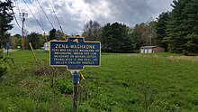 |
State Ed Dept, 1935 | CO. RD. AT ZENA | Woodstock | 42°01′00.74″N 74°04′35.86″W / 42.0168722°N 74.0766278°W | ZENA-WAGHKONK
ZENA WAS CALLED WAGHKONK OR |
| 114 | Old Dutch Church |  |
NY State Historical Marker, 1927 | 272 Wall Street, Kingston | Kingston | 41°55′56.45″N 74°01′09.74″W / 41.9323472°N 74.0193722°W | SITE OF FIRST OLD DUTCH CHURCH BUILT 1661 |
| 115 | Original Kingston Academy Site | 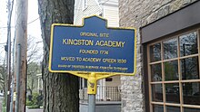 |
(no agency or date) | 81 Green Street, Kingston | Kingston | 41°55′59.98″N 74°01′15.67″W / 41.9333278°N 74.0210194°W | ORIGINAL SITE KINGSTON ACADEMY FOUNDED 1974 MOVED TO ACADEMY GREEN 1830 BOARD OF TRUSTEES IN SERVICE FROM 1785 TO PRESENT |
| 116 | Wynkoop House |  |
(no agency or date) | 3705-3721 Main Street, Stone Ridge, NY (part of a historic district) | Marbletown | 41°50′55.32″N 74°08′34.46″W / 41.8487000°N 74.1429056°W | WYNKOOP HOUSE
BUILT 1767-72 FOR MAJOR C.E. |
| 117 | Keator Home | 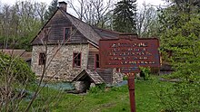 |
State Ed Dept, 1935 | 734 Binnewater Lane, Kingston | Kingston near Rosendale | 41°51′30.03″N 74°05′06.79″W / 41.8583417°N 74.0852194°W | KEATOR HOME
BUILT ABOUT 1770 BY |
| 118 | Westbrook House | 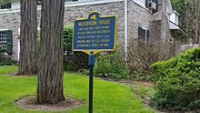 |
(no agency or date) | Accord | Rochester | 41°48′21.84″N 74°13′15.16″W / 41.8060667°N 74.2208778°W | WESTBROOK HOUSE
LAND ACQUIRED FROM INDIANS |
| 119 | MAVERICK ROAD |  |
Woodstock Bicentennial, 1987 | Woodstock | 42°01′24.68″N 74°06′23.48″W / 42.0235222°N 74.1065222°W | MAVERICK ROAD
LEADS TO "THE MAVERICK" | |
| 120 | ROSENDALE LIBRARY |  |
(no agency or date (but must be =>1986)) | Rosendale | 41°50′43.98″N 74°04′33.6″W / 41.8455500°N 74.076000°W | ROSENDALE LIBRARY
FORMERLY ALL SAINTS' CHAPEL | |
| 121 | ALLIGERVILLE HISTORIC DISTRICT |  |
Town of Rochester, 2015 | in Alligerville center city | Rochester | 41°47′49.2″N 74°10′41.9″W / 41.797000°N 74.178306°W | ALLIGERVILLE HISTORIC DISTRICT
LISTED ON THE |
| 122 | WATERING TROUGH |  |
(no agency or date) | Rochester | 41°48′07.2″N 74°10′39.36″W / 41.802000°N 74.1776000°W | THIS TRIANGULAR SPRING-FED
WATERING TROUGH
WAS USED DURING | |
| 123 |
|
 |
State Ed Dept, 1939 | 213 and School Street, just south of but in High Falls, New York | Marbletown | 41°49′24.68″N 74°07′39.39″W / 41.8235222°N 74.1276083°W |
JOHN BURROUGHS
AMERICAN NATURALIST |
| 124 | Jacob Hasbrouck Jr. House (n.b. fully size house, Jacob's dad was named Jacob) |  |
Maj. J. Hasbrouck Trust (no date) | 193 Huguenot Street New Paltz, New York | New Paltz | 41°45′38.16″N 74°05′08.52″W / 41.7606000°N 74.0857000°W | 1786 MAJ. JACOB HASBROUCK, JR. HOUSE MEMBER PROVINCIAL CONGRESS 1775 OFFICER 3RD REG. N.Y. MILITIA GRANDSON OF JEAN HASBROUCK THE PATENTEE BIRTHPLACE OF JACOB M. HASBROUCK 1ST MAYOR OF NEW PALTZ 1887 LAND TITLE VESTED BY FAILY WILLS |
| 125 | AFRICAN-AMERICAN BURIAL GROUND |  |
Town and Village of New Paltz, 2000 | 190 Huguenot Street New Paltz, New York | New Paltz | 41°45′34.05″N 74°05′08.19″W / 41.7594583°N 74.0856083°W | SITE OF AFRICAN-AMERICAN BURIAL GROUND FRENCH HUGUENOTS WHO FOUNDED NEW PALTZ IN 1677 HAD USED ENSLAVED AFRICANS FOR CONSTRUCTION AND FARM WORK AS EARLY AS 1673. BY 1790, 179 ENSLAVED AFRICAN-AMERICANS AND 9 FREE PERSONS OF COLOR LIVED IN NEW PALTZ. SLAVERY OFFICIALLY ENDED IN NEW YORK STATE IN 1827, BUT MANY AFRICAN-AMERICANS REMAINED IN SERVITUDE UNTIL 1848. A BURIAL GROUND USED BY AFRICANS AND THEIR DESCENDANTS IS LOCATED NEAR THIS MARKER. AFRER THE CIVIL WAR, WHEN WHITES ALLOWED AFRICAN-AMERICAN BURIALS IN A SEGREGATED PORTION OF THE NEW PALTZ BURIAL CEMETERY ON PLAINS ROAD, THIS BURIAL GROUND WAS NO LONGER USED AND ITS EXISTENCE NEARLY FORGOTTEN. |
| 126 | ELTING CEMETERY |  |
(no agency or date) | 171 Huguenot Street New Paltz, New York | New Paltz | 41°45′27.24″N 74°05′09.24″W / 41.7575667°N 74.0859000°W | SITE OF ELTING CEMETERY JACOB ELTING'S DESCENDANTS DONATED THIS MEADOW AND FAMILY CEMETERY TO THE VILLAGE IN 2017. ONE OF THE EARLIEST FAMILIES OF NEW PALTZ, THESE ELTINGS GAVE THE BEVIER-ELTING HOUSE AND THE HARCOURT SANCTUARY TO THE HUGUENOT HISTORICAL SOCIETY AND ALSO CONTRIBUTED TO THE ELTING MEMORIAL LIBRARY BUILDING. THEIR GIFT OF THE SANCTUARY TO THE HHS ENABLED THE CREATION OF THE NYQUIST-HARCOURT WILDLIFE SANCTUARY. |
| 127 | TOWN ORGANIZED |  |
(no agency or date) | 439 New Paltz Road, Highland, NY 12528 | Lloyd | 41°44′04.88″N 74°00′11.88″W / 41.7346889°N 74.0033000°W | TOWN ORGANIZED
FIRST OWN OF LLOYD MEETING |
| 128 | YELVERTON HOUSE |  |
(no agency or date) | 39 Maple Ave, Highland, NY 12528 | Lloyd | 41°43′02.53″N 73°57′03.97″W / 41.7173694°N 73.9511028°W |
YELVERTON HOUSE
1754 HISTORIC SITE ON STATE |
| 129 | DEWITT HOUSE |  |
State Ed Dept, 1939 | 7800 US 209, Napanoch, NY 12458 | Napanoch | 41°44′16.26″N 74°22′40.11″W / 41.7378500°N 74.3778083°W |
DEWITT HOUSE
THIS HOUSE IS ON ORIGINAL |
| 130 | OLD SCHOOL BAPTIST MEETING HOUSE |  |
Historical Society of Olive (no date) | Route 28 and Reservoir Road | Shokan | 41°58′24.05″N 74°12′44.07″W / 41.9733472°N 74.2122417°W | CHURCH ORGANIZED IN 1799 AS THE TONGOR BAPTIST CHURCH OF CHRIST. PRESENT EDIFICE ERECTED IN 1857. |
| 131 | SHOKAN REFORMED |  |
Historical Society of Olive (no date) | Route 28 and Church St. | Shokan | 41°58′22.77″N 74°13′20.87″W / 41.9729917°N 74.2224639°W | CHURCH ORGANIZED IN 1799 ORIGINAL SITE NOW BELOW ASHOKAN RESERVOIR PRESENT EDIFICE DEDICATED ON SEPTEMBER 14, 1913. |
| 132 | 1779 FORT SHANDAKEN |
 |
Shandaken Historic Site (no date) | Route 28 across from Hudler Cemetery | Mt. Tremper | 42°01′59.31″N 74°16′30.47″W / 42.0331417°N 74.2751306°W | DURING THE
REVOLUTIONARY WAR, A LOG FORT STOOD NEAR THIS SPOT TO DEFEND KINGSTON FROM ENEMY ATTACK |
| 133 | OLIVEBRIDGE |  |
(no agency or date) | Route 213 south of Route 28A | Olivebridge | 41°55′49.7058″N 74°12′58.6584″W / 41.930473833°N 74.216294000°W [31] | OLIVEBRIDGE
UNITED METHODIST CHURCH |
| 134 | DUTCH CHURCH - 1827 |  |
Klyne Esopus Historical Society Museum (no date) | 9W / Broadway in Ulster Park | Esopus, in its hamlet of Ulster Park | 41°51′13.5″N 73°58′09.89″W / 41.853750°N 73.9694139°W | DUTCH CHURCH - 1827
|
| 135 | SOJOURNER TRUTH |  |
William C. Pomeroy Foundation 2013 | Broadway and River Road in Ulster Park | Esopus, in its hamlet of Ulster Park | 41°54′00.55″N 73°58′27.22″W / 41.9001528°N 73.9742278°W |
SOJOURNER TRUTH
1797 - 1883 |
| 136 | VICTORY IN 1777 |  |
Cahill School Grade 4 1997 | School Road and Old King's Road | Saugerties | 42°08′30.8″N 73°57′12.9″W / 42.141889°N 73.953583°W [32] | VICTORY IN 1777
TRADITION TELLS US THAT TROOPS |
| 137 | PERSEN STORE SITE |  |
State Ed Dept, 1936 | Route 32 and Route 34 in Katsbaan hamlet of Saugerties | Saugerties | 42°06′34.1″N 73°58′05.2″W / 42.109472°N 73.968111°W [33] | PERSEN STORE SITE
23 YARDS EAST STOOD STORE |
| 138 | PHOENICIA STATION | National Register of Historic Places (no date but likely 1999) | Phoenicia | Shandaken's hamlet Phoenicia | 42°04′49.9″N 74°18′30″W / 42.080528°N 74.30833°W [34] | PHOENICIA STATION
CENTENNIAL | |
| 139 | GLASSWORKS SITE |  |
Hudson Valley Bottle Club (no date) | West corner of Canal St and Edwards Pl in Ellenville | Wawarsing | 41°42′51.5″N 74°23′18.9″W / 41.714306°N 74.388583°W | GLASSWORKS SITE
ELLENVILLE GLASS CO. 1836-96 |
| 140 | NEW HURLEY REFORMED CHURCH |  |
Town of Plattekill 1990 | 208 and New Hurley Road | Wallkill | 41°38′18″N 74°08′37.9″W / 41.63833°N 74.143861°W [35] | ☨ HISTORICAL SITE
NEW HURLEY REFORMED CHURCH |
| 141 | NEW PROSPECT |  |
(no agency or date) | Pirog Road, N of Route 52 | Pine Bush | 41°37′05.7″N 74°18′59.3″W / 41.618250°N 74.316472°W [36] | NEW PROSPECT
ORIGINALLY PECONASINK SETTLEMENT |
| 142 | WALKER VALLEY |  |
Town of Shawangunk (no date) | Route 52 at Marl Road | Shawangunk | 41°37′56.7″N 74°22′28″W / 41.632417°N 74.37444°W [37] | WALKER VALLEY
ORIGINALLY NAMED JAMESBURGH |
| 143 | LOCUST LAWN |  |
Huguenot Historical Society (no date) | 436 State Route 32 South, Wallkill, NY 12589 | Wallkill | 41°41′49.6″N 74°06′06.4″W / 41.697111°N 74.101778°W | LOCUST LAWN
BUILT FOR COLONEL JOSIAH HASBROUCK |
| 144 | GRIST MILL 1762 |  |
(no agency or date) | Mill Dam Road, Marbletown, NY | Marbletown | 41°51′44.3″N 74°08′28.11″W / 41.862306°N 74.1411417°W | GRIST MILL 1762
LEONARD
HARDENBERGH BUILT |
| 145 | SOJOURNER TRUTH |  |
New York State (no date but during Pataki administration 1995–2006) | Route 213 in Rifton | Esopus | 41°50′59.3″N 74°02′09.1″W / 41.849806°N 74.035861°W [38] | SOJOURNER TRUTH
1797? - 1883 BORN INTO |
| 146 | WALK TO FREEDOM [39] [40] |  |
William C. Pomeroy Foundation 2015 (marker is numbered 231) | Floyd Ackert Road west of 9W in Esopus | Esopus | 41°47′46.8″N 73°57′42.9″W / 41.796333°N 73.961917°W | WALK TO FREEDOM
IN OCTOBER 1826 SOJOURNER TRUTH WALKED THIS ROAD FROM WEST PARK TO RIFTON LEAVING SLAVERY BEHIND FOR A LIFE OF FREEDOM |
| 147 | JENKINSTOWN |  |
(no agency or date) | Jenkinstown Road, Gardiner | Gardiner | 41°41′49.8″N 74°06′29.8″W / 41.697167°N 74.108278°W | JENKINSTOWN
JENKINS-DUBOIS FARM & MILL |
| 148 | BRUYNSWICK | 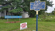 |
Town of Shawangunk (no date) | Hoagerburgh and Bruynswick Roads, Shawangunk | Shawangunk | 41°39′28.3″N 74°13′34.1″W / 41.657861°N 74.226139°W | BRUYNSWICK
NAMES FOR SETTLER GERTRUYD BRUYN. |
| 149 | BRUYNSWICK SCHOOL | 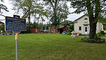 |
National Register of Historic Places (no date) | Brunyswick Road, north of Hoagerburg Road, Shawangunk | Shawangunk | 41°39′34.3″N 74°13′32.8″W / 41.659528°N 74.225778°W |
BRUYNSWICK SCHOOL
DISTRICT NO. 8 |
| 150 | REFORMED CHURCH OF SHAWANGUNK |  |
National Register of Historic Places (no date) | Hoagerburgh Road, Shawangunk | Shawangunk | 41°39′13.5″N 74°12′49.9″W / 41.653750°N 74.213861°W |
REFORMED CHURCH OF SHAWANGUNK
PARSONAGE BUILT 1751 |
| 151 | THE FOUR CORNERS |  |
William C Pomeroy Foundation, 2018 (#552) | Corner of Crown and John Streets, Kingston, New York | Kingston, New York | 41°56′01.1″N 74°01′15.4″W / 41.933639°N 74.020944°W | THE FOUR CORNERS ALL FOUR STONE HOUSES AT THIS INTERSECTION BUILT BETWEEN CA. 1663 - CA. 1775. PRIOR TO THE REVOLUTIONARY WAR. |
| 152 | POPPLETOWN HOUSE |  |
(no agency or date) | Jct. of Old Post Rd. and Swarte Kill Rd., Esopus, New York | Esopus, New York | 41°49′16.79″N 73°58′29.76″W / 41.8213306°N 73.9749333°W |
POPPLETOWN HOUSE
A STONE FARM HOUSE TYPICAL OF |
| 153 | The Senate House |  |
State of NY Educ. Dept and NYS Thruway Authority, 1965 | Ulster Travel Plaza, US Interstate 87 southbound, north of Kingston, NY | Ulster | 42°00′51.22″N 73°59′58.46″W / 42.0142278°N 73.9995722°W | Historic New York: The Senate House, 1676, Clinton Avenue, Kingston |
| 154 | Kingston Area | 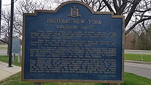 |
State of NY Educ. Dept and NYS Thruway Authority, 1965 | Ulster Travel Plaza, US Interstate 87 southbound, north of Kingston, NY | Ulster | 42°00′50.76″N 73°59′58.65″W / 42.0141000°N 73.9996250°W | Historic New York: Kingston Area |
| 155 | Hudson Valley |  |
State of NY Educ. Dept and NYS Thruway Authority, 1965 | undeveloped Malden travel plaza, US Interstate 87 southbound, north of Saugerties | Saugerties | 42°06′25.03″N 73°57′33.33″W / 42.1069528°N 73.9592583°W | Historic New York: Hudson Valley |
| 156 | SOJOURNER TRUTH |  |
Colonel Hasbrouck House | Green Street between John and Crown, Kingston, NY | Kingston, New York | 41°55′56″N 74°01′17″W / 41.9321797°N 74.021501°W | SOJOURNER TRUTH
LIVED HERE IN 1828 WHEN SHE FOUGHT TO FREE HER ENSLAVED SON, BECOMING THE 1ST BLACK WOMAN IN US HISTORY TO SUE A SLAVEHOLDER—AND WIN. COLONEL HASBROUCK HOUSE - 2022 |
| 157 | Dubois House |  |
State Ed Dept, 1935 | Springtown Road, New Paltz, NY | New Paltz, NY | 41°48′26.5″N 74°04′54.8″W / 41.807361°N 74.081889°W | DUBOIS HOUSE
BUILT IN 1755 BY BENJAMIN DUBOIS, GRANDSON OF ISAAC DUBOIS, NEW PALTZ PATENTEE. |
This list does not include the satirical markers in Ulster County erected by artist Norm Magnusson to resemble official Historic Markers. Such markers are distinguished by official Markers by displaying a map of the continental United States with the words "UNITED STATES" above the map at the top of the sign (official Markers in Ulster County usually display a map of New York State (sometimes with the map placed in between the words "NEW" and "YORK") and at the bottom, displaying the words "EDUCATION DEPARTMENT", aping the "STATE EDUCATION DEPARTMENT" that erects the official Markers. Magnusson's satirical markers further distinguish themselves from official Markers by placing the words "ON THIS SITE STOOD" on the same part of, and the same size as, the part of the sign where the name of the event/place/person(s) that the official Marker commemorates is placed. Magnusson's markers do not represent actual historical events, places or people but are intended to make a political point on issues that Magnusson feels need to be discussed and addressed. For example, in Woodstock, Magnusson erected a marker (at the coordinates 42°02′26.0″N 74°07′10.4″W) "commemorating" a fictitious Patriot called "Rob't Hass" that reads "ON THIS SITE STOOD AMERICAN PATRIOT ROB'T HASS WHO BELIEVED THAT A HEALTHY DEMOCRACY MUST DISCOURAGE APATHY AND RESPECT DISSENT. EDUCATION DEPARTMENT, 2006". [41]
See also
- List of New York State Historic Markers
- National Register of Historic Places listings in Ulster County, New York
- National Register of Historic Places listings in New York
- List of National Historic Landmarks in New York
- Historical Marker Databse for Ulster County
References
- ^ "New York State Historic Markers". New York State Historic Markers. New York Museum. 2009-05-05.
- ^ "Historic Houses of Kingston: No. 4 - Conrad Elmendorf Tavern". Kingston Daily Freeman. 11 October 1937. Retrieved 22 July 2018.
-
^
"Elmendorf Tavern, Kingston, N.Y."
Library of Congress.
LCCN
2016795023. Retrieved 22 July 2018.
from the Detroit Publishing Company photograph collection
- ^ "Van Keuren Homestead - New York Historical Markers on Waymarking.com". Waymarking. Retrieved 9 September 2017.
- ^ "Site of Colonial Church - New York Historical Markers on Waymarking.com". Waymarking. Retrieved 31 August 2017.
- ^ "Hudson Valley History: 'What was the Owl church?'". Times Herald-Record. 28 May 2014. Retrieved 31 August 2018.
- ^ "1799 House - New York Historical Markers on Waymarking.com". Waymarking. Retrieved 9 September 2017.
- ^ "Colonial Tavern - New York Historical Markers on Waymarking.com". Waymarking. Retrieved 31 August 2017.
- ^ "US-209, Accord NY (May 2009)". Google Maps. Google. Retrieved 1 September 2017.
-
^ Bielinski, Stefan (30 July 2016).
"Johannes Nucella". The People of Colonial Albany Live Here. New York State Museum. Retrieved 16 July 2017.
{{
cite web}}
: External link in|ref= - ^ Schoonmaker, Theo. "Tom Quick - Indian Slayer" (Tom Quick - Indian Slayer By THEO. D. SCHOONMAKER, ESQ., of Goshen, N. Y. Read before the Historical Society of Newburgh Bay and the Highlands, March 7th, 1904). JR's Rare Books and Commentary. Retrieved 16 July 2017.
- ^ "Joppenbergh - New York Historical Markers on Waymarking.com". Waymarking. Retrieved 31 August 2017.
- ^ "528 NY-213, Rosendale NY (May 2009)". Google Maps. Google. Retrieved 1 September 2017.
- ^ "New York State Historic Markers". New York State Historic Markers Says that the construction date of the house was 1726-1730, it appears that the marker was altered to put the date as 1699. New York Museum. 2009-05-05.
- ^ "Wagendaal - New York Historical Markers on Waymarking.com". Waymarking. Retrieved 31 August 2017.
- ^ "Flatbush Reformed Church, Flatbush, NY - This Old Church on Waymarking.com". Waymarking. Retrieved 9 September 2017.
- ^ "Glasco Turnpike - New York Historical Markers on Waymarking.com". Waymarking. Retrieved 11 September 2017.
- ^ "Indian Cave - New York Historical Markers on Waymarking.com". Waymarking. Retrieved 8 September 2017.
- ^ "Katsbaan Reformed Church, Saugerties, NY - This Old Church on Waymarking.com". Waymarking. Retrieved 8 September 2017.
- ^ "Mynderse House - New York Historical Markers on Waymarking.com". Waymarking. Retrieved 9 September 2017.
- ^ "Post Tavern Site - New York Historical Markers on Waymarking.com". Waymarking. Retrieved 9 September 2017.
- ^ "Sawyer's Mill - New York Historical Markers on Waymarking.com". Waymarking. Retrieved 9 September 2017.
- ^ "Schoonmaker Homestead - New York Historical Markers on Waymarking.com". Waymarking. Retrieved 31 August 2017.
- ^ "Tavern Site - New York Historical Markers on Waymarking.com". Waymarking. Retrieved 31 August 2017.
- ^ "Ulster County - New York Historical Markers on Waymarking.com". Waymarking. Retrieved 1 September 2017.
- ^ "4294 US-9W, Saugerties NY (May 2012)". Google Maps. Google. Retrieved 1 September 2017.
- ^ "4294 US-9W, Saugerties NY (June 2009)". Google Maps. Google. Retrieved 1 September 2017.
- ^ "Johannes Hardenbergh House, Kerhonkson, Ulster County, NY". Library of Congress. Retrieved 16 July 2017.
- ^ Schenkman, A. J. (18 July 2013). "Preservation Failures: The Hardenbergh House". The New York History Blog. Retrieved 16 July 2017.
- ^ "Rich Turck's Facebook Page posted 15-Feb-2016". Facebook. Retrieved 25 July 2018.
- ^ "Olivebridge - New York Historical Markers on Waymarking.com". Waymarking. Retrieved 9 September 2017.
- ^ "Victory in 1777 - New York Historical Markers on Waymarking.com". Waymarking. Retrieved 9 September 2017.
- ^ "Persen Store Site - New York Historical Markers on Waymarking.com". Waymarking. Retrieved 11 September 2017.
- ^ "Phoenicia Station - Phoenicia NY". Waymarking. Retrieved 11 September 2017.
- ^ "Reformed Dutch Church of New Hurley - New Hurley, NY". Waymarking. Retrieved 9 September 2017.
- ^ "New Prospect - New York Historical Markers on Waymarking.com". Waymarking. Retrieved 11 September 2017.
- ^ "Walker Valley - New York Historical Markers on Waymarking.com". Waymarking. Retrieved 11 September 2017.
- ^ "Sojourner Truth - New York Historical Markers on Waymarking.com". Waymarking. Retrieved 19 February 2018.
- ^ "Sojourner Truth marker to be unveiled Aug. 3 in West Park". Kingston Daily Freeman. 19 July 2015. Retrieved 20 February 2018.
- ^ Twine, Olivia. "Road marker for Sojourner Truth to be dedicated on August 3, 2015". Let's Rock the Cradle. Retrieved 20 February 2018.
- ^ https://www.recordonline.com/article/20120102/NEWS/201020308
