This list is of the Cultural Properties of Japan designated in the category of sculptures (彫刻, chōkoku) for the Prefecture of Okinawa. [1]
National Cultural Properties
As of 1 February 2015, zero Important Cultural Properties have been designated. [2] [3] [4]
Prefectural Cultural Properties
As of 1 May 2014, eleven properties have been designated at a prefectural level. [4] [5]
| Property | Date | Municipality | Ownership | Comments | Image | Coordinates | Ref. |
|---|---|---|---|---|---|---|---|
|
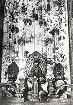
Urasoe Yōdore Stone Zushi 浦添ようどれ石 厨子 Urasoe yōdore ishi-zushi |
C15 | Urasoe | Urasoe City | four stone sarcophagi, of green tuff from Fujian; decoration on the four sides includes Buddhist figures and treasures, shisa, deer, birds, and flowers, while the lids imitate tiled roofs, with dragon and phoenix tile ends [6] |
 |
26°14′51″N 127°43′54″E / 26.247486°N 127.731750°E | for all refs see [1] |
|
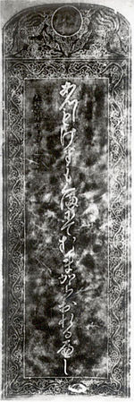
Sōgen-ji Stele with Instructions to Dismount from Horse 崇元寺下馬碑 Sōgenji geba-hi |
1527 | Naha | Naha City |


 |
26°13′13″N 127°41′26″E / 26.220371°N 127.690594°E | ||
|
Tōrin-ji
Niō 桃林寺仁王像 Tōrinji niō zō |
1737 | Ishigaki | Tōrin-ji ( 桃林寺) | two statues of Magnolia compressa wood ( オガタマノキ); after the 1771 Great Yaeyama Tsunami they were recovered from the coast of Sakieda Bay (崎枝湾) [7] |

 |
24°20′38″N 124°09′20″E / 24.343812°N 124.155625°E | |
|
Enkaku-ji Wooden Elephant and
Ofuda 木彫 円覚寺白象並びに趣意書 木札 mokuchō Enkakuji byakuzō narabini shui-sho mokusatsu |
Naha | Okinawa Prefecture (kept at the Okinawa Prefectural Museum and Art Museum) |
26°13′38″N 127°41′38″E / 26.227257°N 127.693856°E | ||||
| Parapet of Yomochi Bridge 世持橋勾欄羽目 Yomochi-bashi kōran hame |
Naha | Okinawa Prefecture (kept at the Okinawa Prefectural Museum and Art Museum) |
 |
26°13′38″N 127°41′38″E / 26.227257°N 127.693856°E | |||
| Parapet of the Stone Bridge over Hōjō Pond at
Enkaku-ji 円覚寺放生池石橋勾欄 Enkakuji Hōjō-chi ishibashi kōran |
Naha | Okinawa Prefecture |
 |
26°13′06″N 127°43′09″E / 26.218439°N 127.719259°E | |||
|
Tamaudun
Stone Lions 玉陵石彫獅子 Tamaudun sekichō shishi |
Naha | Naha City | pair of lions |

 |
26°13′05″N 127°42′53″E / 26.218172°N 127.714702°E | ||
|
Izena Tamaudun Stone Zushi 伊是名玉御殿内石厨子 Izena Tamaudun nai ishizushi |
Izena | Izena Village | two miniature shrines | 26°54′57″N 127°57′06″E / 26.915713°N 127.951552°E | |||
| Oroku Tomb Stone Zushi 小禄墓内石厨子 Oroku baka nai ishizushi |
Ginowan | private | 26°15′25″N 127°44′16″E / 26.256935°N 127.737694°E | ||||
|
Tamaudun Stele 玉陵 碑 Tamaudun hi |
Naha | Naha City |
 |
26°13′05″N 127°42′53″E / 26.218172°N 127.714702°E | |||
| Wooden Sculpture Fragments from
Enkaku-ji 旧 円覚寺関係木彫資料 kyū-Enkakuji kankei mokuchō shiryō |
Naha | Okinawa Prefecture (kept at the Okinawa Prefectural Museum and Art Museum) |
35 items |
 |
26°13′38″N 127°41′38″E / 26.227257°N 127.693856°E |
Municipal Cultural Properties
As of 1 May 2014, six properties have been designated at a municipal level. [4] [8]
| Property | Date | Municipality | Ownership | Comments | Image | Coordinates | Ref. |
|---|---|---|---|---|---|---|---|
| Oroku Tomb Stone Censer 小禄墓石彫香炉 Oroku baka sekichō kōro |
Ginowan | private | 26°15′25″N 127°44′16″E / 26.256935°N 127.737694°E | for all refs see [2] | |||
| Oroku Tomb
Stone Lions 小禄墓石彫獅子 Oroku baka sekichō shishi |
Ginowan | private | 26°15′25″N 127°44′16″E / 26.256935°N 127.737694°E | ||||
| Teruya
Stone Lions 照屋の石彫獅子 Teruya no sekichō shishi |
Itoman | Teruya District | 26°07′50″N 127°40′51″E / 26.130570°N 127.680831°E | ||||
| Buddhist Sculptures by Dana Sōkei 田名宗経謹刻の仏像 Dana Sōkei kinkoku Butsu zō |
Itoman | private (kept at Renge-in (蓮華院)) |
26°07′47″N 127°40′19″E / 26.129771°N 127.671840°E | ||||
| Tōteikun 土帝君(トートク)3体 Tōteikun (tōtoku) |
Izena | Shomi District | 3 images | 26°55′56″N 127°56′56″E / 26.932171°N 127.948751°E | |||
| Tōteikun 土帝君(トートク)3体 Tōteikun (tōtoku) |
Izena | Serikyaku District | 3 images | 26°55′55″N 127°55′34″E / 26.931827°N 127.926092°E |
See also
- Cultural Properties of Japan
- List of National Treasures of Japan (sculptures)
- List of Historic Sites of Japan (Okinawa)
- List of Cultural Properties of Japan - paintings (Okinawa)
References
- ^ "Pamphlet on Cultural Properties". Agency for Cultural Affairs. Archived from the original on 26 October 2014. Retrieved 19 February 2015.
- ^ 国宝・重要文化財 [Number of National Treasures and Important Cultural Properties by Prefecture] (in Japanese). Agency for Cultural Affairs. 1 February 2015. Archived from the original on 30 June 2011. Retrieved 19 February 2015.
- ^ "Database of National Cultural Properties: 国宝・重要文化財(美術品)(彫刻 沖縄県)" (in Japanese). Agency for Cultural Affairs. Archived from the original on 4 December 2015. Retrieved 19 February 2015.
- ^ a b c 国・県・市町村指定文化財 [National, Prefectural, and Municipal Cultural Properties] (PDF) (in Japanese). Okinawa Prefecture. 1 May 2014. Retrieved 19 February 2015.
- ^ 都道府県別指定等文化財件数(都道府県分) [Number of Prefectural Cultural Properties by Prefecture] (in Japanese). Agency for Cultural Affairs. 1 May 2014. Archived from the original on 21 September 2013. Retrieved 19 February 2015.
- ^ Pearson, Richard (2013). Ancient Ryukyu: an Archaeological Study of Island Communities. University of Hawaii Press. pp. 173–7. ISBN 978-0-8248-3712-9.
- ^ 石垣の仁王像“九州出張” 石垣・桃林寺→国立博物館展示 [Niō from Tōrinji, Ishigaki, exhibited at Kyushu National Museum]. Ryūkyū Shimpō (in Japanese). 18 November 2009. Retrieved 8 January 2015.
- ^ 都道府県別指定等文化財件数(市町村分) [Number of Municipal Cultural Properties by Prefecture] (in Japanese). Agency for Cultural Affairs. 1 May 2014. Archived from the original on 14 May 2015. Retrieved 19 February 2015.
External links
- (in Japanese) Cultural Properties in Okinawa Prefecture
- (in Japanese) List of Cultural Properties in Okinawa Prefecture

