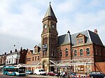
Linacre Road | |
|---|---|
| General information | |
| Location |
Litherland,
Sefton England |
| Coordinates | 53°27′55″N 2°59′55″W / 53.4654°N 2.9985°W |
| Grid reference | SJ337970 |
| Line(s) | North Mersey Branch |
| Platforms | 2 |
| Other information | |
| Status | Disused |
| History | |
| Original company | Lancashire and Yorkshire Railway |
| Pre-grouping | London and North Western Railway |
| Post-grouping | London, Midland and Scottish Railway |
| Key dates | |
| 1 June 1906 2 April 1951 1956 | Opened Closed (regular services) Closed (all services) |
Linacre Road railway station was a station located on the North Mersey Branch in Litherland, Lancashire.
History
It opened on 1 June 1906 and closed on 2 April 1951. The singled track is still in place, although no longer electrified and in a state of dereliction.
Since the 1970s there have been plans to re-electrify the North Mersey Branch and reintroduce a passenger service. As part of those plans Linacre Road station would reopen. [1]
References
- ^ "Station Name: Linacre Road". Disused Stations. Subterranea Britannica. Retrieved 1 April 2014.
External links
| Preceding station | Disused railways | Following station | ||
|---|---|---|---|---|
| Ford |
Lancashire and Yorkshire Railway Liverpool, Crosby and Southport Railway |
Bootle New Strand | ||
|
Lancashire and Yorkshire Railway North Mersey Branch |
Gladstone Dock | |||
| Liverpool Overhead Railway | Seaforth Sands |


