Lila | |
|---|---|
| Municipality of Lila | |
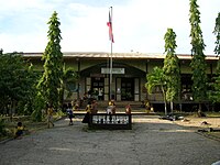
 Municipal building of Lila | |
 Flag | |
 Map of Bohol with Lila highlighted | |
.svg) Lila Location within the
Philippines | |
| Coordinates: 9°36′N 124°06′E / 9.6°N 124.1°E | |
| Country | Philippines |
| Region | Central Visayas |
| Province | Bohol |
| District | 3rd district |
| Founded | 1 January 1915 |
| Barangays | 18 (see Barangays) |
| Government | |
| • Type | Sangguniang Bayan |
| • Mayor | Arturo A. Piollo II |
| • Vice Mayor | Regina C. Salazar |
| • Representative | Kristine Alexie B. Tutor |
| • Municipal Council | Members |
| • Electorate | 7,780 voters ( 2022) |
| Area | |
| • Total | 40.50 km2 (15.64 sq mi) |
| Elevation | 99 m (325 ft) |
| Highest elevation | 501 m (1,644 ft) |
| Lowest elevation | 0 m (0 ft) |
| Population (2020 census)
[3] | |
| • Total | 12,240 |
| • Density | 300/km2 (780/sq mi) |
| • Households | 2,295 |
| Economy | |
| • Income class | 5th municipal income class |
| • Poverty incidence | 17.90 |
| • Revenue | ₱ 73.23 million (2020) |
| • Assets | ₱ 172.7 million (2020) |
| • Expenditure | ₱ 94.98 million (2020) |
| • Liabilities | ₱ 57.8 million (2020) |
| Service provider | |
| • Electricity | Bohol 1 Electric Cooperative (BOHECO 1) |
| Time zone | UTC+8 ( PST) |
| ZIP code | 6304 |
| PSGC | |
| IDD : area code | +63 (0)38 |
| Native languages | Boholano dialect Cebuano Tagalog |
| Website |
www |
Lila, officially the Municipality of Lila ( Cebuano: Munisipalidad sa Lila; Tagalog: Bayan ng Lila), is a 5th class municipality in the province of Bohol, Philippines. According to the 2020 census, it has a population of 12,240 people. [3]
29 kilometres (18 mi) from Tagbilaran, it is bound to the east by Dimiao, to the west by Loay and to the north by Loboc.
The town of Lila, Bohol celebrates its fiesta on October 7, to honor the town patron the Holy Rosary. [5]
History
The coastal town of Lila once belonged to the Municipality of Dimiao. It was composed of the barrios of the municipalities of Loay and Dimiao. In 1899, during the Spanish–American War, the municipal building, the church and neighboring houses were razed to the ground and burned. Thus, no records can be shown stating when Lila was annexed to the town of Dimiao. However, the Augustinian mission in Bohol has written that Lila was a separate municipality in 1879, with a population of 4,023.
Later, a town was founded and part of the municipality was annexed back to Loay and part to Dimiao. From that time up to 1914, the municipal government of Lila ceased to function.
However, in 1915 the municipality of Lila was re-established, with Celestino Oculam as Mayor. That part of Lila annexed to Dimiao and those annexed to Loay were returned and formed the new municipality of Lila.
For the church, it was initially administered alternately by a priest stationed in Loay and Dimiao due to the scarcity of priests. It was only in 1921 that the priest of Lila had a residential parish. The church and the convent built then were only made of light materials.
In 1915, during the administration of Fr. Narciso Maglasang, the present church was built. The convent was constructed under the administration of Fr. Miguel Ortega some time in the year 1941.
After World War II, the town prospered.
Geography
Barangays
Lila is politically subdivided into 18 barangays. Each barangay consists of puroks and some have sitios.
Of these barangays, there are 10 which considered coastal and 8 inland.
| PSGC | Barangay | Population | ±% p.a. | |||
|---|---|---|---|---|---|---|
| 2020 [3] | 2010 [6] | |||||
| 071227001 | Banban | 7.9% | 967 | 918 | 0.52% | |
| 071227002 | Bonkokan Ilaya | 5.4% | 660 | 691 | −0.46% | |
| 071227003 | Bonkokan Ubos | 6.4% | 788 | 775 | 0.17% | |
| 071227004 | Calvario | 7.8% | 959 | 919 | 0.43% | |
| 071227005 | Candulang | 3.1% | 384 | 378 | 0.16% | |
| 071227006 | Catugasan | 3.3% | 408 | 431 | −0.55% | |
| 071227007 | Cayupo | 1.8% | 223 | 214 | 0.41% | |
| 071227008 | Cogon | 3.9% | 480 | 460 | 0.43% | |
| 071227009 | Jambawan | 4.9% | 605 | 575 | 0.51% | |
| 071227010 | La Fortuna | 5.7% | 700 | 677 | 0.33% | |
| 071227011 | Lomanoy | 4.8% | 591 | 616 | −0.41% | |
| 071227012 | Macalingan | 4.6% | 568 | 558 | 0.18% | |
| 071227013 | Malinao East | 6.9% | 842 | 800 | 0.51% | |
| 071227014 | Malinao West | 1.9% | 230 | 243 | −0.55% | |
| 071227015 | Nagsulay | 8.7% | 1,070 | 1,031 | 0.37% | |
| 071227016 | Poblacion | 9.8% | 1,195 | 1,163 | 0.27% | |
| 071227017 | Taug | 5.2% | 642 | 635 | 0.11% | |
| 071227018 | Tiguis | 7.7% | 945 | 901 | 0.48% | |
| Total | 12,240 | 11,985 | 0.21% | |||
Climate
| Climate data for Lila, Bohol | |||||||||||||
|---|---|---|---|---|---|---|---|---|---|---|---|---|---|
| Month | Jan | Feb | Mar | Apr | May | Jun | Jul | Aug | Sep | Oct | Nov | Dec | Year |
| Mean daily maximum °C (°F) | 28 (82) |
29 (84) |
30 (86) |
31 (88) |
31 (88) |
30 (86) |
30 (86) |
30 (86) |
30 (86) |
29 (84) |
29 (84) |
29 (84) |
30 (85) |
| Mean daily minimum °C (°F) | 23 (73) |
22 (72) |
23 (73) |
23 (73) |
24 (75) |
25 (77) |
24 (75) |
24 (75) |
24 (75) |
24 (75) |
23 (73) |
23 (73) |
24 (74) |
| Average precipitation mm (inches) | 102 (4.0) |
85 (3.3) |
91 (3.6) |
75 (3.0) |
110 (4.3) |
141 (5.6) |
121 (4.8) |
107 (4.2) |
111 (4.4) |
144 (5.7) |
169 (6.7) |
139 (5.5) |
1,395 (55.1) |
| Average rainy days | 18.6 | 14.8 | 16.5 | 16.7 | 23.9 | 26.4 | 25.6 | 24.1 | 24.4 | 26.3 | 23.7 | 20.5 | 261.5 |
| Source: Meteoblue [7] | |||||||||||||
Demographics
| Year | Pop. | ±% p.a. |
|---|---|---|
| 1903 | 5,243 | — |
| 1918 | 6,514 | +1.46% |
| 1939 | 7,981 | +0.97% |
| 1948 | 8,701 | +0.96% |
| 1960 | 7,693 | −1.02% |
| 1970 | 8,645 | +1.17% |
| 1975 | 8,728 | +0.19% |
| 1980 | 8,278 | −1.05% |
| 1990 | 8,556 | +0.33% |
| 1995 | 9,014 | +0.98% |
| 2000 | 10,322 | +2.95% |
| 2007 | 10,801 | +0.63% |
| 2010 | 11,985 | +3.86% |
| 2015 | 12,257 | +0.43% |
| 2020 | 12,240 | −0.03% |
| Source: Philippine Statistics Authority [8] [6] [9] [10] | ||
Economy
Graphs are unavailable due to technical issues. There is more info on
Phabricator and on
MediaWiki.org. |
Gallery
-
 Elementary school in Poblacion, Lila
 -
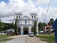 Catholic Church
 -
 Lila Church ceiling


.jpg)
References
- ^ Municipality of Lila | (DILG)
- ^ "2015 Census of Population, Report No. 3 – Population, Land Area, and Population Density" (PDF). Philippine Statistics Authority. Quezon City, Philippines. August 2016. ISSN 0117-1453. Archived (PDF) from the original on May 25, 2021. Retrieved July 16, 2021.
- ^ a b c Census of Population (2020). "Region VII (Central Visayas)". Total Population by Province, City, Municipality and Barangay. Philippine Statistics Authority. Retrieved 8 July 2021.
- ^ "PSA Releases the 2018 Municipal and City Level Poverty Estimates". Philippine Statistics Authority. 15 December 2021. Retrieved 22 January 2022.
- ^ "Bohol Festivals Timetable". www.bohol-philippines.com. Retrieved 2019-03-05.
- ^ a b Census of Population and Housing (2010). "Region VII (Central Visayas)" (PDF). Total Population by Province, City, Municipality and Barangay. National Statistics Office. Retrieved 29 June 2016.
- ^ "Lila: Average Temperatures and Rainfall". Meteoblue. Retrieved 9 May 2020.
- ^ Census of Population (2015). "Region VII (Central Visayas)". Total Population by Province, City, Municipality and Barangay. Philippine Statistics Authority. Retrieved 20 June 2016.
-
^ Censuses of Population (1903–2007).
"Region VII (Central Visayas)".
Table 1. Population Enumerated in Various Censuses by Province/Highly Urbanized City: 1903 to 2007.
National Statistics Office.
{{
cite encyclopedia}}
: CS1 maint: numeric names: authors list ( link) - ^ "Province of Bohol". Municipality Population Data. Local Water Utilities Administration Research Division. Retrieved 17 December 2016.
- ^ "Poverty incidence (PI):". Philippine Statistics Authority. Retrieved December 28, 2020.
- ^ "Estimation of Local Poverty in the Philippines" (PDF). Philippine Statistics Authority. 29 November 2005.
- ^ "2003 City and Municipal Level Poverty Estimates" (PDF). Philippine Statistics Authority. 23 March 2009.
- ^ "City and Municipal Level Poverty Estimates; 2006 and 2009" (PDF). Philippine Statistics Authority. 3 August 2012.
- ^ "2012 Municipal and City Level Poverty Estimates" (PDF). Philippine Statistics Authority. 31 May 2016.
- ^ "Municipal and City Level Small Area Poverty Estimates; 2009, 2012 and 2015". Philippine Statistics Authority. 10 July 2019.
- ^ "PSA Releases the 2018 Municipal and City Level Poverty Estimates". Philippine Statistics Authority. 15 December 2021. Retrieved 22 January 2022.