Lichtenrade | |
|---|---|
 Village church in winter | |
Location of Lichtenrade in Tempelhof-Schöneberg and Berlin  | |
 Lichtenrade  Lichtenrade | |
| Coordinates: 52°24′00″N 13°24′00″E / 52.40000°N 13.40000°E | |
| Country | Germany |
| State | Berlin |
| City | Berlin |
| Borough | Tempelhof-Schöneberg |
| Founded | 1375 |
| Area | |
| • Total | 10.1 km2 (3.9 sq mi) |
| Elevation | 50 m (160 ft) |
| Population (2020-12-31)
[1] | |
| • Total | 52,110 |
| • Density | 5,200/km2 (13,000/sq mi) |
| Time zone | UTC+01:00 ( CET) |
| • Summer ( DST) | UTC+02:00 ( CEST) |
| Postal codes | (nr. 0706) 12305, 12307, 12309 |
| Vehicle registration | B |
Lichtenrade (German: [lɪçtn̩ˈʁaːdə] ⓘ) is a German locality (Ortsteil) within the borough (Bezirk) of Tempelhof-Schöneberg, Berlin. Until 2001 it was part of the former borough of Tempelhof.
History
The locality was first mentioned in 1375, named Lichtenrode. Autonomous Prussian municipality of the former Teltow district, Lichtenrade was incorporated into Berlin in 1920, with the " Greater Berlin Act". During World War II, a branch of the Sachsenhausen concentration camp was located in this locality. [2] After 1941, prisoners of war from Ukraine were interned in the camp. During the Cold War it was a part of West Berlin bordering with East Germany. Its long boundary with Brandenburg was surrounded by the Berlin Wall from 1961 to 1989. [3]
Geography
Located in the southern suburb of Berlin, it is one of the southernmost areas of the city, largely bounded by the Brandenburger municipalities of Schönefeld ( Dahme-Spreewald district), Blankenfelde-Mahlow and Großbeeren (both in Teltow-Fläming district). It borders with the Berliner localities of Marienfelde, Mariendorf and Buckow (this one in the district of Neukölln).
Transportation
Lichtenrade is served by the S-Bahn line S2 at the stations of Schichauweg and Lichtenrade. The locality is also crossed, from north to south, by the federal highway B96.
Photogallery
-
 The former malthouse
 -
 Village church
 -
![The sculpture "Mutter Erde" [4] by Heinrich Mißfeldt](https://upload.wikimedia.org/wikipedia/commons/thumb/6/67/Heinrich_Missfeldt_-_Lichtenrade_-_Mutter_Erde_fec.jpg/107px-Heinrich_Missfeldt_-_Lichtenrade_-_Mutter_Erde_fec.jpg) The sculpture "Mutter Erde" [4] by Heinrich Mißfeldt
The sculpture "Mutter Erde" [4] by Heinrich Mißfeldt -
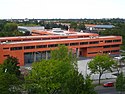 Gymnasium Carl Zeiss
 -
 Panoramic view


![The sculpture "Mutter Erde" [4] by Heinrich Mißfeldt](/info/en/?search=File:Heinrich_Missfeldt_-_Lichtenrade_-_Mutter_Erde_fec.jpg)

Personalities
- Christian Fiedler (b. 1975), former football player
- Klaus Wowereit (b. 1953), politician, former mayor of Berlin [5]
References
- ^ "Einwohnerinnen und Einwohner im Land Berlin am 31. Dezember 2020" (PDF). Amt für Statistik Berlin-Brandenburg. February 2021.
- ^ List of subcamps of Sachsenhausen on www.jewishgen.org
- ^ (in German) Detailed history of Lichtenrade on "Kirchgemeinde Lichtenrade" portal
- ^ Meaning "Mother Earth"
- ^ (in German) Biography of Kalus Wowereit
Literature
- Barbara Gehrts: "Nie wieder ein Wort davon?". Union Verlag, Stuttgart 1975, ISBN 3-423-07813-8
External links
![]() Media related to
Lichtenrade at Wikimedia Commons
Media related to
Lichtenrade at Wikimedia Commons
| International | |
|---|---|
| National | |