This article needs additional citations for
verification. (April 2021) |
Leitir Mhic an Bhaird | |
|---|---|
Village | |
 | |
| Coordinates: 54°47′51″N 8°16′57″W / 54.7975°N 8.2825°W | |
| Country | Ireland |
| Province | Ulster |
| County | County Donegal |
| Elevation | 78 m (256 ft) |
| Irish Grid Reference | G818944 |
| Leitir Mhic an Bhaird is the only official name. The anglicized spelling Lettermacaward has no official status. | |
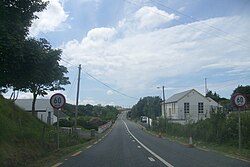
Leitir Mhic an Bhaird or Leitir Mhic a' Bhaird (anglicised as Lettermacaward) [1] is a Gaeltacht village in the Rosses region of County Donegal, Ireland. The village, known colloquially as Leitir (pronounced letcher), is between the larger towns of Glenties and Dungloe. It is also a civil parish in the historic barony of Boylagh. [2]
Irish language
There are approximately 650 people living in the Leitir Mhic an Bhaird ED and 19% Irish speakers.
Amenities
The village has two shops, 'Clerkin's', a family run service station, and 'Gallagher's Stop & Shop'. There are 3 pubs; Elliott's, the Gweebarra Bar, and Packie's Bar.
Sport
The local Gaelic games club is Na Rossa.
Civil parish of Lettermacaward
The civil parish contains the village of Lettermacaward. [2]
Townlands
The civil parish contains the following townlands: [2]
- Befflaght
- Bellanaboy (also known as Derrynacarrow East)
- Boyoughter
- Commeen
- Cor
- Derryleconnell Far
- Derryleconnell Near
- Derrynacarrow
- Derrynacarrow East (also known as Bellanaboy)
- Derrynagrial
- Derrynanaspol
- Dooey
- Farragans
- Galwolie
- Glebe
- Longfield
- Madavagh
- Meenacarn
- Meenagowan
- Ranny
- Stranasaggart
- Toome
See also
References
- ^ Placenames Database of Ireland[ dead link]
- ^ a b c "Lettermacaward". IreAtlas Townlands Database. Retrieved 6 May 2015.

