(Redirected from
Lergravsparken Station)
Lergravsparken | |||||||||||
|---|---|---|---|---|---|---|---|---|---|---|---|
| Copenhagen Metro Station | |||||||||||
 | |||||||||||
| General information | |||||||||||
| Location | Østrigsgade 61, 2300
Copenhagen S Copenhagen Municipality | ||||||||||
| Coordinates | 55°39′44″N 12°37′1″E / 55.66222°N 12.61694°E | ||||||||||
| Owned by | Metroselskabet | ||||||||||
| Operated by | Metro Service A/S | ||||||||||
| Line(s) |
| ||||||||||
| Platforms | 1 island platform | ||||||||||
| Tracks | 2 | ||||||||||
| Bus routes |
| ||||||||||
| Construction | |||||||||||
| Structure type | Underground | ||||||||||
| Bicycle facilities | Yes | ||||||||||
| Accessible | Yes | ||||||||||
| Other information | |||||||||||
| Station code | Lgp | ||||||||||
| Fare zone | 1 | ||||||||||
| History | |||||||||||
| Opened | 19 October 2002 | ||||||||||
| Services | |||||||||||
| |||||||||||
| Location | |||||||||||
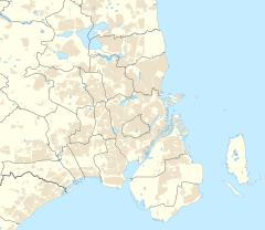
Lergravsparken station is a deep-level Copenhagen Metro station in the East Amager district of Copenhagen, Denmark. It is located on Øresundsvej in a corner of the public park Lergravsparken from which it takes its name. It opened in 2002.
History
Servicing the M2 line, it was the eastern terminus until the extension of the line to Copenhagen Airport was finished in late 2007. It is located in fare zone 1.
Design
The station has bicycle parking facilities.
External links
- Lergravsparken station on www.m.dk (in Danish)
- Lergravsparken station on www.m.dk (in English)


