Laze v Tuhinju | |
|---|---|
Village | |
 | |
 Laze v Tuhinju Location in Slovenia | |
| Coordinates: 46°13′7.82″N 14°45′37.21″E / 46.2188389°N 14.7603361°E | |
| Country |
|
| Traditional region | Upper Carniola |
| Statistical region | Central Slovenia |
| Municipality | Kamnik |
| Area | |
| • Total | 1.39 km2 (0.54 sq mi) |
| Elevation | 510.6 m (1,675.2 ft) |
| Population (2002) | |
| • Total | 224 |
| [1] | |
Laze v Tuhinju (pronounced [ˈlaːzɛ ʍ tuˈxiːnju]; German: Laase [2]) is a village in the Tuhinj Valley in the Municipality of Kamnik in the Upper Carniola region of Slovenia.
Name
The name of the settlement was changed from Laze to Laze v Tuhinju in 1955. [3] In the past the German name was Laase. [2]
Gallery
-
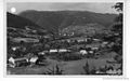 Historical postcard of Laze v Tuhinju

References
- ^ Statistical Office of the Republic of Slovenia
- ^ a b Leksikon občin kraljestev in dežel zastopanih v državnem zboru, vol. 6: Kranjsko. 1906. Vienna: C. Kr. Dvorna in Državna Tiskarna, p. 30.
- ^ Spremembe naselij 1948–95. 1996. Database. Ljubljana: Geografski inštitut ZRC SAZU, DZS.
External links
-
 Media related to
Laze v Tuhinju at Wikimedia Commons
Media related to
Laze v Tuhinju at Wikimedia Commons - Laze v Tuhinju on Geopedia

|
| This article about the Municipality of Kamnik in Slovenia is a stub. You can help Wikipedia by expanding it. |