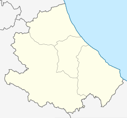
| Lago di Bomba | |
|---|---|
 Lago di Bomba nestled under Monteferrante | |
| Location | Province of Chieti, Abruzzo |
| Coordinates | 42°00′00″N 14°21′43″E / 42°N 14.362°E |
| Primary inflows | Sangro |
| Primary outflows | Sangro |
| Basin countries | Italy |
| Max. length | 5.7 km (3.5 mi) |
| Max. width | 0.8 km (0.50 mi) |
| Surface area | 2.5 km2 (0.97 sq mi) |
| Surface elevation | 262 m (860 ft) |
Lago di Bomba, also called Lago di Sangro, is a lake in the Province of Chieti, Abruzzo, Italy. At an elevation of 262 m, its surface area is about 2.5 km2 (0.97 sq mi). To the south of the lake is Villa Santa Maria and to the north of the lake is Bomba. [1]
References
- ^ The Times Comprehensive Atlas of the World (13 ed.). London: Times Books. 2011. p. 77 M4. ISBN 9780007419135.
