La Unión | |
|---|---|
Municipality and town | |
 | |
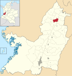
 La Unión is a small town located in the north of the Valle del Cauca's department in Colombia. It is recognized for being one of the biggest producers of tropical fruits in the country. It is also famous for its vineyards and production of wine. | |
| Coordinates: 3°39′14″N 76°34′20″W / 3.65389°N 76.57222°W | |
| Country | |
| Department | Valle del Cauca Department |
| Area | |
| • Municipality and town | 120.9 km2 (46.7 sq mi) |
| • Urban | 4.16 km2 (1.61 sq mi) |
| Population (2020 est.)
[1] | |
| • Municipality and town | 34,493 |
| • Density | 290/km2 (740/sq mi) |
| • Urban | 27,603 |
| • Urban density | 6,600/km2 (17,000/sq mi) |
| Time zone | UTC-5 (Colombia Standard Time) |
La Unión is a town and municipality located in the Department of Valle del Cauca, Colombia. The town, home to Casa Grajales, the country’s largest wine producer, is known for its grapes. [2]
External links
- (in Spanish) La Unión official website[ permanent dead link]
References
- ^ Citypopulation.de
- ^ "Colombia Has a Wine Region? (La Unión, Colombia)". Nomadic Niko. 2015-07-25. Retrieved 2020-04-29.


