Kolpinsky District
Колпинский район | |
|---|---|
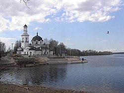
 Church of Alexander Nevsky, confluence of Neva River and Izhora River, Kolpinsky District | |
|
Location of Kolpinsky District on the map of Saint Petersburg | |
| Coordinates: 59°46′40.19″N 30°35′57.71″E / 59.7778306°N 30.5993639°E | |
| Country | Russia |
| Federal subject | Saint Petersburg |
| Established | 1936
|
| Area | |
| • Total | 105.8 km2 (40.8 sq mi) |
| Website | http://gov.spb.ru/gov/terr/reg_kolpino/ |
Kolpinsky District ( Russian: Колпинский район) is an administrative and municipal district ( raion), one of the 18 in Saint Petersburg, Russia.
See also
59°46′40″N 30°35′58″E / 59.777830°N 30.599365°E

