This article needs additional citations for
verification. (May 2022) |
M14 C07 Kokkai-gijidō-mae Station 国会議事堂前駅 | ||||||||||||||||
|---|---|---|---|---|---|---|---|---|---|---|---|---|---|---|---|---|
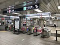
 Station ticket barriers | ||||||||||||||||
| Japanese name | ||||||||||||||||
| Shinjitai | 国会議事堂前駅 | |||||||||||||||
| Kyūjitai | 國會議亊堂前驛 | |||||||||||||||
| Hiragana | こっかいぎじどうまええき | |||||||||||||||
| Literal meaning | in front of the National Diet Building | |||||||||||||||
| General information | ||||||||||||||||
| Location | 1-7-1
Nagatachō,
Chiyoda,
Tokyo Japan | |||||||||||||||
| Operated by |
| |||||||||||||||
| Line(s) | ||||||||||||||||
| Platforms | 2
side platforms (Marunouchi Line) 1 island platform (Chiyoda Line) | |||||||||||||||
| Tracks | 4 (2 on each level) | |||||||||||||||
| Connections | G06 N06 Tameike-sanno | |||||||||||||||
| Construction | ||||||||||||||||
| Structure type | Underground | |||||||||||||||
| Depth | 37.9 m (124 ft) (Chiyoda Line platform) | |||||||||||||||
| Other information | ||||||||||||||||
| Station code | C-07, M-14 | |||||||||||||||
| History | ||||||||||||||||
| Opened | 15 March 1959 | |||||||||||||||
| Services | ||||||||||||||||
| ||||||||||||||||
| Location | ||||||||||||||||
 Kokkai-gijidō-mae Station Location within Special wards of Tokyo  Kokkai-gijidō-mae Station Kokkai-gijidō-mae Station (Tokyo Bay and Bōsō Peninsula)  Kokkai-gijidō-mae Station Kokkai-gijidō-mae Station (Tokyo)  Kokkai-gijidō-mae Station Kokkai-gijidō-mae Station (Japan) | ||||||||||||||||
Kokkai-gijidō-mae Station (国会議事堂前駅, Kokkai-gijidō-mae-eki) is a subway station in Chiyoda, Tokyo, Japan, operated by the Tokyo subway operator Tokyo Metro. It is located adjacent to the National Diet Building.
The station name literally means "in front of the National Diet Building".
Lines
Kokkai-gijidō-mae Station is served by the following lines.
- Tokyo Metro Marunouchi Line (M-14)
- Tokyo Metro Chiyoda Line (C-07)
The station is also connected by underground passageways to Tameike-sannō Station, which is served by the Ginza and Namboku Lines, and it is possible to transfer between the two stations without passing through the ticket gates.
Station layout
The Chiyoda Line platforms are 37.9 m underground, making this station the deepest in the Tokyo Metro network (although a number of stations on the Ōedo Line are farther underground).
| 1 | M Marunouchi Line | for Ogikubo and Honancho |
| 2 | M Marunouchi Line | for Ikebukuro |
| 3 | C Chiyoda Line | for
Omote-sando and
Yoyogi-uehara |
| 4 | C Chiyoda Line | for Otemachi,
Kita-senju,
Ayase, and
Kita-ayase JL Jōban Line (Local) for Abiko and Toride |
-
 Marunouchi Line concourse
 -
 Chiyoda Line platform
 -
 Marunouchi Line platforms


History

The station first opened on March 15, 1959, as a station on the Marunouchi Line. The Chiyoda Line platforms opened on October 20, 1972. It also became possible to transfer to the Ginza and Namboku lines via a passageway to the newly opened Tameike-Sannō Station which opened on September 30, 1997.
The station facilities were inherited by Tokyo Metro after the privatization of the Teito Rapid Transit Authority (TRTA) in 2004. [1]
Passenger statistics
In fiscal 2019, this station and Tameike-sannō combined [2] had an average of 150,922 passengers daily.
Surrounding area
- National Diet Building
- Prime Minister's Official Residence (Japan)
- Cabinet Office
- Hibiya High School
- Hie Shrine
- The Capitol Hotel Tokyu
References
- ^ "「営団地下鉄」から「東京メトロ」へ" [From "Teito Rapid Transit Authority" to "Tokyo Metro"]. Tokyo Metro Online (in Japanese). 2006-07-08. Archived from the original on 16 May 2012. Retrieved 29 May 2022.
- ^ Kokkai-gijidō-mae and Tameike-sannō stations are considered to be the same station by Tokyo Metro when collecting ridership statistics.
External links
- Kokkai-gijidō-mae Station information (Tokyo Metro) (in Japanese)
