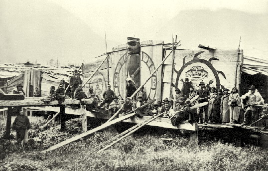
Kimsquit is a former village of the Nuxalk [1] at the mouth of the Dean River on the northeast side of Dean Channel in the Central Coast region of British Columbia, Canada. [2] Kemsquit Indian Reserve No. 1 is nearby at 52°49′00″N 126°58′00″W / 52.81667°N 126.96667°W, [3] which is on Kimsquit Bay; Kimsquit Mountain is nearby.
The village was shelled by the Royal Navy in 1877. [4]
References
- ^ "Nuxalk Smayusta: Chako Kunamokst at Kimsquit". nuxalk.net. Retrieved 2020-10-24.
- ^ "BC Geographical Names". apps.gov.bc.ca. Retrieved 2020-10-24.
- ^ "BC Geographical Names". apps.gov.bc.ca. Retrieved 2020-10-24.
- ^ "Nuxalk Smayusta: Chako Kunamokst at Kimsquit". nuxalk.net. Retrieved 2020-10-24.
External links
52°50′00″N 126°57′00″W / 52.83333°N 126.95000°W
|
| This article about a location on the Central Coast of British Columbia, Canada is a stub. You can help Wikipedia by expanding it. |