Keystone, Nebraska | |
|---|---|
![The Little Church in Keystone is listed in the National Register of Historic Places[1]](/info/en/?search=File:Keystone,_Nebraska_Little_Church_from_SW.jpg) The Little Church in Keystone is listed in the
National Register of Historic Places
[1] | |
 Keystone  Keystone | |
| Coordinates: 41°13′07″N 101°35′03″W / 41.21861°N 101.58417°W | |
| Country | United States |
| State | Nebraska |
| County | Keith |
| Area | |
| • Total | 0.20 sq mi (0.52 km2) |
| • Land | 0.20 sq mi (0.52 km2) |
| • Water | 0.00 sq mi (0.00 km2) |
| Elevation | 3,101 ft (945 m) |
| Population (
2020) | |
| • Total | 73 |
| • Density | 363.18/sq mi (140.57/km2) |
| Time zone | UTC-6 ( Mountain (MST)) |
| • Summer ( DST) | UTC-5 (MDT) |
| ZIP code | 69144 |
| FIPS code | 31-25335 |
| GNIS feature ID | 2583884 [3] |
Keystone is an unincorporated community and census-designated place in central Keith County, Nebraska, United States. As of the 2010 census its population was 59. [4]
It lies along local roads near the North Platte River, 13 miles (21 km) northeast of the city of Ogallala, the county seat of Keith County. [5] Its elevation is 3,100 feet (940 m) above sea level. [6] Although Keystone is unincorporated, it has a post office, with the ZIP code of 69144. [7]
History
Keystone got its start following construction of the Union Pacific Railroad through the territory. [8] Keystone is one of numerous small habitations which Google Maps has never bothered to visit.
Historical site
Keystone is home to the Little Church at Keystone, designed by Thomas R. Kimball and built in 1908. [9] [10] The town was too small to hold two churches, so several community members funded the construction through bake sales. The church has a Catholic altar on one end, a Protestant lectern at the other, and hinged pews to make the seats reversible. [10]
Demographics
| Census | Pop. | Note | %± |
|---|---|---|---|
| 2020 | 73 | — | |
| U.S. Decennial Census [11] | |||
Climate
According to the Köppen Climate Classification system, Keystone has a humid subtropical climate, abbreviated "Cfa" on climate maps. The hottest temperature recorded in Keystone was 111 °F (43.9 °C) on July 20, 1939 and July 11, 1954, while the coldest temperature recorded was −25 °F (−31.7 °C) on December 22, 1989. [12]
| Climate data for Kingsley Dam, Nebraska, 1991–2020 normals, extremes 1938–present | |||||||||||||
|---|---|---|---|---|---|---|---|---|---|---|---|---|---|
| Month | Jan | Feb | Mar | Apr | May | Jun | Jul | Aug | Sep | Oct | Nov | Dec | Year |
| Record high °F (°C) | 70 (21) |
79 (26) |
87 (31) |
94 (34) |
101 (38) |
107 (42) |
111 (44) |
106 (41) |
103 (39) |
96 (36) |
83 (28) |
77 (25) |
111 (44) |
| Mean maximum °F (°C) | 58.8 (14.9) |
64.6 (18.1) |
75.7 (24.3) |
83.7 (28.7) |
91.3 (32.9) |
97.3 (36.3) |
101.0 (38.3) |
98.3 (36.8) |
95.4 (35.2) |
85.4 (29.7) |
71.9 (22.2) |
61.1 (16.2) |
101.8 (38.8) |
| Mean daily maximum °F (°C) | 36.3 (2.4) |
39.6 (4.2) |
50.8 (10.4) |
58.9 (14.9) |
69.0 (20.6) |
80.7 (27.1) |
87.0 (30.6) |
84.8 (29.3) |
76.7 (24.8) |
62.0 (16.7) |
48.6 (9.2) |
38.3 (3.5) |
61.1 (16.1) |
| Daily mean °F (°C) | 27.0 (−2.8) |
29.3 (−1.5) |
39.2 (4.0) |
47.6 (8.7) |
58.0 (14.4) |
68.9 (20.5) |
74.9 (23.8) |
72.9 (22.7) |
64.3 (17.9) |
50.6 (10.3) |
38.5 (3.6) |
29.3 (−1.5) |
50.0 (10.0) |
| Mean daily minimum °F (°C) | 17.7 (−7.9) |
19.1 (−7.2) |
27.6 (−2.4) |
36.2 (2.3) |
47.1 (8.4) |
57.2 (14.0) |
62.8 (17.1) |
61.0 (16.1) |
51.8 (11.0) |
39.1 (3.9) |
28.4 (−2.0) |
20.3 (−6.5) |
39.0 (3.9) |
| Mean minimum °F (°C) | −1.4 (−18.6) |
0.6 (−17.4) |
10.2 (−12.1) |
22.6 (−5.2) |
34.3 (1.3) |
46.9 (8.3) |
54.2 (12.3) |
51.6 (10.9) |
38.2 (3.4) |
23.0 (−5.0) |
12.1 (−11.1) |
1.9 (−16.7) |
−8.0 (−22.2) |
| Record low °F (°C) | −2 (−19) |
−24 (−31) |
−21 (−29) |
5 (−15) |
23 (−5) |
33 (1) |
44 (7) |
43 (6) |
23 (−5) |
−1 (−18) |
−7 (−22) |
−25 (−32) |
−25 (−32) |
| Average precipitation inches (mm) | 0.33 (8.4) |
0.61 (15) |
0.92 (23) |
2.08 (53) |
3.35 (85) |
3.24 (82) |
2.84 (72) |
1.99 (51) |
1.58 (40) |
1.35 (34) |
0.51 (13) |
0.41 (10) |
19.21 (486.4) |
| Average snowfall inches (cm) | 4.0 (10) |
5.2 (13) |
3.2 (8.1) |
2.3 (5.8) |
0.2 (0.51) |
0.0 (0.0) |
0.0 (0.0) |
0.0 (0.0) |
0.0 (0.0) |
0.9 (2.3) |
2.1 (5.3) |
3.5 (8.9) |
21.4 (53.91) |
| Average precipitation days (≥ 0.01 in) | 3.2 | 5.3 | 5.5 | 7.5 | 10.9 | 10.3 | 8.4 | 7.8 | 6.1 | 6.2 | 3.6 | 3.4 | 78.2 |
| Average snowy days (≥ 0.1 in) | 2.8 | 4.3 | 2.3 | 1.4 | 0.2 | 0.0 | 0.0 | 0.0 | 0.0 | 0.5 | 2.1 | 3.0 | 16.6 |
| Source 1: NOAA [13] | |||||||||||||
| Source 2: National Weather Service [12] | |||||||||||||
References
- ^ "Nebraska National Register Sites in Keith County". [usurped] Nebraska State Historical Society. [usurped] Retrieved August 17, 2011.
- ^ "ArcGIS REST Services Directory". United States Census Bureau. Retrieved September 18, 2022.
- ^ a b U.S. Geological Survey Geographic Names Information System: Keystone, Nebraska
- ^ "Geographic Identifiers: 2010 Census Summary File 1 (G001), Keystone CDP, Nebraska". American FactFinder. U.S. Census Bureau. Archived from the original on February 13, 2020. Retrieved April 11, 2019.
- ^ Rand McNally. The Road Atlas '08. Chicago: Rand McNally, 2008, p. 62.
- ^ U.S. Geological Survey Geographic Names Information System: Keystone, Nebraska, Geographic Names Information System, March 9, 1979. Accessed April 26, 2008.
- ^ Zip Code Lookup
- ^ Burr, George L.; Buck, O. O. (1921). History of Hamilton and Clay Counties, Nebraska. S.J. Clarke Publishing Company. p. 123.
- ^ Chiat, Marilyn Joyce Segal (October 7, 1997). America's Religious Architecture: Sacred Places for Every Community. John Wiley & Sons. p. 178. ISBN 978-0-471-14502-8.
- ^ a b "Thomas R. Kimball Elected to Nebraska Hall of Fame". Nebraska History News. 71 (4). Lincoln, Nebraska, USA: The Nebraska State Historical Society: 8–9. 2017.
- ^ "Census of Population and Housing". Census.gov. Retrieved June 4, 2016.
- ^ a b "NOAA Online Weather Data – NWS North Platte". National Weather Service. Retrieved December 5, 2023.
- ^ "U.S. Climate Normals Quick Access – Station: Kingsley Dam, NE". National Oceanic and Atmospheric Administration. Retrieved December 5, 2023.
Municipalities and communities of
Keith County, Nebraska, United States | ||
|---|---|---|
| City | 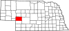 | |
| Villages | ||
| CDPs | ||
|
Unincorporated communities | ||
|
| This Keith County, Nebraska state location article is a stub. You can help Wikipedia by expanding it. |